2000s (21st Century) Maps of Meadow Lake Park, Truckee
Explore 5 historic maps of Meadow Lake Park from the 2000s (21st Century). These maps offer a rare glimpse into what life looked like during the 2000s — showing old roads, neighborhoods, homes, and landmarks that have changed or disappeared over time.
Whether you're researching your family's past, planning a metal detecting trip, or studying how Meadow Lake Park's landscape evolved across the 2000s, these high-resolution maps are a powerful tool for exploring the history of this region.
- Focus on a specific era: All maps on this page are from the 2000s, giving you a focused view of this time period.
- See what’s changed: Compare century-old streets, trails, and buildings to today's modern landscape using overlays and satellite layers.
- Research with precision: Use these maps for genealogy, historical research, land use analysis, or educational projects.
- View, download, or print: Maps are fully viewable online in high resolution, and can be downloaded or printed for your own records.
Start exploring Meadow Lake Park's history through authentic maps from the 2000s. This is your window into the past.
Meadow Lake Park, Truckee maps
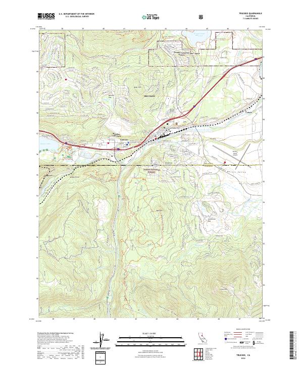
(5)- 2000 Map of Truckee, 2003 Print
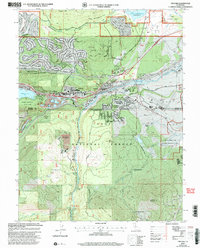 2000 Truckee2003 Print · USGSTruckee and the surrounding Sierra Nevada highlands are shown at the turn of the millennium as the area balanced mountain recreation with its deep rail and pioneer history. Trace the path of the Commemorative Overland Emigrant Trail and find historic sites like Old Schaeffer Mill.2 unique versions available
 - 2012 Map of Truckee, 2012 Print
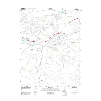 2012 Truckee2012 Print · USGSCovers Meadow Lake Park, including Truckee, Placer County, and other nearby areas
 - 2015 Map of Truckee, 2015 Print
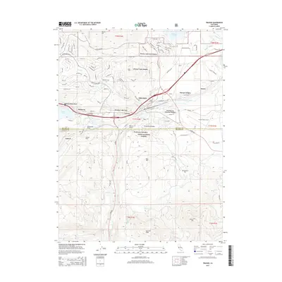 2015 Truckee2015 Print · USGSCovers Meadow Lake Park, including Truckee, Placer County, and other nearby areas
 - 2018 Map of Truckee, 2018 Print
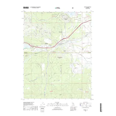 2018 Truckee2018 Print · USGSCovers Meadow Lake Park, including Truckee, Placer County, and other nearby areas
 - 2022 Map of Truckee, 2022 Print
 2022 Truckee2022 Print · USGSThe Sierra Nevada foothills near the Nevada and Placer county line are shown here in modern detail, where alpine peaks meet a growing mountain community. Genealogists and historians can trace local sites like the Old Truckee Catholic Cemetery, the Truckee Courthouse, and the waters of Donner Lake.
End of results
Showing maps 1-5 of 5
Frequently asked questions
- What are the different types of historical maps available for Meadow Lake Park?
- What is the oldest map of Meadow Lake Park?
- Where can I purchase historical maps of Meadow Lake Park for my home or office?
- Where can I download high-res historical maps of Meadow Lake Park?
- Are there historical topographic maps available for Meadow Lake Park?
- Is there historical aerial imagery available for Meadow Lake Park?
- Where are historical maps of Meadow Lake Park sourced from?