Old Maps of Foresthill, California
Explore 19 old maps of Foresthill, spanning from 1891 to today. These high-resolution historic maps reveal how streets, neighborhoods, landmarks, and natural features evolved over time — perfect for genealogy, metal detecting, research, and local history exploration.
What you can do with these maps:
- See how Foresthill changed over time: Compare historical maps to modern-day views to trace roads, homesites, rail lines & more.
- View detailed metadata: Each map includes creators, publishers, year, scale, and archive source.
- Overlay maps with satellite & LiDAR: Visualize the past alongside modern tools to explore terrain & human change.
- Trusted historical sources: Maps sourced from the USGS, Library of Congress, and other archives.
- Access maps your way: View online, download high-res files, or order prints for personal or research use.
Start exploring old maps of Foresthill to uncover forgotten places, hidden landmarks, and the deep history beneath your feet.
Foresthill, CA maps
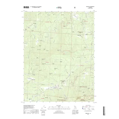
(19)- 1891 Map of Colfax
 1891 Colfax1891 Print · USGSThe Sierra Nevada foothills and high ridges of the Gold Country appear in this late nineteenth-century survey during a peak era of mining and rail expansion. Genealogists and historians can trace old hydraulic mining sites like Malakoff and mountain settlements such as North Bloomfield and Gold Run.
 - 1892 Map of Colfax
 1892 Colfax1892 Print · USGSThe Sierra Nevada foothills thrive with mining and rail activity in the 1890s as the gold industry matures. Genealogists and historians can trace old claims and communities like North Bloomfield, Alleghany, and the Alaska Mine along the Central Pacific Railroad.
 - 1894 Map of Colfax
 1894 Colfax1894 Print · USGSThe northern Sierra Nevada's mining heartland is mapped here during the late nineteenth-century gold boom. Researchers can trace the paths of the Central Pacific Railroad and locate historic claims like the Delhi Mine and Derbec Mine.
 - 1898 Map of Colfax
 1898 Colfax1898 Print · USGSThe Sierra Nevada gold fields come to life in the late nineteenth century as hydraulic mining reaches its peak. Genealogists and researchers can trace the early industrial footprint of the Malakoff Mine and settlements like Alleghany and North Bloomfield.
 - 1900 Map of Colfax
 1900 Colfax1900 Print · USGSThe Sierra Nevada foothills and high peaks are shown at the turn of the century as the mining economy and transcontinental rail travel reached their maturity. Researchers can trace historic industrial sites like the Alaska Mine, remote camps such as Moores Flat, and the path of the Southern Pacific RR.
 - 1902 Map of Colfax
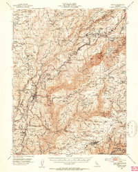
 1902 Colfax1902 Print · USGSGold-rush towns and hydraulic mining sites define this portion of the Sierra Nevada at the turn of the century. Genealogists and historians can trace the foundations of North Bloomfield, locate the remote Alaska Mine, or follow the Southern Pacific through Emigrant Gap.7 unique versions available
 - 1938 Map of Colfax
 1938 Colfax1938 Print · USGSThe Sierra Nevada's gold and timber country comes into focus in the late 1930s, showing a landscape defined by deep river canyons and industrial high-country camps. Researchers can locate remote sites like the Sixteen to One Mine, the North Bloomfield Ranger Station, and vanished settlements like Lake City.3 unique versions available
 - 1948 Map of Foresthill, 1975 Print
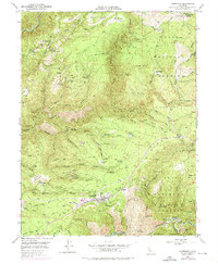 1948 Foresthill1975 Print · USGSThe gold-bearing ridges of the Sierra Nevada foothills come alive in this mid-century survey of the Placer County mining country. Genealogists and historians can locate family claims and old outposts like Yankee Jims, the Mayflower Mine, and Ebberts Ranch.
 - 1949 Map of Foresthill, 1957 Print
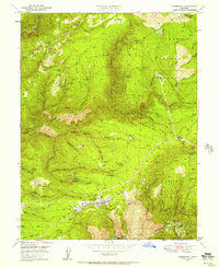 1949 Foresthill1957 Print · USGSPlacer County gold mining country is captured here during the late 1940s, showing the ridge-top settlements and deep river canyons. Genealogists and historians can trace family-named sites like Ebberts Ranch, the Mayflower Mine, and the old Iowa Hill diggings.4 unique versions available
 - 1950 Map of Colfax, 1953 Print
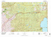
 1950 Colfax1953 Print · USGSPlacer and Nevada Counties are shown here during the early post-war years, as the Mother Lode's industrial footprint remained clearly visible. Genealogists and historians can trace the Southern Pacific line through historic sites like Illinoistown and active communities such as Foresthill and Weimar.4 unique versions available
 - 1951 Map of Foresthill
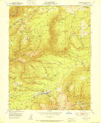 1951 Foresthill1951 Print · USGSIn the Gold Country of the 1950s, the Sierra Nevada ridges were defined by decades of mining and the timber industry. Researchers can trace the extensive Placer Diggings and historic claims like the Baltimore Mine, Mayflower Mine, and Morning Star Mine.
 - 1958 Map of Chico, 1962 Print
 1958 Chico1962 Print · USGSMid-century Northern California comes to life across the Central Valley and high Sierras as the postwar economy transformed the landscape. Trace the rail lines of the Southern Pacific RR, locate family roots near Chico Cem, or explore the early layout of Paradise and Beale Air Force Base.4 unique versions available
 - 1960 Map of Chico
 1960 Chico1960 Print · USGSThe Northern California high country and Sacramento Valley meet in this 1960s-era landscape of mining towns and river settlements. Trace the rail-and-water economy of the gold country through the Empire Mine, Beale Air Force Base, and the Western Pacific Railroad.
 - 1977 Map of Truckee, 1978 Print
 1977 Truckee1978 Print · USGSThe High Sierra and Lake Tahoe regions come into focus in the late seventies, showing a landscape defined by massive reservoir projects and mountain transit. Genealogists and historians can trace the Southern Pacific rail line through Truckee or explore old mining districts near North Bloomfield and Colfax.2 unique versions available
 - 2000 Map of Foresthill, 2003 Print
 2000 Foresthill2003 Print · USGSThe Placer County gold country around the Foresthill Divide is shown here at the turn of the millennium. Researchers can locate historic mining sites like Yankee Jims, Iowa Hill, and the Mayflower Mine alongside the Western States Trail.
 - 2012 Map of Foresthill, 2012 Print
 2012 Foresthill2012 Print · USGSCovers Foresthill, including Four Acres, Hughes Mill, and other nearby areas
 - 2015 Map of Foresthill, 2015 Print
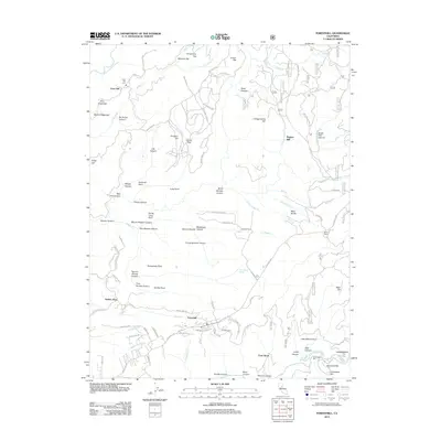
 2015 Foresthill2015 Print · USGSCovers Foresthill, including Four Acres, Hughes Mill, and other nearby areas
 - 2018 Map of Foresthill, 2018 Print
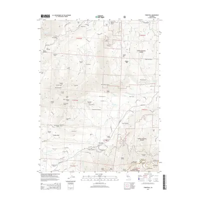
 2018 Foresthill2018 Print · USGSCovers Foresthill, including Four Acres, Hughes Mill, and other nearby areas
 - 2022 Map of Foresthill, 2022 Print
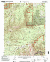
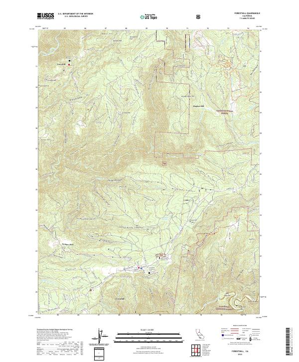 2022 Foresthill2022 Print · USGSThe Sierra Nevada foothills near Foresthill are revealed in this modern survey, capturing a landscape shaped by ridge-top settlements and deep river canyons. Researchers can trace the legacy of the Gold Rush through sites like Yankee Jims, Hughes Mill, and the Old Iowa Hill Cem.
End of results
Showing maps 1-19 of 19
Top cities near Foresthill
- Grass Valley historical maps
- Meadow Vista historical maps
- Nevada City historical maps
- Colfax historical maps
- Applegate historical maps
Frequently asked questions
- What are the different types of historical maps available for Foresthill?
- What is the oldest map of Foresthill?
- Where can I purchase historical maps of Foresthill for my home or office?
- Where can I download high-res historical maps of Foresthill?
- Are there historical topographic maps available for Foresthill?
- Is there historical aerial imagery available for Foresthill?
- Where are historical maps of Foresthill sourced from?