Old Maps of Southside Park, Sacramento for Hiking & Exploration
Hike through history with 22 historic maps of Southside Park. Explore old trails, ghost towns, and forgotten backroads — perfect for outdoor adventurers and local explorers.
- Rediscover forgotten places: Map out old mining camps, roads, and footpaths that no longer exist on modern maps.
- Layer with modern tools: Combine with LiDAR or satellite views to plan hikes through historical terrain.
- Made for exploration: Popular among hikers, overlanders, and local history lovers.
Use these maps to find adventure and explore the hidden past of Southside Park.
Southside Park, Sacramento maps
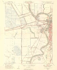
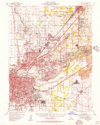
(22)- 1891 Map of Sacramento
 1891 Sacramento1891 Print · USGSCovers Southside Park, including Sacramento, Roseville, and other nearby areas
 - 1892 Map of Sacramento
 1892 Sacramento1892 Print · USGSCovers Southside Park, including Sacramento, Roseville, and other nearby areas5 unique versions available
 - 1893 Map of Sacramento, 1900 Print
 1893 Sacramento1900 Print · USGSCovers Southside Park, including Sacramento, Roseville, and other nearby areas
 - 1902 Map of Fairoaks
 1902 Fairoaks1902 Print · USGSCovers Southside Park, including Sacramento, Roseville, and other nearby areas2 unique versions available
 - 1907 Map of Davisville
 1907 Davisville1907 Print · USGSCovers Southside Park, including Sacramento, Davis, and other nearby areas2 unique versions available
 - 1911 Map of Brighton
 1911 Brighton1911 Print · USGSCovers Southside Park, including Sacramento, Elvas, and other nearby areas2 unique versions available
 - 1916 Map of Lovdal
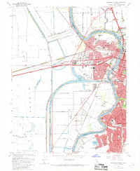
 1916 Lovdal1916 Print · USGSCovers Southside Park, including Sacramento, West Sacramento, and other nearby areas
 - 1947 Map of Sacramento, 1948 Print
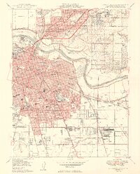
 1947 Sacramento1948 Print · USGSCovers Southside Park, including Sacramento, Stockton, and other nearby areas2 unique versions available
 - 1948 Map of Sacramento, 1951 Print
 1948 Sacramento1951 Print · USGSCovers Southside Park, including Sacramento, Stockton, and other nearby areas
 - 1948 Map of Sacramento West, 1958 Print
 1948 Sacramento West1958 Print · USGSCovers Southside Park, including Sacramento, West Sacramento, and other nearby areas
 - 1949 Map of Sacramento West
 1949 Sacramento West1949 Print · USGSCovers Southside Park, including Sacramento, West Sacramento, and other nearby areas2 unique versions available
 - 1949 Map of Sacramento East
 1949 Sacramento East1949 Print · USGSCovers Southside Park, including Sacramento, Elvas, and other nearby areas2 unique versions available
 - 1954 Map of Sacramento East, 1956 Print
 1954 Sacramento East1956 Print · USGSCovers Southside Park, including Sacramento, Elvas, and other nearby areas2 unique versions available
 - 1954 Map of Davis, 1956 Print
 1954 Davis1956 Print · USGSCovers Southside Park, including Sacramento, Davis, and other nearby areas2 unique versions available
 - 1954 Map of Fair Oaks, 1957 Print
 1954 Fair Oaks1957 Print · USGSCovers Southside Park, including Sacramento, Roseville, and other nearby areas2 unique versions available
 - 1956 Map of Sacramento
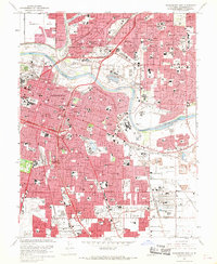
 1956 Sacramento1956 Print · USGSCovers Southside Park, including Sacramento, Stockton, and other nearby areas2 unique versions available
 - 1957 Map of Sacramento, 1966 Print
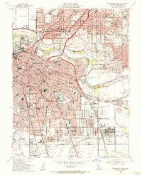
 1957 Sacramento1966 Print · USGSCovers Southside Park, including Sacramento, Stockton, and other nearby areas4 unique versions available
 - 1967 Map of Sacramento West, 1968 Print
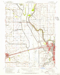
 1967 Sacramento West1968 Print · USGSCovers Southside Park, including Sacramento, West Sacramento, and other nearby areas3 unique versions available
 - 1967 Map of Sacramento East, 1969 Print
 1967 Sacramento East1969 Print · USGSCovers Southside Park, including Sacramento, Elvas, and other nearby areas3 unique versions available
 - 1992 Map of Sacramento East, 1997 Print
 1992 Sacramento East1997 Print · USGSCovers Southside Park, including Sacramento, Elvas, and other nearby areas
 - 1992 Map of Sacramento West, 1997 Print
 1992 Sacramento West1997 Print · USGSCovers Southside Park, including Sacramento, West Sacramento, and other nearby areas
 - 1994 Map of Sacramento
 1994 Sacramento1994 Print · USGSCovers Southside Park, including Sacramento, Roseville, and other nearby areas2 unique versions available
End of results
Showing maps 1-22 of 22
Frequently asked questions
- What are the different types of historical maps available for Southside Park?
- What is the oldest map of Southside Park?
- Where can I purchase historical maps of Southside Park for my home or office?
- Where can I download high-res historical maps of Southside Park?
- Are there historical topographic maps available for Southside Park?
- Is there historical aerial imagery available for Southside Park?
- Where are historical maps of Southside Park sourced from?