1940s Maps of Calico Estates, San Bernardino County
Explore 4 historic maps of Calico Estates from the 1940s. These maps offer a rare glimpse into what life looked like during the 1940s — showing old roads, neighborhoods, homes, and landmarks that have changed or disappeared over time.
Whether you're researching your family's past, planning a metal detecting trip, or studying how Calico Estates's landscape evolved across the 1940s, these high-resolution maps are a powerful tool for exploring the history of this region.
- Focus on a specific era: All maps on this page are from the 1940s, giving you a focused view of this time period.
- See what’s changed: Compare century-old streets, trails, and buildings to today's modern landscape using overlays and satellite layers.
- Research with precision: Use these maps for genealogy, historical research, land use analysis, or educational projects.
- View, download, or print: Maps are fully viewable online in high resolution, and can be downloaded or printed for your own records.
Start exploring Calico Estates's history through authentic maps from the 1940s. This is your window into the past.
Calico Estates, San Bernardino County maps
(4)- 1947 Map of Trona, 1948 Print
 1947 Trona1948 Print · USGSThe Mojave Desert and Southern Sierra foothills come alive in the late 1940s, showing the industrial nodes of the Argus Range and the burgeoning Camp Irwin. Trace the legacy of desert mining and railroading through Trona, the Ashford Mill, and the historic districts of Randsburg and Garlock.
 - 1948 Map of Trona
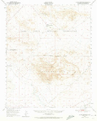
 1948 Trona1948 Print · USGSThe Mojave Desert and Death Valley frontier appear here during a mid-century era of military expansion and industrial mining. Trace the remnants of the Old Spanish Trail or locate isolated landmarks like Ashford Mill and the mining hub of Randsburg.
 - 1948 Map of Alvord Mountain
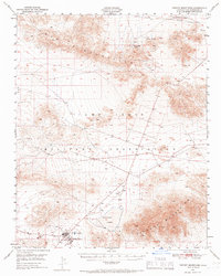
 1948 Alvord Mountain1948 Print · USGSSan Bernardino County's high desert landscape appears here shortly after the war, defined by expansive military grounds and isolated water sources. Researchers can trace early infrastructure and resource points like the Alvord Mine, the Union Pacific line, and Garlic Spring.3 unique versions available
 - 1948 Map of Tiefort Mountains, 1966 Print
 1948 Tiefort Mountains1966 Print · USGSThe Mojave Desert at the start of the Cold War reveals the strategic development of the Camp Irwin Military Reservation. Researchers can trace early military infrastructure around Camp Irwin and locate remote desert water sources like Drinkwater Spring and Bicycle Lake.2 unique versions available
End of results
Showing maps 1-4 of 4
Frequently asked questions
- What are the different types of historical maps available for Calico Estates?
- What is the oldest map of Calico Estates?
- Where can I purchase historical maps of Calico Estates for my home or office?
- Where can I download high-res historical maps of Calico Estates?
- Are there historical topographic maps available for Calico Estates?
- Is there historical aerial imagery available for Calico Estates?
- Where are historical maps of Calico Estates sourced from?