Old Maps of Chino Hills, California
Explore 75 old maps of Chino Hills, spanning from 1894 to today. These high-resolution historic maps reveal how streets, neighborhoods, landmarks, and natural features evolved over time — perfect for genealogy, metal detecting, research, and local history exploration.
What you can do with these maps:
- See how Chino Hills changed over time: Compare historical maps to modern-day views to trace roads, homesites, rail lines & more.
- View detailed metadata: Each map includes creators, publishers, year, scale, and archive source.
- Overlay maps with satellite & LiDAR: Visualize the past alongside modern tools to explore terrain & human change.
- Trusted historical sources: Maps sourced from the USGS, Library of Congress, and other archives.
- Access maps your way: View online, download high-res files, or order prints for personal or research use.
Start exploring old maps of Chino Hills to uncover forgotten places, hidden landmarks, and the deep history beneath your feet.
Chino Hills, CA maps
(75)- 1894 Map of Pomona, 1960 Print
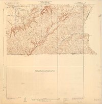
 1894 Pomona1960 Print · USGSThe eastern San Gabriel Valley is shown here in the 1890s, when the orchard economy and railroads were first reshaping the landscape. Genealogists and historians can trace early settlements and rail stops like Lordsburg, Alosta, and Rowland Siding.
 - 1896 Map of Anaheim
 1896 Anaheim1896 Print · USGSThe Orange County basin appears here in the mid-1890s, when iron rails first connected the young citrus towns to the wider world. Genealogists and researchers can trace the early grids of Anaheim, Fullerton, and Orange alongside now-obscure rail stops like Almond and Marlboro.
 - 1897 Map of Pomona
 1897 Pomona1897 Print · USGSThe San Gabriel Valley is captured here in the late nineteenth century as a patchwork of citrus-growing colonies and emerging rail towns. Genealogists and historians can trace early property lines and settlements like Lordsburg, Alosta, and Spadra along the Covina Branch line.
 - 1897 Map of Cucamonga
 1897 Cucamonga1897 Print · USGSIn the late nineteenth century, the Inland Empire was a rapidly emerging rail and citrus hub defined by major land grants. Genealogists and researchers can trace the early footprints of Cucamonga, Ontario, and Pomona alongside the Narrow Gauge and Southern Pacific lines.
 - 1898 Map of Pomona
 1898 Pomona1898 Print · USGSThe San Gabriel Valley is captured here during its late nineteenth-century rail boom, before the suburban expansion of the Los Angeles basin. Genealogists can trace the early streets of Pomona, Lordsburg, and San Dimas along the busy Southern Pacific Railroad.2 unique versions available
 - 1898 Map of Anaheim, 1899 Print
 1898 Anaheim1899 Print · USGSNorthern Orange County is captured here at the height of its citrus and rail era. Genealogists and local historians can trace the early footprints of Anaheim, Fullerton, and Orange, alongside smaller vanished stops like McPherson and Almond.
 - 1900 Map of Cucamonga
 1900 Cucamonga1900 Print · USGSSan Bernardino and Los Angeles Counties are shown here during the late nineteenth-century citrus boom, before urban sprawl merged these distinct agricultural colonies. Trace early rail lines through Ioamosa, Claremont, and Chino, or locate the isolated Toll House and Power House in the northern canyons.
 - 1901 Map of Southern California Sheet No. 1
 1901 Southern California Sheet No. 11901 Print · USGSGreater Los Angeles at the dawn of the twentieth century is a landscape of growing citrus towns and a burgeoning rail network. Genealogists and historians can trace the early gridded streets of Hollywood and Pasadena or locate landmarks like Bear Lake and the Cahuilla Indian Reservation.6 unique versions available
 - 1901 Map of Anaheim
 1901 Anaheim1901 Print · USGSOrange County's citrus and rail heartland is meticulously detailed at the start of the century, showing the early layouts of Anaheim and Fullerton. Genealogists can trace early homesteads and rail stops like Loara, Miraflores, and Olinda.6 unique versions available
 - 1902 Map of Corona
 1902 Corona1902 Print · USGSThe Orange County and Riverside borderlands at the start of the 1900s show an era of rapid rail expansion and water engineering. Researchers can trace the early footprints of Anaheim and Orange or find vanished industry at the Santiago Coal Mine.7 unique versions available
 - 1903 Map of Cucamonga
 1903 Cucamonga1903 Print · USGSThe Inland Empire is shown at a pivotal moment of agricultural expansion in the early twentieth century, when irrigation was transforming the valley. Trace the early rail networks of the Southern Pacific and the Santa Fe through citrus-growing centers like Ontario, Cucamonga, and Ioamosa.11 unique versions available
 - 1904 Map of Pomona
 1904 Pomona1904 Print · USGSThe eastern San Gabriel Valley is shown here at the turn of the century as a burgeoning network of citrus towns and vital rail lines. Genealogists can trace early homesteads and vanished stops such as Lordsburg, Alosta, and the Rowland Siding along the Southern Pacific RR.7 unique versions available
 - 1904 Map of Southern California Sheet No. 1, 1905 Print
 1904 Southern California Sheet No. 11905 Print · USGSSouthern California at the dawn of the twentieth century shows a landscape of citrus groves and coastal towns connected by rail. Genealogists and historians can trace early settlements like San Juan Capistrano, find remote sites like the Rose Mine, and study the original water systems of the Santa Ana River.2 unique versions available
 - 1928 Map of Claremont
 1928 Claremont1928 Print · USGSEastern Los Angeles County appears here in the late twenties, during a period of rapid suburban and academic growth. Researchers can trace the early layouts of Claremont and Pomona, locating Pomona College, the Pacific Electric lines, and the Pomona Cemetery.3 unique versions available
 - 1928 Map of La Brea
 1928 La Brea1928 Print · USGSThe hills of Eastern Los Angeles County are captured here in the late twenties during a period of expanding ranching and early oil exploration. Genealogists and historians can trace family-named sites like Silver Peak Ranch, local landmarks such as Fairview School, and the path of the Union Pacific Railroad.3 unique versions available
 - 1933 Map of Prado
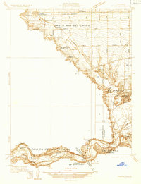 1933 Prado1933 Print · USGSIn the early 1930s, the Chino Valley was a hub of irrigation canals and rail-side settlements before later development changed the landscape. Genealogists and historians can trace old homesteads like Pellissier Ranch and schools like the California Junior Republic School.
 - 1933 Map of Ontario
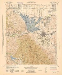
 1933 Ontario1933 Print · USGSThe citrus heart of the Inland Empire comes into focus in the early thirties as it transitions into a major transit hub. Genealogists and historians can trace the early footprints of Ontario, Upland, and Chino, while locating landmarks like Bellevue Cem and the Pacific Electric line.
 - 1935 Map of Olinda
 1935 Olinda1935 Print · USGSOrange County in the mid-1930s shows an evolving landscape of rail lines and irrigation networks. Genealogists and local historians can trace the early footprints of Yorba Linda and Placentia, or locate defunct rail stops like Loftus and Carlton.
 - 1941 Map of Prado
 1941 Prado1941 Print · USGSSouthern California's inland corridor is captured here in the 1930s, showing the river valley before the dam changed the landscape forever. Trace the old routes of the Union Pacific through Prado and locate local landmarks like the Pellissier Ranch.2 unique versions available
 - 1942 Map of Anaheim
 1942 Anaheim1942 Print · USGSOrange County's agricultural heart is captured mid-century during a period of rapid wartime development. Genealogists can locate family landmarks like Diamond Bar Ranch, local schools such as Alamitos Sch, and communities like Garden Grove or Stanton.2 unique versions available
 - 1942 Map of Ontario and Vicinity
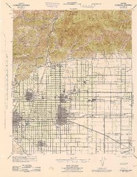
 1942 Ontario and Vicinity1942 Print · USGSThe Inland Empire is shown at a pivotal moment in the early 1940s, when orange groves and vineyards still dominated the landscape between the mountains and the valley floor. Researchers can trace the rail corridors of the SOUTHERN PACIFIC and the Pacific Electric while locating old neighborhood markers like Narod, Sunsweet, and the Sierra Vista Sch.2 unique versions available
 - 1942 Map of Corona, 1947 Print
 1942 Corona1947 Print · USGSRiverside County at the dawn of the 1940s reveals a unique mix of agricultural roots, mountain canyons, and significant regional infrastructure projects. Genealogists and local historians can trace the early street plans of Corona and Norco, or locate landmarks like the East Vale Sch and the Santiago Reservoir.2 unique versions available
 - 1943 Map of Corona
 1943 Corona1943 Print · USGSThe Santa Ana River valley during the mid-forties shows a landscape shaped by water management and early inland growth. Trace the development of Corona and Norco alongside the massive Prado Dam and local landmarks like the East Vale Sch.
 - 1944 Map of Cucamonga
 1944 Cucamonga1944 Print · USGSThe San Gabriel Valley and Inland Empire are shown here during the mid-forties, capturing the peak of the region's citrus era and rail-based transit. Researchers can trace early campus layouts at Pomona College or locate vanished landmarks like the Monta Vista Resort and Padua Hills Theater.
 - 1947 Map of Santa Ana, 1949 Print
 1947 Santa Ana1949 Print · USGSSouthern California is depicted here in the late forties, showing the expansion of the Inland Empire and the Orange County coast. Researchers can trace the early layout of Palm Springs or locate long-standing tribal lands like the Pala Indian Reservation and Rincon Indian Res.
Showing maps 1-25 of 75
Top cities near Chino Hills
- Anaheim historical maps
- Santa Ana historical maps
- Riverside historical maps
- Irvine historical maps
- Fontana historical maps
- Huntington Beach historical maps
See more
Top neighborhoods of Chino Hills
Frequently asked questions
- What are the different types of historical maps available for Chino Hills?
- What is the oldest map of Chino Hills?
- Where can I purchase historical maps of Chino Hills for my home or office?
- Where can I download high-res historical maps of Chino Hills?
- Are there historical topographic maps available for Chino Hills?
- Is there historical aerial imagery available for Chino Hills?
- Where are historical maps of Chino Hills sourced from?