Old Maps of Kenton Mill, California for Metal Detecting
Plan your next treasure hunt with 13 historic maps of Kenton Mill. Find old homesites, ghost towns, trails, and gathering spots that may be lost to time — perfect for identifying promising metal detecting locations.
- Locate forgotten sites: Uncover places like long-lost settlements, abandoned rail lines, or gathering spots.
- Plan better hunts: Use map overlays combined with LiDAR or satellite views to narrow in on historically rich areas.
- Made for detectorists: Thousands of hobbyists use these maps to discover relics, coins, and hidden history.
Use these historic maps to boost your research and find new opportunities beneath the surface of Kenton Mill.
Kenton Mill, CA maps
(13)- 1953 Map of San Bernardino
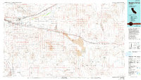
 1953 San Bernardino1953 Print · USGSSouthern California underwent massive post-war growth as suburban sprawl reached the foothills of the San Bernardino Mountains. Genealogists and historians can trace the rail-and-road roots of the Inland Empire through the Union Pacific RR and Lake Arrowhead resorts.2 unique versions available
 - 1955 Map of Lavic Lake
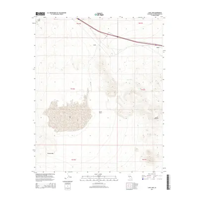
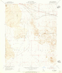 1955 Lavic Lake1955 Print · USGSThe Mojave Desert landscape during the mid-fifties reveals a crossroads of military training grounds and heavy rail transport. You can trace the historic Atchison Topeka and Santa Fe line past Pisgah Crater to the isolated Kenton Mill.3 unique versions available
 - 1955 Map of Lavic, 1956 Print
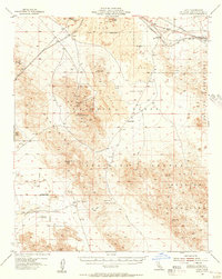 1955 Lavic1956 Print · USGSSan Bernardino County's high desert reveals its volcanic and industrial character in the mid-fifties, dominated by the stark lava flow and Pisgah Crater. Genealogists and desert historians can trace early mining life at the National Lead Mine, Imperial Lode Mine, and the now-quiet settlement of Argos.3 unique versions available
 - 1956 Map of San Bernardino
 1956 San Bernardino1956 Print · USGSSouthern California's Inland Empire and High Desert come into focus in the mid-fifties as agriculture gives way to suburban and military growth. Trace early rail lines like the Pacific Electric or find remote landmarks like Camp Rock Mine and George AFB.
 - 1957 Map of San Bernardino
 1957 San Bernardino1957 Print · USGSSouthern California's Inland Empire and High Desert met during the postwar expansion of the late fifties. Genealogists and historians can trace the growth of San Bernardino and Redlands alongside remote landmarks like Edwards AFB and the Camp Rock Mine.
 - 1958 Map of San Bernardino, 1975 Print
 1958 San Bernardino1975 Print · USGSSouthern California’s Inland Empire and High Desert come into focus during the mid-century boom, showing the rise of suburbs and massive military installations. Researchers can trace the rail networks of the Union Pacific RR or locate landmarks like Norton AFB and Big Bear Lake.
 - 1959 Map of San Bernardino
 1959 San Bernardino1959 Print · USGSSouthern California underwent a massive transformation in the late fifties as suburban growth and military power reshaped the desert and valley. Researchers can trace the legacy of the Union Pacific Railroad and locate early footprints of Joshua Tree National Monument and Edwards Air Force Base.
 - 1966 Map of San Bernardino
 1966 San Bernardino1966 Print · USGSThe San Bernardino Valley and Mojave Desert met during a period of massive military and suburban growth in the mid-sixties. Genealogists and historians can trace the development of Edwards Air Force Base, old desert mines like the Bagdad Chase Mine, and mountain communities near Big Bear Lake.
 - 1977 Map of Newberry Springs, 1993 Print
 1977 Newberry Springs1993 Print · USGSThe Mojave High Desert in the late seventies is shown here as a landscape of railroads and mining. Researchers can trace the legacy of remote camps and transport hubs like Stedman, Ragtown, and the busy Barstow-Daggett Airport.
 - 2012 Map of Lavic Lake, 2012 Print
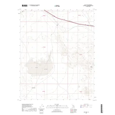
 2012 Lavic Lake2012 Print · USGSCovers Kenton Mill, including San Bernardino County, United States, and other nearby areas
 - 2015 Map of Lavic Lake, 2015 Print
 2015 Lavic Lake2015 Print · USGSCovers Kenton Mill, including San Bernardino County, United States, and other nearby areas
 - 2018 Map of Lavic Lake, 2018 Print
 2018 Lavic Lake2018 Print · USGSCovers Kenton Mill, including San Bernardino County, United States, and other nearby areas
 - 2021 Map of Lavic Lake, 2021 Print
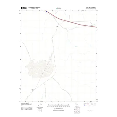
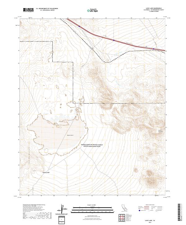 2021 Lavic Lake2021 Print · USGSSan Bernardino County's high desert is captured here in the early twenty-first century, showing the remote industrial and transit corridors of the Mojave Desert. Researchers can trace the legacy of mining at Kenton Mill and follow the path of the National Trails Hwy through Lavic.
End of results
Showing maps 1-13 of 13
Frequently asked questions
- What are the different types of historical maps available for Kenton Mill?
- What is the oldest map of Kenton Mill?
- Where can I purchase historical maps of Kenton Mill for my home or office?
- Where can I download high-res historical maps of Kenton Mill?
- Are there historical topographic maps available for Kenton Mill?
- Is there historical aerial imagery available for Kenton Mill?
- Where are historical maps of Kenton Mill sourced from?