2020s Maps of Lytle Creek, California
Explore 4 historic maps of Lytle Creek from the 2020s. These maps offer a rare glimpse into what life looked like during the 2020s — showing old roads, neighborhoods, homes, and landmarks that have changed or disappeared over time.
Whether you're researching your family's past, planning a metal detecting trip, or studying how Lytle Creek's landscape evolved across the 2020s, these high-resolution maps are a powerful tool for exploring the history of this region.
- Focus on a specific era: All maps on this page are from the 2020s, giving you a focused view of this time period.
- See what’s changed: Compare century-old streets, trails, and buildings to today's modern landscape using overlays and satellite layers.
- Research with precision: Use these maps for genealogy, historical research, land use analysis, or educational projects.
- View, download, or print: Maps are fully viewable online in high resolution, and can be downloaded or printed for your own records.
Start exploring Lytle Creek's history through authentic maps from the 2020s. This is your window into the past.
Lytle Creek, CA maps
(4)- 2021 Map of Telegraph Peak, 2021 Print
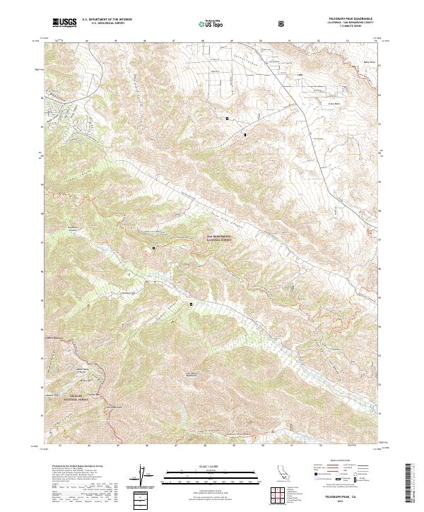 2021 Telegraph Peak2021 Print · USGSHigh in the San Gabriel Mountains during the early twenty-first century, this map shows the intersection of two national forests and the rugged divide of Lytle Creek. Hikers and historians can trace the Pacific Crest National Scenic Trl as it passes Telegraph Peak, Stockton Flat, and the Miners Bowl.
 - 2021 Map of Devore, 2021 Print
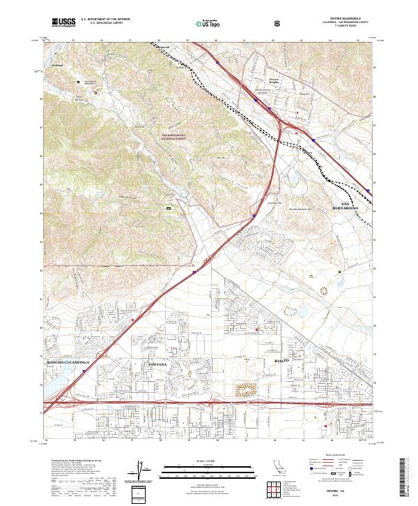 2021 Devore2021 Print · USGSThe foothills of the San Bernardino and San Gabriel ranges meet in this 2021 survey of the northern Inland Empire. Genealogists and historians can trace the evolution of Fontana and Rialto as they reach toward the slopes of Mormon Battalion Mtn.
 - 2021 Map of Cucamonga Peak, 2021 Print
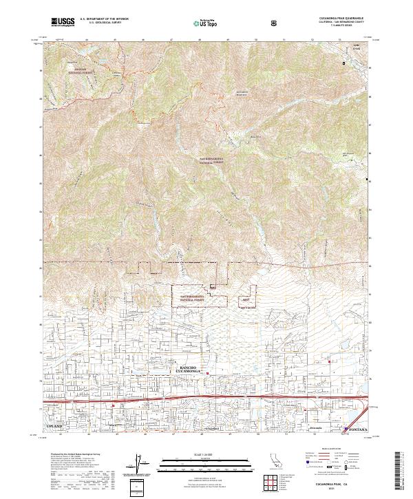 2021 Cucamonga Peak2021 Print · USGSRancho Cucamonga and the foothills of the San Gabriel Mountains are captured in this contemporary view of the northern Inland Empire. Trace the suburban interface from Chaffey College to the wilderness trails at Icehouse Canyon or the old rail corridor of the Pacific Electric Trl.
 - 2021 Map of Cajon, 2021 Print
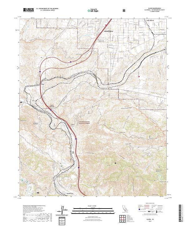 2021 Cajon2021 Print · USGSThe critical gateway of the Cajon Pass is captured here in the early twenty-first century as it bridges the gap between the San Gabriel and San Bernardino ranges. Researchers can trace the rail corridor and historic transit stops at Alray, Cosy Dell, and Keenbrook.
End of results
Showing maps 1-4 of 4
Top cities near Lytle Creek
- Riverside historical maps
- Fontana historical maps
- Ontario historical maps
- Rancho Cucamonga historical maps
- Victorville historical maps
- Rialto historical maps
See more
Top neighborhoods of Lytle Creek
Frequently asked questions
- What are the different types of historical maps available for Lytle Creek?
- What is the oldest map of Lytle Creek?
- Where can I purchase historical maps of Lytle Creek for my home or office?
- Where can I download high-res historical maps of Lytle Creek?
- Are there historical topographic maps available for Lytle Creek?
- Is there historical aerial imagery available for Lytle Creek?
- Where are historical maps of Lytle Creek sourced from?