1900s (20th Century) Maps of Rimrock, California
Explore 12 historic maps of Rimrock from the 1900s (20th Century). These maps offer a rare glimpse into what life looked like during the 1900s — showing old roads, neighborhoods, homes, and landmarks that have changed or disappeared over time.
Whether you're researching your family's past, planning a metal detecting trip, or studying how Rimrock's landscape evolved across the 1900s, these high-resolution maps are a powerful tool for exploring the history of this region.
- Focus on a specific era: All maps on this page are from the 1900s, giving you a focused view of this time period.
- See what’s changed: Compare century-old streets, trails, and buildings to today's modern landscape using overlays and satellite layers.
- Research with precision: Use these maps for genealogy, historical research, land use analysis, or educational projects.
- View, download, or print: Maps are fully viewable online in high resolution, and can be downloaded or printed for your own records.
Start exploring Rimrock's history through authentic maps from the 1900s. This is your window into the past.
Rimrock, CA maps
(12)- 1901 Map of Southern California Sheet No. 1
 1901 Southern California Sheet No. 11901 Print · USGSGreater Los Angeles at the dawn of the twentieth century is a landscape of growing citrus towns and a burgeoning rail network. Genealogists and historians can trace the early gridded streets of Hollywood and Pasadena or locate landmarks like Bear Lake and the Cahuilla Indian Reservation.6 unique versions available
 - 1902 Map of San Gorgonio
 1902 San Gorgonio1902 Print · USGSSouthern California at the turn of the century reveals a land of high-desert ranches and remote mountain mining camps. Genealogists and historians can locate early landmarks like Box S Ranch, Old Woman Springs, and the Rose Mine.8 unique versions available
 - 1904 Map of Southern California Sheet No. 1, 1905 Print
 1904 Southern California Sheet No. 11905 Print · USGSSouthern California at the dawn of the twentieth century shows a landscape of citrus groves and coastal towns connected by rail. Genealogists and historians can trace early settlements like San Juan Capistrano, find remote sites like the Rose Mine, and study the original water systems of the Santa Ana River.2 unique versions available
 - 1953 Map of San Bernardino
 1953 San Bernardino1953 Print · USGSSouthern California underwent massive post-war growth as suburban sprawl reached the foothills of the San Bernardino Mountains. Genealogists and historians can trace the rail-and-road roots of the Inland Empire through the Union Pacific RR and Lake Arrowhead resorts.2 unique versions available
 - 1955 Map of Morongo Valley, 1957 Print
 1955 Morongo Valley1957 Print · USGSMorongo Valley and the high desert canyons are seen here in the mid-fifties, showing the mix of historic ranching and early film-era settlement. Researchers can locate remote homesteads like The Pipes Ranch, old operations like the Rose Mine, and the developing streets of Pioneertown.3 unique versions available
 - 1956 Map of San Bernardino
 1956 San Bernardino1956 Print · USGSSouthern California's Inland Empire and High Desert come into focus in the mid-fifties as agriculture gives way to suburban and military growth. Trace early rail lines like the Pacific Electric or find remote landmarks like Camp Rock Mine and George AFB.
 - 1957 Map of San Bernardino
 1957 San Bernardino1957 Print · USGSSouthern California's Inland Empire and High Desert met during the postwar expansion of the late fifties. Genealogists and historians can trace the growth of San Bernardino and Redlands alongside remote landmarks like Edwards AFB and the Camp Rock Mine.
 - 1958 Map of San Bernardino, 1975 Print
 1958 San Bernardino1975 Print · USGSSouthern California’s Inland Empire and High Desert come into focus during the mid-century boom, showing the rise of suburbs and massive military installations. Researchers can trace the rail networks of the Union Pacific RR or locate landmarks like Norton AFB and Big Bear Lake.
 - 1959 Map of San Bernardino
 1959 San Bernardino1959 Print · USGSSouthern California underwent a massive transformation in the late fifties as suburban growth and military power reshaped the desert and valley. Researchers can trace the legacy of the Union Pacific Railroad and locate early footprints of Joshua Tree National Monument and Edwards Air Force Base.
 - 1966 Map of San Bernardino
 1966 San Bernardino1966 Print · USGSThe San Bernardino Valley and Mojave Desert met during a period of massive military and suburban growth in the mid-sixties. Genealogists and historians can trace the development of Edwards Air Force Base, old desert mines like the Bagdad Chase Mine, and mountain communities near Big Bear Lake.
 - 1972 Map of Rimrock, 1975 Print
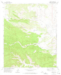 1972 Rimrock1975 Print · USGSThe San Bernardino high desert is shown here in the early seventies as a land of granite peaks and winding washes. Local historians can trace old access routes like the Bowden Pipes Road past Pioneertown, the Kee Ranch, and the Prospects of the south.2 unique versions available
 - 1982 Map of Big Bear Lake, 1996 Print
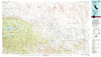 1982 Big Bear Lake1996 Print · USGSThe San Bernardino Mountains meet the high Mojave desert in the early eighties, showing a landscape defined by mountain resorts and desert basins. Trace the historic Belleville (Site), the rail lines of the Atchison Topeka and Santa Fe, and old mining works like the Gold Belt Mine.
End of results
Showing maps 1-12 of 12
Top cities near Rimrock
Frequently asked questions
- What are the different types of historical maps available for Rimrock?
- What is the oldest map of Rimrock?
- Where can I purchase historical maps of Rimrock for my home or office?
- Where can I download high-res historical maps of Rimrock?
- Are there historical topographic maps available for Rimrock?
- Is there historical aerial imagery available for Rimrock?
- Where are historical maps of Rimrock sourced from?