Old Maps of Yucca Grove, California for Genealogy
Trace your family roots with 17 historic maps of Yucca Grove. These high-res maps reveal old neighborhoods, homesites, landmarks, and streets — helping you uncover where your ancestors lived and how the area evolved over time.
- Explore historic neighborhoods: Identify where your relatives may have lived in the 1800s or 1900s.
- Compare maps over time: Trace the changes in streets, buildings, and landmarks for multi-generational research.
- Perfect for genealogy & ancestry research: Used by family historians and researchers to map out lineage and migration.
These maps are an incredible resource for exploring your personal connection to Yucca Grove's past.
Yucca Grove, CA maps
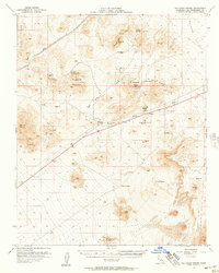
(17)- 1910 Map of Ivanpah, 1957 Print
 1910 Ivanpah1957 Print · USGSThe Mojave high desert at the start of the twentieth century was a landscape of remote mining camps and vital railroad junctions. Trace the early industrial footprint of Vanderbilt, the Copper World Mine, and the rail stops at Nipton and Kelso.
 - 1912 Map of Ivanpah
 1912 Ivanpah1912 Print · USGSThe Mojave high desert at the border of California and Nevada was a bustling corridor of mining and transcontinental rail at the start of the century. Genealogists and historians can trace defunct settlements and industrial sites like the abandoned copper smelter, Good Springs, and the Old Traction Road.5 unique versions available
 - 1942 Map of Ivanpah
 1942 Ivanpah1942 Print · USGSThe Mojave Desert frontier comes into focus during the early war years, showing a landscape shaped by mining and rail. You can trace the path of the Union Pacific through remote stops like Nipton, Goodsprings, and the junction at Barnwell.
 - 1947 Map of Kingman, 1948 Print
 1947 Kingman1948 Print · USGSThe tri-state Mojave desert region comes into focus during the late 1940s, as post-war travel began to surge along U S 66. Genealogists and historians can trace the mining-and-rail economy through the Atchison Topeka and Santa Fe line, the Copper World Mine, and old settlements like Oatman or Goodsprings.2 unique versions available
 - 1948 Map of Kingman
 1948 Kingman1948 Print · USGSThe Mojave Desert at the dawn of the fifties shows a landscape of deep canyons and booming mines along the Arizona and Nevada border. Genealogists and historians can trace rail-stop towns and mining claims like Oatman, Searchlight, and the Mohawk Mine.
 - 1954 Map of Kingman, 1964 Print
 1954 Kingman1964 Print · USGSThe High Desert borderlands come to life in the mid-fifties, showing the intersection of mining legacies and massive river projects. Researchers can trace old rail stops like Roach Station, mining sites such as Chloride, and river landmarks like Searchlight Ferry.4 unique versions available
 - 1955 Map of Kingman
 1955 Kingman1955 Print · USGSThe Mojave Desert and Colorado River corridor come alive in the mid-fifties, showing a landscape of mining camps and rail junctions. Trace the river to the Searchlight Ferry or locate old desert mining sites like Goldroad and the Great Monster Mine.
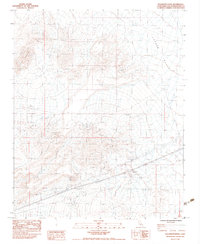
 - 1956 Map of Halloran Spring, 1957 Print
 1956 Halloran Spring1957 Print · USGSSan Bernardino County's high desert reveals its mining heart during the mid-fifties, centered on the vital water of Halloran Spring. Researchers can trace the network of prospects and claims including the Great Wanamingo Mine, Jumbo Mine, and Cree Camp.4 unique versions available
 - 1958 Map of Kingman
 1958 Kingman1958 Print · USGSThe tri-state desert borders of Arizona, Nevada, and California are shown in the late fifties as a network of mining camps and river crossings. Genealogists and historians can trace the legacy of remote outposts like Oatman, Chloride, and the Searchlight Ferry along the Colorado River.2 unique versions available
 - 1960 Map of Kingman
 1960 Kingman1960 Print · USGSThe high desert landscape of the Arizona-Nevada border comes alive in the mid-twentieth century, showcasing the rise of recreation alongside deep-rooted mining history. Genealogists and historians can trace the roots of towns like Kingman and Oatman, or locate remote sites like the Lucky Dutchman Mine and Santa Claus.3 unique versions available
 - 1983 Map of Solomons Knob
 1983 Solomons Knob1983 Print · USGSSan Bernardino County's high desert reaches are captured here in the early eighties, showing a landscape shaped by mining and rugged terrain. Researchers can locate remote sites like the Great Whamingo Mine, Telegraph Mine, and water sources at Francis Spring.2 unique versions available
 - 1985 Map of Ivanpah
 1985 Ivanpah1985 Print · USGSThe high desert of San Bernardino County is shown here in the mid-eighties, centered on the newly designated East Mojave National Scenic Area. Researchers can trace the Union Pacific rail line through remote stops like Kelso and Cima or locate historic extraction sites like the Morning Star Mine.2 unique versions available
 - 2012 Map of Solomons Knob, 2012 Print
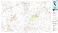
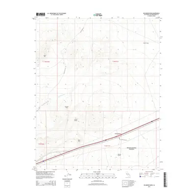
 2012 Solomons Knob2012 Print · USGSCovers Yucca Grove, including San Bernardino County, United States, and other nearby areas
 - 2015 Map of Solomons Knob, 2015 Print
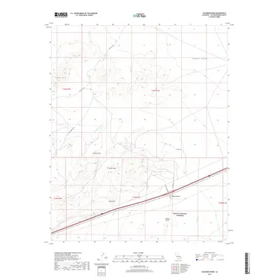
 2015 Solomons Knob2015 Print · USGSCovers Yucca Grove, including San Bernardino County, United States, and other nearby areas
 - 2018 Map of Solomons Knob, 2018 Print
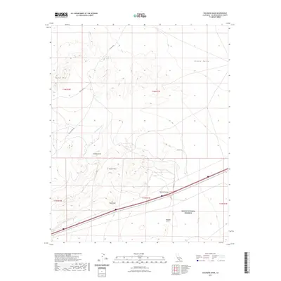
 2018 Solomons Knob2018 Print · USGSCovers Yucca Grove, including San Bernardino County, United States, and other nearby areas
 - 2021 Map of Solomons Knob, 2021 Print
 2021 Solomons Knob2021 Print · USGSCovers Yucca Grove, including San Bernardino County, United States, and other nearby areas
 - 2023 Map of Solomons Knob, 2023 Print
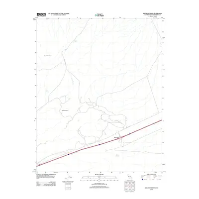
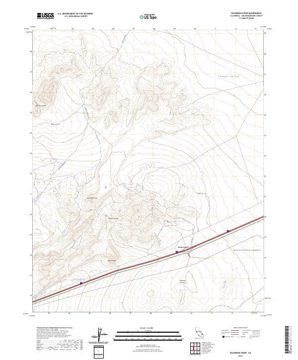 2023 Solomons Knob2023 Print · USGSThe high desert landscape of San Bernardino County is documented in the 2020s, showing the intersection of transit and protected wilderness. Researchers can locate remote desert water sources like Francis Spring and Bull Spring, or trace travel routes through Yucca Grove and Halloran Summit.
End of results
Showing maps 1-17 of 17
Top cities near Yucca Grove
Frequently asked questions
- What are the different types of historical maps available for Yucca Grove?
- What is the oldest map of Yucca Grove?
- Where can I purchase historical maps of Yucca Grove for my home or office?
- Where can I download high-res historical maps of Yucca Grove?
- Are there historical topographic maps available for Yucca Grove?
- Is there historical aerial imagery available for Yucca Grove?
- Where are historical maps of Yucca Grove sourced from?