Old Maps of Oceanside, California for Hiking & Exploration
Hike through history with 60 historic maps of Oceanside. Explore old trails, ghost towns, and forgotten backroads — perfect for outdoor adventurers and local explorers.
- Rediscover forgotten places: Map out old mining camps, roads, and footpaths that no longer exist on modern maps.
- Layer with modern tools: Combine with LiDAR or satellite views to plan hikes through historical terrain.
- Made for exploration: Popular among hikers, overlanders, and local history lovers.
Use these maps to find adventure and explore the hidden past of Oceanside.
Oceanside, CA maps
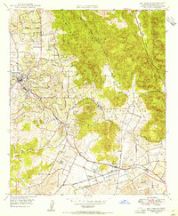
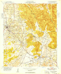
(60)- 1893 Map of Oceanside
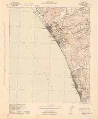
 1893 Oceanside1893 Print · USGSCoastal San Diego County was just beginning its transformation into a series of rail-side resort towns in the early 1890s. Researchers can trace the early grids of Oceanside, Carlsbad, and Encinitas alongside landmarks like the San Luis Rey Mission and Bati Quitos Lagoon.2 unique versions available
 - 1893 Map of Escondido
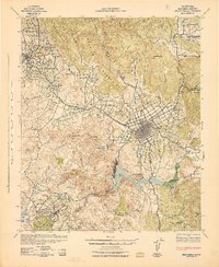
 1893 Escondido1893 Print · USGSNorth County San Diego emerges in the early 1890s as a region of new railroad towns and foothill settlements. Genealogists and historians can trace early grids in Escondido and locate smaller outposts like Olivenhain, Bernardo, and Vista.2 unique versions available
 - 1898 Map of Oceanside, 1955 Print
 1898 Oceanside1955 Print · USGSNorthern San Diego County's coast appears at the end of the nineteenth century as the rail lines sparked new growth in seaside towns. Genealogists and historians can trace early settlements and landmarks like Oceanside, the San Luis Rey Mission, and Encinitas.5 unique versions available
 - 1901 Map of Escondido
 1901 Escondido1901 Print · USGSInland San Diego County was a landscape of citrus groves and cattle ranges at the dawn of the twentieth century. Genealogists can trace family footprints in early settlements like Escondido and Bernardo, or follow the rail path of the Southern California R. R. Escondido Branch.6 unique versions available
 - 1901 Map of Oceanside
 1901 Oceanside1901 Print · USGSCoastal San Diego County is captured at the turn of the century, showing the early rail-driven growth of the shoreline. Genealogists and historians can trace the foundations of Oceanside, Carlsbad, and the San Luis Rey Mission along the Surf Line rail route.8 unique versions available
 - 1901 Map of San Luis Rey
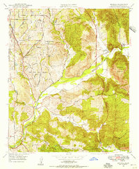
 1901 San Luis Rey1901 Print · USGSNorthern San Diego County is shown at the turn of the century as a landscape of sprawling ranchos, early coastal railroads, and secluded mountain valleys. Researchers can trace the routes of the California Southern RR or locate early settlements like De Luz, Pala, and the Temecula Indian Res.8 unique versions available
 - 1904 Map of Southern California Sheet No. 2
 1904 Southern California Sheet No. 21904 Print · USGSSouthern California during the early 1900s shows the transition from vast ranchos to coastal rail towns. Genealogists and researchers can trace the Southern California R.R. through Oceanside, explore old land grants like Mission Viejo, and locate early settlements from Fallbrook to Julian.5 unique versions available
 - 1941 Map of Margarita Peak, 1961 Print
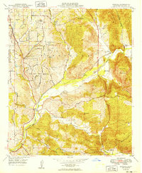
 1941 Margarita Peak1961 Print · USGSSan Diego's coastal ranch lands and backcountry peaks are captured here in the early forties, just before the landscape shifted toward major military use. Researchers can trace historic family estates like Rancho Santa Margarita and old rail stops along the AT&SF RR near De Luz Station.
 - 1942 Map of Margarita Peak
 1942 Margarita Peak1942 Print · USGSDuring the early years of World War II, this region of San Diego County remained a landscape of vast ranchos and scattered citrus groves. Genealogists can trace family holdings like Doville Ranch and community hubs including Deluz PO and the Horno Canyon CCC Camp.
 - 1942 Map of Temecula
 1942 Temecula1942 Print · USGSNorthern San Diego County and southern Riverside County are mapped here in the early 1940s, showing a rural landscape of canyons and ranch lands. Genealogists can trace family holdings at San Luis Rey Rancho or find early schools like Lilac Valley Sch.
 - 1942 Map of Oceanside
 1942 Oceanside1942 Print · USGSNorthern San Diego County coastal life during the early 1940s is shown here along the Pacific shoreline. Researchers can trace the original footprints of Carlsbad, Encinitas, and Leucadia, or find family landmarks like Libby Sch and the San Luis Rey Mission.
 - 1942 Map of Escondido
 1942 Escondido1942 Print · USGSNorthern San Diego County is captured here in the early 1940s, showing the inland citrus and ranching valleys before major development. Researchers can locate early schoolhouses like Rincon Sch and trace the original Escondido Branch rail line.
 - 1944 Map of Margarita Peak
 1944 Margarita Peak1944 Print · USGSThe northern reaches of San Diego County are documented here during the mid-1940s, highlighting the vast ranching estates and mountain canyons. Trace the path of the Atchison Topeka and Santa Fe railroad or locate legacy holdings like Rancho Santa Margarita and Doville Ranch.
 - 1944 Map of Morro Hill
 1944 Morro Hill1944 Print · USGSThe Los Padres National Forest high country is meticulously mapped in the mid-1940s, showing the intersection of Santa Barbara and Ventura counties. Historians can trace the isolation of the Apache School and the high-altitude Potrero Seco settlement.
 - 1947 Map of Santa Ana, 1949 Print
 1947 Santa Ana1949 Print · USGSSouthern California is depicted here in the late forties, showing the expansion of the Inland Empire and the Orange County coast. Researchers can trace the early layout of Palm Springs or locate long-standing tribal lands like the Pala Indian Reservation and Rincon Indian Res.
 - 1947 Map of Oceanside, 1957 Print
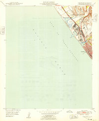
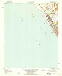 1947 Oceanside1957 Print · USGSThe Southern California coast undergoes a military transformation in the years following World War II as Camp Pendleton expands. Researchers can trace the early layout of Oceanside and the intersection of the Coast Highway with the Atchison Topeka and Santa Fe railroad.2 unique versions available
 - 1948 Map of San Luis Rey, 1955 Print
 1948 San Luis Rey1955 Print · USGSThe North County coastline and San Luis Rey valley appear here in the late Forties during a period of steady post-war expansion. Researchers can trace the early footprints of Carlsbad and Oceanside, locate the Academy of the Little Flower, or find defunct Clay Pits near Agua Hedionda.3 unique versions available
 - 1948 Map of San Marcos, 1955 Print
 1948 San Marcos1955 Print · USGSPost-war San Diego County comes to life as citrus groves and early suburban growth meet the rugged San Marcos Mountains. Trace local heritage at San Marcos Cem, the early campus of Palomar Junior College and High School, and the San Marcos Valley Airport.2 unique versions available
 - 1948 Map of Bonsall, 1956 Print
 1948 Bonsall1956 Print · USGSBonsall and the San Luis Rey River valley are shown here just after the war, when the landscape was a mix of working cattle ranches and emerging residential heights. Genealogists and local historians can locate early landmarks like Duffy Ranch Sch, Dulin Ranch, and the Fallbrook Naval Reservation.2 unique versions available
 - 1948 Map of Morro Hill, 1960 Print
 1948 Morro Hill1960 Print · USGSCoastal San Diego County appears here during the post-war buildup of the late 1940s, showing the massive integration of military and rail infrastructure. Genealogists and researchers can trace the early layout of Camp Pendleton, the Supply Depot, and the vanished stops of the Atchison Topeka and Santa Fe Railway at Ysidora.
 - 1949 Map of San Luis Rey
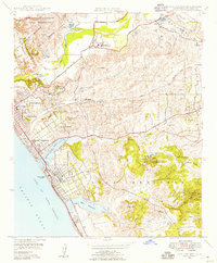
 1949 San Luis Rey1949 Print · USGSCoastal San Diego County is shown here in the late forties, just as the postwar boom began reshaping the shoreline between the naval reservation and the lagoons. You can trace the historic grounds of Mission San Luis Rey De Francia and locate landmarks like the Oceanside Municipal Airport and Rancho Guajome.
 - 1949 Map of Bonsall
 1949 Bonsall1949 Print · USGSNorthern San Diego County is captured here in the late 1940s as a landscape of large ranches and riverside settlements. Genealogists can trace property and community roots near Bonsall, the Duffy Ranch Sch, and the extensive Circle R Ranch.
 - 1949 Map of Morro Hill
 1949 Morro Hill1949 Print · USGSCoastal San Diego County appears in the late 1940s as a massive strategic hub during the early years of the Camp Joseph H Pendleton Naval Reservation. Genealogists and historians can trace the foundations of the Naval Hospital, the rail stop at Ysidora, and the original Home Ranch site.2 unique versions available
 - 1949 Map of Oceanside
 1949 Oceanside1949 Print · USGSCoastal San Diego County was undergoing a major military and industrial transition just after the war. Researchers can trace the early layout of Camp Pendleton, the rail activity at Fallbrook Junc, and the path of the original Coast Highway.
 - 1949 Map of San Marcos
 1949 San Marcos1949 Print · USGSNorthern San Diego County is captured here in the late 1940s, showing a landscape of burgeoning agricultural valleys and rugged mountain peaks. Genealogists can locate family landmarks like the San Marcos Cem, Rich-mar Sch, and the early San Marcos Valley Airport.
Showing maps 1-25 of 60
Top cities near Oceanside
- San Diego historical maps
- Escondido historical maps
- Carlsbad historical maps
- Temecula historical maps
- Vista historical maps
- San Marcos historical maps
See more
Top neighborhoods of Oceanside
- Escondido Junction historical maps
- South Oceanside historical maps
- Talich historical maps
- Ocean Hills historical maps
- Oceana historical maps
- San Luis Rey historical maps
Frequently asked questions
- What are the different types of historical maps available for Oceanside?
- What is the oldest map of Oceanside?
- Where can I purchase historical maps of Oceanside for my home or office?
- Where can I download high-res historical maps of Oceanside?
- Are there historical topographic maps available for Oceanside?
- Is there historical aerial imagery available for Oceanside?
- Where are historical maps of Oceanside sourced from?