1900s (20th Century) Maps of The Muirlands, San Diego
Explore 10 historic maps of The Muirlands from the 1900s (20th Century). These maps offer a rare glimpse into what life looked like during the 1900s — showing old roads, neighborhoods, homes, and landmarks that have changed or disappeared over time.
Whether you're researching your family's past, planning a metal detecting trip, or studying how The Muirlands's landscape evolved across the 1900s, these high-resolution maps are a powerful tool for exploring the history of this region.
- Focus on a specific era: All maps on this page are from the 1900s, giving you a focused view of this time period.
- See what’s changed: Compare century-old streets, trails, and buildings to today's modern landscape using overlays and satellite layers.
- Research with precision: Use these maps for genealogy, historical research, land use analysis, or educational projects.
- View, download, or print: Maps are fully viewable online in high resolution, and can be downloaded or printed for your own records.
Start exploring The Muirlands's history through authentic maps from the 1900s. This is your window into the past.
The Muirlands, San Diego maps
(10)- 1904 Map of Southern California Sheet No. 2
 1904 Southern California Sheet No. 21904 Print · USGSSouthern California during the early 1900s shows the transition from vast ranchos to coastal rail towns. Genealogists and researchers can trace the Southern California R.R. through Oceanside, explore old land grants like Mission Viejo, and locate early settlements from Fallbrook to Julian.5 unique versions available
 - 1943 Map of La Jolla
 1943 La Jolla1943 Print · USGSSan Diego's coastline and inland mesas are captured here during the early 1940s, showing the early footprints of coastal neighborhoods. Researchers can trace historic landmarks like Scripps Institute of Oceanography, Crystal Pier, and the Brown Military Academy.2 unique versions available
 - 1950 Map of San Diego, 1954 Print
 1950 San Diego1954 Print · USGSCoastal San Diego and the Baja California border region come alive in this mid-century survey. Trace the early layout of National City and Chula Vista, or locate historic landmarks like the San Diego and Arizona Eastern RR and Fort Rosecrans.
 - 1953 Map of La Jolla, 1955 Print
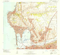 1953 La Jolla1955 Print · USGSSan Diego's coastline and canyons are captured in the early fifties during a period of significant suburban and military development. Genealogists and local historians can locate early schools and landmarks like The Bishops School, Old Town, and the Scripps Institute of Oceanography.2 unique versions available
 - 1954 Map of San Diego
 1954 San Diego1954 Print · USGSSan Diego and the northern reaches of Baja California are captured here during a decade of rapid post-war growth and military expansion. Researchers can trace the mid-century shoreline of Mission Beach, find established tribal lands like Capitan Grande Indian Reservation, and follow the border crossing into Tijuana.
 - 1955 Map of San Diego
 1955 San Diego1955 Print · USGSSouthern California underwent massive growth in the post-war years, as suburban development pushed into the canyons and foothills. Researchers can trace the mid-century infrastructure of Lindbergh Field, the Otay River, and numerous sites like Lemon Grove.
 - 1958 Map of San Diego, 1961 Print
 1958 San Diego1961 Print · USGSSan Diego and its inland mountain ranges are captured here in the late fifties as coastal suburbs began to climb the mesas. Researchers can trace the mid-century footprint of Miramar Naval Air Station, the winding San Diego & Arizona Eastern Ry, and local landmarks like Cabrillo Nat Mon.4 unique versions available
 - 1967 Map of La Jolla, 1970 Print
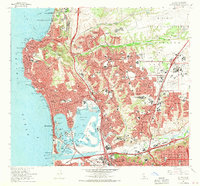 1967 La Jolla1970 Print · USGSCoastal San Diego is seen here during a transformative era of mid-century growth and freeway expansion. Genealogists and local historians can trace the development of neighborhoods from La Jolla to Serra Mesa, finding landmarks like Sea World Aquatic Park and the San Diego Serra Museum.3 unique versions available
 - 1979 Map of San Diego, 1980 Print
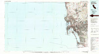 1979 San Diego1980 Print · USGSSan Diego and the southern California coastline are shown in the late seventies as the region's modern layout became firmly established. Researchers can trace the extensive military footprint at Miramar and find local landmarks from Cabrillo National Monument to Mission Bay Park.3 unique versions available
 - 1996 Map of La Jolla, 2000 Print
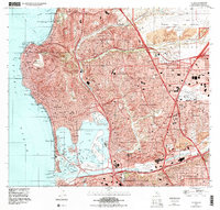 1996 La Jolla2000 Print · USGSSan Diego's coastal neighborhoods and canyons are shown at a peak of late-century suburban density. Trace the footprints of iconic sites like Sea World, the Mission San Diego De Alcala, and the sprawling campus of University of California San Diego.
End of results
Showing maps 1-10 of 10
Frequently asked questions
- What are the different types of historical maps available for The Muirlands?
- What is the oldest map of The Muirlands?
- Where can I purchase historical maps of The Muirlands for my home or office?
- Where can I download high-res historical maps of The Muirlands?
- Are there historical topographic maps available for The Muirlands?
- Is there historical aerial imagery available for The Muirlands?
- Where are historical maps of The Muirlands sourced from?