Old Maps of Oak Shores, California for Metal Detecting
Plan your next treasure hunt with 16 historic maps of Oak Shores. Find old homesites, ghost towns, trails, and gathering spots that may be lost to time — perfect for identifying promising metal detecting locations.
- Locate forgotten sites: Uncover places like long-lost settlements, abandoned rail lines, or gathering spots.
- Plan better hunts: Use map overlays combined with LiDAR or satellite views to narrow in on historically rich areas.
- Made for detectorists: Thousands of hobbyists use these maps to discover relics, coins, and hidden history.
Use these historic maps to boost your research and find new opportunities beneath the surface of Oak Shores.
Oak Shores, CA maps
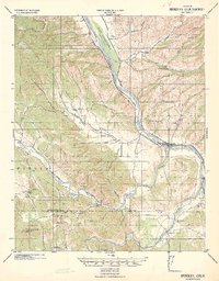
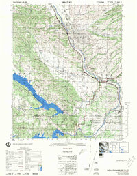
(16)- 1919 Map of Bradley
 1919 Bradley1919 Print · USGSThe Salinas River valley comes alive in the late 1910s, showing the early railroad era in Monterey County. Genealogists can trace family-named sites like Williams Ranch and schools like Hames Valley School or Nacimiento School.4 unique versions available
 - 1941 Map of Bradley
 1941 Bradley1941 Print · USGSCoastal California ranching and rail life are recorded here during the early years of the war. Genealogists and local historians can locate early homesteads and schoolhouses like Hames School or trace the Southern Pacific Coast Line through Bradley.
 - 1947 Map of San Luis Obispo, 1948 Print
 1947 San Luis Obispo1948 Print · USGSCoastal California at the dawn of the Cold War reveals a landscape of massive military reservations and quiet seaside towns. Genealogists and researchers can trace the Southern Pacific rail line, old mining sites like Los Burros Mine, and local landmarks from Point Buchon to the Carrizo Plain.
 - 1948 Map of San Luis Obispo
 1948 San Luis Obispo1948 Print · USGSCentral Coast life in the late 1940s is centered on the Southern Pacific rail line and expanding military bases. Genealogists can trace early rural life through Union School and local operations like the Klau Mine or Buena Vista Mine.
 - 1948 Map of Bradley, 1957 Print
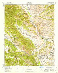 1948 Bradley1957 Print · USGSMonterey and San Luis Obispo counties come together in the late 1940s as military expansion meets traditional ranching along the Salinas River. Genealogists and historians can trace the transition from rural holdings like Branch Ranch to the borders of Camp Roberts and the Hunter Liggett Military Reservation.2 unique versions available
 - 1949 Map of Tierra Redonda Mountain, 1952 Print
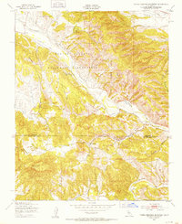 1949 Tierra Redonda Mountain1952 Print · USGSThe Central Coast ranges of Monterey and San Luis Obispo counties are shown here just after the war, dominated by the Hunter Liggett Military Reservation. Researchers can locate family landmarks like Branch Ranch, the settlement of Pleyto, and the local Cem near the river.4 unique versions available
 - 1956 Map of San Luis Obispo, 1963 Print
 1956 San Luis Obispo1963 Print · USGSCentral California coastal and valley life unfolds in the mid-fifties, from the shoreline of Pismo Beach to the arid Carrizo Plain. Trace early travel routes along the Southern Pacific RR or locate family sites near the Templeton Cemetery and Paso Robles County Cemetery.5 unique versions available
 - 1957 Map of San Luis Obispo
 1957 San Luis Obispo1957 Print · USGSCoastal California in the late fifties is defined by the steep Santa Lucia Range and the rail-connected hub of San Luis Obispo. Genealogists and researchers can trace rural life via Union School, the Southern Pacific line, and old sites like the Polar Star Mine.
 - 1958 Map of San Luis Obispo
 1958 San Luis Obispo1958 Print · USGSThe Central Coast in the late fifties reveals a landscape of ranching and early tourism before the massive expansion of the modern era. Trace the path of the Southern Pacific through Atascadero or locate family roots in coastal towns like Cayucos and Cambria.
 - 1961 Map of Bradley, 1968 Print
 1961 Bradley1968 Print · USGSMonterey County in the early sixties is a landscape defined by the intersection of military training grounds, oil extraction, and ranching life. Researchers can trace the path of the Southern Pacific Railroad through Bradley or locate family sites near Pleyto and Hames Valley Hall.2 unique versions available
 - 1976 Map of Bradley
 1976 Bradley1976 Print · USGSThe Salinas River valley in the mid-1970s shows a complex landscape of oil extraction, military training, and massive reservoirs. Researchers can trace the legacy of the Southern Pacific railroad, the rural Hames Valley Hall, and the vast Camp Roberts Military Reservation.
 - 1989 Map of Paso Robles
 1989 Paso Robles1989 Print · USGSCoastal mountains and the Salinas River valley meet in the late eighties as this region balances military installations and agriculture. Genealogists and historians can trace the Southern Pacific line through Paso Robles and Templeton or locate the Klau Mine and San Miguel.
 - 2012 Map of Tierra Redonda Mountain, 2012 Print
 2012 Tierra Redonda Mountain2012 Print · USGSCovers Oak Shores, including Lake Nacimiento, Bee Rock, and other nearby areas
 - 2015 Map of Tierra Redonda Mountain, 2015 Print
 2015 Tierra Redonda Mountain2015 Print · USGSCovers Oak Shores, including Lake Nacimiento, Bee Rock, and other nearby areas
 - 2018 Map of Tierra Redonda Mountain, 2018 Print
 2018 Tierra Redonda Mountain2018 Print · USGSCovers Oak Shores, including Lake Nacimiento, Bee Rock, and other nearby areas
 - 2021 Map of Tierra Redonda Mountain, 2021 Print
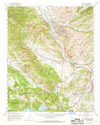
 2021 Tierra Redonda Mountain2021 Print · USGSThe California lakeside communities of Monterey and San Luis Obispo counties are shown here as they appeared in the early 2020s. Researchers can trace the residential development of Oak Shores and the geographic character of Bee Rock and Tierra Redonda Mtn.
End of results
Showing maps 1-16 of 16
Top cities near Oak Shores
Frequently asked questions
- What are the different types of historical maps available for Oak Shores?
- What is the oldest map of Oak Shores?
- Where can I purchase historical maps of Oak Shores for my home or office?
- Where can I download high-res historical maps of Oak Shores?
- Are there historical topographic maps available for Oak Shores?
- Is there historical aerial imagery available for Oak Shores?
- Where are historical maps of Oak Shores sourced from?