2020s Maps of Suey Creek, California
Explore 1 historic maps of Suey Creek from the 2020s. These maps offer a rare glimpse into what life looked like during the 2020s — showing old roads, neighborhoods, homes, and landmarks that have changed or disappeared over time.
Whether you're researching your family's past, planning a metal detecting trip, or studying how Suey Creek's landscape evolved across the 2020s, these high-resolution maps are a powerful tool for exploring the history of this region.
- Focus on a specific era: All maps on this page are from the 2020s, giving you a focused view of this time period.
- See what’s changed: Compare century-old streets, trails, and buildings to today's modern landscape using overlays and satellite layers.
- Research with precision: Use these maps for genealogy, historical research, land use analysis, or educational projects.
- View, download, or print: Maps are fully viewable online in high resolution, and can be downloaded or printed for your own records.
Start exploring Suey Creek's history through authentic maps from the 2020s. This is your window into the past.
Suey Creek, CA maps
(1)- 2021 Map of Nipomo, 2021 Print
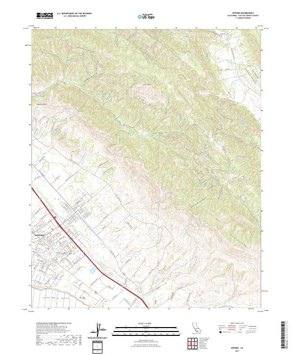 2021 Nipomo2021 Print · USGSNipomo and the surrounding mesa are captured in the early 2020s, showing the intersection of coastal valleys and rugged ridges. Trace local growth from the PO out toward Nipomo Mesa or follow the route of the Edmund G Brown Coastal Br California Aqueduct through Los Berros Canyon.
End of results
Showing maps 1-1 of 1
Top cities near Suey Creek
- Santa Maria historical maps
- San Luis Obispo historical maps
- Orcutt historical maps
- Arroyo Grande historical maps
- Grover Beach historical maps
- Pismo Beach historical maps
See more
Frequently asked questions
- What are the different types of historical maps available for Suey Creek?
- What is the oldest map of Suey Creek?
- Where can I purchase historical maps of Suey Creek for my home or office?
- Where can I download high-res historical maps of Suey Creek?
- Are there historical topographic maps available for Suey Creek?
- Is there historical aerial imagery available for Suey Creek?
- Where are historical maps of Suey Creek sourced from?