Old Maps of San Mateo County, California for Genealogy
Trace your family roots with 184 historic maps of San Mateo County. These high-res maps reveal old neighborhoods, homesites, landmarks, and streets — helping you uncover where your ancestors lived and how the area evolved over time.
- Explore historic neighborhoods: Identify where your relatives may have lived in the 1800s or 1900s.
- Compare maps over time: Trace the changes in streets, buildings, and landmarks for multi-generational research.
- Perfect for genealogy & ancestry research: Used by family historians and researchers to map out lineage and migration.
These maps are an incredible resource for exploring your personal connection to San Mateo County's past.
San Mateo County, CA maps
(184)- 1892 Map of San Mateo
 1892 San Mateo1892 Print · USGSThe San Francisco Peninsula in the 1890s reveals a landscape of ranchos and rising rail towns. Trace the early footprints of Colma, Millbrae, and South San Francisco alongside vital water infrastructure like the Crystal Springs Dam.
 - 1896 Map of San Mateo
 1896 San Mateo1896 Print · USGSThe northern San Francisco Peninsula comes alive in this late nineteenth-century survey. Genealogists and historians can trace early trackage of the Southern Pacific R. R. through Colma and Millbrae, or locate the Industrial School and Brewer School.
 - 1897 Map of Palo Alto
 1897 Palo Alto1897 Print · USGSThe San Francisco Peninsula and Santa Clara Valley emerge in the late nineteenth century as academic and rail hubs. Trace the early footprints of Stanford University, the primary line of the Southern Pacific RR, and the transition of old ranchos like La Purisima Concepcion.
 - 1899 Map of Palo Alto
 1899 Palo Alto1899 Print · USGSThe San Francisco Peninsula was entering a period of rapid development in the 1890s as railroad towns began to flourish around the new Stanford University campus. You can trace early property lines across Pastoria de las Borregas or locate nineteenth-century landings like Cooley Landing and Jagel Landing.11 unique versions available
 - 1899 Map of Haywards
 1899 Haywards1899 Print · USGSThe East Bay shoreline at the end of the century was a landscape of industrial salt works and vital maritime landings. Genealogists and historians can trace the early rail stops at Haywards Sta. or locate family trade hubs at Mulford Landing and Jarvis Landing.5 unique versions available
 - 1899 Map of San Mateo
 1899 San Mateo1899 Print · USGSThe northern San Mateo peninsula appears here in the late nineteenth century as a landscape of early rail lines and critical water infrastructure. Trace the early development of South San Francisco, the sprawling Cemeteries of Colma, and rural schoolhouses like Hoyt School.6 unique versions available
 - 1902 Map of Santa Cruz
 1902 Santa Cruz1902 Print · USGSCoastal California at the end of the Victorian era reveals a landscape of redwood forests, early university towns, and remote Pacific outposts. Genealogists and historians can trace the early rail corridors through Boulder Creek and Felton or locate coastal landmarks like Pigeon Point and Halfmoon Bay.9 unique versions available
 - 1915 Map of San Mateo
 1915 San Mateo1915 Print · USGSThe San Francisco Peninsula at the start of the twentieth century shows a landscape transitioning from rural ranchos to industrial centers and suburbs. Genealogists can trace family footprints at Colma, locate the Hoyt School, or follow the Southern Pacific RR through Baden Sta.6 unique versions available
 - 1915 Map of Haywards
 1915 Haywards1915 Print · USGSThe East Bay shoreline and inland foothills are shown here in the mid-1910s during a height of coastal industry. Genealogists and historians can trace old shipping points like Mulford Landing, early salt operations at Union City Salt Works, and the rail lines of the Western Pacific.4 unique versions available
 - 1939 Map of San Mateo, 1956 Print
 1939 San Mateo1956 Print · USGSThe San Francisco Peninsula at the brink of the 1940s reveals a landscape of ridge-top vistas and growing railroad towns. Researchers can trace the early layouts of Burlingame, San Bruno, and Millbrae, or locate institutional landmarks like St Josephs Military Academy and the extensive Chinese Cem.3 unique versions available
 - 1940 Map of Halfmoon Bay
 1940 Halfmoon Bay1940 Print · USGSThe San Mateo coast and Santa Cruz Mountains appear here in the early 1940s, balancing rural ranching with early oil exploration. Genealogists and local historians can trace family-named sites like Bowman Ranch and old rural hubs including Pescadero and La Honda.2 unique versions available
 - 1940 Map of Ano Nuevo, 1943 Print
 1940 Ano Nuevo1943 Print · USGSThe San Mateo and Santa Cruz coastlines appear here in the early 1940s, highlighting a period of rural ranching and isolated coastal outposts. Genealogists and historians can trace the locations of Coastways Ranch, the Whitehouse Camp, and Trantor.
 - 1941 Map of Ano Nuevo Pt.
 1941 Ano Nuevo Pt.1941 Print · USGSThe rugged San Mateo coastline comes alive in the early 1940s, showing a landscape of maritime navigation and coastal ranching. Genealogy and history buffs can locate early landmarks like Pigeon Point LH, Notley Junction, and the historic Coastways Ranch.
 - 1941 Map of Palo Alto
 1941 Palo Alto1941 Print · USGSThe Peninsula and Santa Clara Valley are seen here in the early 1940s, just as the region began its mid-century transformation. Researchers can trace the layout of Stanford University, the military grounds of Moffett Field, and local landmarks like Flood Park.
 - 1942 Map of Ano Nuevo
 1942 Ano Nuevo1942 Print · USGSThe Central Coast south of Pescadero appears in this wartime survey, showing a landscape of remote ranching and prominent maritime landmarks. Researchers can trace early 20th-century coastal sites like Coastways Ranch, Notley Junction, and the iconic Pigeon Point light station.2 unique versions available
 - 1942 Map of Hayward
 1942 Hayward1942 Print · USGSThe East Bay shoreline and inland foothills come alive in the early 1940s as industry and infrastructure reshape the landscape. Researchers can trace the original footprints of Russell City and Mt Eden or locate the historic Oakland Speedway and Fairmont Hospital.
 - 1943 Map of Palo Alto
 1943 Palo Alto1943 Print · USGSThe San Francisco Peninsula was still a region of orchards and academic outposts in the years following the Great Depression. Researchers can trace the development of early Silicon Valley through the Southern Pacific line and family landmarks like Duveneck Ranch and the Whisman Dist School.
 - 1943 Map of San Mateo
 1943 San Mateo1943 Print · USGSThe San Francisco Peninsula during the mid-war years shows a region of expanding shoreline industry and established hillside communities. Researchers can trace historic landmarks like St Josephs Military Academy and the Golden Gate National Cem.
 - 1943 Map of Halfmoon Bay
 1943 Halfmoon Bay1943 Print · USGSSan Mateo County's coastline and mountain ridges appear here during the mid-war years, showcasing a landscape of rural schoolhouses and coastal hamlets. Trace family roots and local landmarks from the Pulgas Water Temple to old sites like Pescadero and Purisima Sch.
 - 1947 Map of San Francisco, 1948 Print
 1947 San Francisco1948 Print · USGSThe Bay Area in the late 1940s reveals a region transitioning from wartime intensity to post-war suburban growth. Trace the historic rail lines of the Southern Pacific RR or locate early military footprints at Fort Funston and Moffett Field.
 - 1947 Map of San Francisco South, 1955 Print
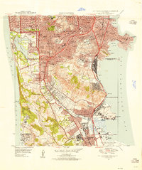 1947 San Francisco South1955 Print · USGSPost-war San Mateo County and the city's southern edge are caught here during a period of rapid peninsula growth. Genealogists can trace the many memorial grounds of Colma, while historians can locate the Tanforan Race Track and early San Francisco International Airport.
 - 1947 Map of San Leandro, 1956 Print
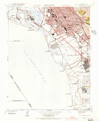 1947 San Leandro1956 Print · USGSThe East Bay shoreline in the late 1940s shows a fascinating mix of industrial salt production and rapid suburban development. Researchers can trace early aviation at the Oakland Municipal Airport or locate community anchors like San Lorenzo Village and the Oakland Speedway.
 - 1947 Map of San Mateo, 1957 Print
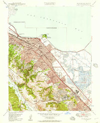 1947 San Mateo1957 Print · USGSMid-century San Mateo County shows a landscape of growing suburbs and salt marshes before the era of massive bay fill. Genealogists and historians can locate the San Mateo Junior College, trace the Southern Pacific line, or find the California Military Academy in Belmont.
 - 1947 Map of Newark, 1958 Print
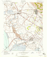 1947 Newark1958 Print · USGSThe industrial shoreline and agricultural plains of the East Bay are captured here just after the war. Local historians can trace early landings like Jarvis Landing and family landmarks such as Patterson Ranch and the Masonic Home.
 - 1948 Map of San Leandro
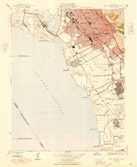 1948 San Leandro1948 Print · USGSPost-war East Bay growth is on full display in this late 1940s survey of the shoreline. Genealogists and historians can trace the emergence of San Lorenzo Village or locate local landmarks like the Oakland Speedway, Powder Works, and the Naval Chapel.
Showing maps 1-25 of 184
Top cities of San Mateo County
- San Mateo historical maps
- Daly City historical maps
- Redwood City historical maps
- South San Francisco historical maps
- San Bruno historical maps
- Pacifica historical maps
See more
Frequently asked questions
- What are the different types of historical maps available for San Mateo County?
- What is the oldest map of San Mateo County?
- Where can I purchase historical maps of San Mateo County for my home or office?
- Where can I download high-res historical maps of San Mateo County?
- Are there historical topographic maps available for San Mateo County?
- Is there historical aerial imagery available for San Mateo County?
- Where are historical maps of San Mateo County sourced from?