1940s Maps of Painted Cave, California
Explore 4 historic maps of Painted Cave from the 1940s. These maps offer a rare glimpse into what life looked like during the 1940s — showing old roads, neighborhoods, homes, and landmarks that have changed or disappeared over time.
Whether you're researching your family's past, planning a metal detecting trip, or studying how Painted Cave's landscape evolved across the 1940s, these high-resolution maps are a powerful tool for exploring the history of this region.
- Focus on a specific era: All maps on this page are from the 1940s, giving you a focused view of this time period.
- See what’s changed: Compare century-old streets, trails, and buildings to today's modern landscape using overlays and satellite layers.
- Research with precision: Use these maps for genealogy, historical research, land use analysis, or educational projects.
- View, download, or print: Maps are fully viewable online in high resolution, and can be downloaded or printed for your own records.
Start exploring Painted Cave's history through authentic maps from the 1940s. This is your window into the past.
Painted Cave, CA maps
(4)- 1941 Map of San Rafael Mtn. , 1955 Print
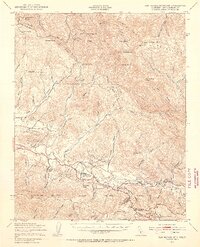 1941 San Rafael Mtn.1955 Print · USGSSanta Barbara County’s backcountry comes into focus during the early 1940s, showing a rugged landscape of high peaks and river-valley ranches. Researchers can locate remote sites like the Redrock Quicksilver Mine and Rancho San Fernando Rey or trace the route to Cold Spring Tavern.3 unique versions available
 - 1942 Map of San Rafael Mtn. , 1945 Print
 1942 San Rafael Mtn.1945 Print · USGSThe Santa Barbara backcountry in the early 1940s is shown here as a network of canyon ranches and mountain fire lookouts. Genealogists and historians can trace family properties like Storke Ranch or locate the Redrock Quicksilver Mine and Cold Spring Tavern.
 - 1943 Map of San Rafael Mtn.
 1943 San Rafael Mtn.1943 Print · USGSSanta Barbara's interior mountains during the Second World War reveal a landscape of remote quicksilver mining and sprawling cattle ranches. Researchers can trace historic properties like Rancho San Fernando Rey and landmarks like Cold Spring Tavern or the Redrock Quicksilver Mine.
 - 1949 Map of Los Angeles
 1949 Los Angeles1949 Print · USGSSouthern California and the South Coast appear at the onset of the post-war boom, from the Channel Islands to the Mojave Desert. Trace early aviation sites like Lockheed Air Terminal and mining history at the Redrock Quicksilver Mine and Redrover Mine.2 unique versions available
End of results
Showing maps 1-4 of 4
Top cities near Painted Cave
- Santa Barbara historical maps
- Goleta historical maps
- Isla Vista historical maps
- Montecito historical maps
- Mission Canyon historical maps
- Toro Canyon historical maps
See more
Frequently asked questions
- What are the different types of historical maps available for Painted Cave?
- What is the oldest map of Painted Cave?
- Where can I purchase historical maps of Painted Cave for my home or office?
- Where can I download high-res historical maps of Painted Cave?
- Are there historical topographic maps available for Painted Cave?
- Is there historical aerial imagery available for Painted Cave?
- Where are historical maps of Painted Cave sourced from?