1990s Maps of Santa Barbara, California
Explore 2 historic maps of Santa Barbara from the 1990s. These maps offer a rare glimpse into what life looked like during the 1990s — showing old roads, neighborhoods, homes, and landmarks that have changed or disappeared over time.
Whether you're researching your family's past, planning a metal detecting trip, or studying how Santa Barbara's landscape evolved across the 1990s, these high-resolution maps are a powerful tool for exploring the history of this region.
- Focus on a specific era: All maps on this page are from the 1990s, giving you a focused view of this time period.
- See what’s changed: Compare century-old streets, trails, and buildings to today's modern landscape using overlays and satellite layers.
- Research with precision: Use these maps for genealogy, historical research, land use analysis, or educational projects.
- View, download, or print: Maps are fully viewable online in high resolution, and can be downloaded or printed for your own records.
Start exploring Santa Barbara's history through authentic maps from the 1990s. This is your window into the past.
Santa Barbara, CA maps
(2)- 1995 Map of Goleta, 2000 Print
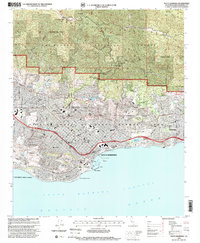
 1995 Goleta2000 Print · USGSThe Santa Barbara coast during the mid-nineties shows a mix of academic expansion and historic land grants. Researchers can trace the layout of the U of Cal Santa Barbara, the operations at Santa Barbara Airport, and the grounds of Goleta Cem.
 - 1995 Map of Santa Barbara, 2000 Print
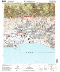
 1995 Santa Barbara2000 Print · USGSSanta Barbara and Montecito are shown in the mid-nineties as the city's historic core meets the rising Los Padres foothills. Researchers can trace local landmarks like the Santa Barbara Mission, Stearns Wharf, and the Andree Clark Bird Refuge.
End of results
Showing maps 1-2 of 2
Top cities near Santa Barbara
- Goleta historical maps
- Isla Vista historical maps
- Carpinteria historical maps
- Montecito historical maps
- Mission Canyon historical maps
- Toro Canyon historical maps
See more
Top neighborhoods of Santa Barbara
- Las Positas Meadows historical maps
- Vista Del Monte historical maps
- Upper State historical maps
- East Side historical maps
- Riviera historical maps
- The Mesa historical maps
See more
Frequently asked questions
- What are the different types of historical maps available for Santa Barbara?
- What is the oldest map of Santa Barbara?
- Where can I purchase historical maps of Santa Barbara for my home or office?
- Where can I download high-res historical maps of Santa Barbara?
- Are there historical topographic maps available for Santa Barbara?
- Is there historical aerial imagery available for Santa Barbara?
- Where are historical maps of Santa Barbara sourced from?