Old Maps of Buena Vista Mobile Home Park, Palo Alto for Hiking & Exploration
Hike through history with 22 historic maps of Buena Vista Mobile Home Park. Explore old trails, ghost towns, and forgotten backroads — perfect for outdoor adventurers and local explorers.
- Rediscover forgotten places: Map out old mining camps, roads, and footpaths that no longer exist on modern maps.
- Layer with modern tools: Combine with LiDAR or satellite views to plan hikes through historical terrain.
- Made for exploration: Popular among hikers, overlanders, and local history lovers.
Use these maps to find adventure and explore the hidden past of Buena Vista Mobile Home Park.
Buena Vista Mobile Home Park, Palo Alto maps
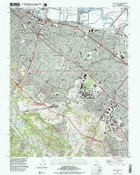
(22)- 1897 Map of Palo Alto
 1897 Palo Alto1897 Print · USGSCovers Buena Vista Mobile Home Park, including San Jose, Fremont, and other nearby areas
 - 1899 Map of Palo Alto
 1899 Palo Alto1899 Print · USGSCovers Buena Vista Mobile Home Park, including San Jose, Fremont, and other nearby areas11 unique versions available
 - 1902 Map of Santa Cruz
 1902 Santa Cruz1902 Print · USGSCovers Buena Vista Mobile Home Park, including San Jose, Fremont, and other nearby areas9 unique versions available
 - 1941 Map of Palo Alto
 1941 Palo Alto1941 Print · USGSCovers Buena Vista Mobile Home Park, including San Jose, Fremont, and other nearby areas
 - 1943 Map of Palo Alto
 1943 Palo Alto1943 Print · USGSCovers Buena Vista Mobile Home Park, including San Jose, Fremont, and other nearby areas
 - 1947 Map of San Francisco, 1948 Print
 1947 San Francisco1948 Print · USGSCovers Buena Vista Mobile Home Park, including San Jose, San Francisco, and other nearby areas
 - 1948 Map of San Francisco, 1951 Print
 1948 San Francisco1951 Print · USGSCovers Buena Vista Mobile Home Park, including San Jose, San Francisco, and other nearby areas
 - 1948 Map of Palo Alto, 1956 Print
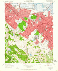
 1948 Palo Alto1956 Print · USGSCovers Buena Vista Mobile Home Park, including San Jose, Fremont, and other nearby areas
 - 1953 Map of Palo Alto, 1955 Print
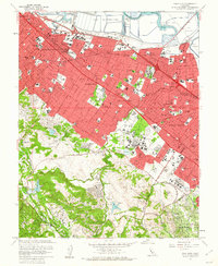
 1953 Palo Alto1955 Print · USGSCovers Buena Vista Mobile Home Park, including Redwood City, Palo Alto, and other nearby areas2 unique versions available
 - 1955 Map of San Francisco
 1955 San Francisco1955 Print · USGSCovers Buena Vista Mobile Home Park, including San Jose, San Francisco, and other nearby areas
 - 1956 Map of San Francisco
 1956 San Francisco1956 Print · USGSCovers Buena Vista Mobile Home Park, including San Jose, San Francisco, and other nearby areas4 unique versions available
 - 1957 Map of San Francisco
 1957 San Francisco1957 Print · USGSCovers Buena Vista Mobile Home Park, including San Jose, San Francisco, and other nearby areas
 - 1960 Map of San Francisco
 1960 San Francisco1960 Print · USGSCovers Buena Vista Mobile Home Park, including San Jose, San Francisco, and other nearby areas
 - 1961 Map of San Francisco
 1961 San Francisco1961 Print · USGSCovers Buena Vista Mobile Home Park, including San Jose, San Francisco, and other nearby areas
 - 1961 Map of Palo Alto, 1962 Print
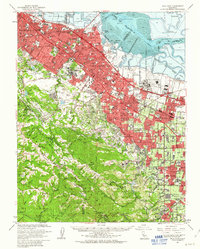
 1961 Palo Alto1962 Print · USGSCovers Buena Vista Mobile Home Park, including Redwood City, Palo Alto, and other nearby areas4 unique versions available
 - 1961 Map of Palo Alto, 1963 Print
 1961 Palo Alto1963 Print · USGSCovers Buena Vista Mobile Home Park, including San Jose, Fremont, and other nearby areas3 unique versions available
 - 1964 Map of San Francisco
 1964 San Francisco1964 Print · USGSCovers Buena Vista Mobile Home Park, including San Jose, San Francisco, and other nearby areas
 - 1971 Map of San Francisco
 1971 San Francisco1971 Print · USGSCovers Buena Vista Mobile Home Park, including San Jose, San Francisco, and other nearby areas
 - 1982 Map of Palo Alto, 1983 Print
 1982 Palo Alto1983 Print · USGSCovers Buena Vista Mobile Home Park, including San Jose, Fremont, and other nearby areas2 unique versions available
 - 1985 Map of San Francisco, 1989 Print
 1985 San Francisco1989 Print · USGSCovers Buena Vista Mobile Home Park, including San Jose, San Francisco, and other nearby areas
 - 1991 Map of Palo Alto, 1995 Print
 1991 Palo Alto1995 Print · USGSCovers Buena Vista Mobile Home Park, including Redwood City, Palo Alto, and other nearby areas2 unique versions available
 - 1997 Map of Palo Alto, 1999 Print
 1997 Palo Alto1999 Print · USGSCovers Buena Vista Mobile Home Park, including Redwood City, Palo Alto, and other nearby areas
End of results
Showing maps 1-22 of 22
Frequently asked questions
- What are the different types of historical maps available for Buena Vista Mobile Home Park?
- What is the oldest map of Buena Vista Mobile Home Park?
- Where can I purchase historical maps of Buena Vista Mobile Home Park for my home or office?
- Where can I download high-res historical maps of Buena Vista Mobile Home Park?
- Are there historical topographic maps available for Buena Vista Mobile Home Park?
- Is there historical aerial imagery available for Buena Vista Mobile Home Park?
- Where are historical maps of Buena Vista Mobile Home Park sourced from?