Old Maps of San Jose, California
Explore 118 old maps of San Jose, spanning from 1889 to today. These high-resolution historic maps reveal how streets, neighborhoods, landmarks, and natural features evolved over time — perfect for genealogy, metal detecting, research, and local history exploration.
What you can do with these maps:
- See how San Jose changed over time: Compare historical maps to modern-day views to trace roads, homesites, rail lines & more.
- View detailed metadata: Each map includes creators, publishers, year, scale, and archive source.
- Overlay maps with satellite & LiDAR: Visualize the past alongside modern tools to explore terrain & human change.
- Trusted historical sources: Maps sourced from the USGS, Library of Congress, and other archives.
- Access maps your way: View online, download high-res files, or order prints for personal or research use.
Start exploring old maps of San Jose to uncover forgotten places, hidden landmarks, and the deep history beneath your feet.
San Jose, CA maps
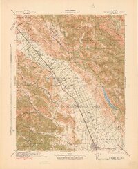
(118)- 1889 Map of San Jose, 1939 Print
 1889 San Jose1939 Print · USGSSanta Clara County during the late nineteenth century was a mosaic of historic ranchos and developing rail lines. Genealogists can trace family footprints through early settlements like Milpitas, Berryessa, and the grounds of the Santa Clara Co. Alms House.2 unique versions available
 - 1897 Map of San Jose
 1897 San Jose1897 Print · USGSThe Santa Clara Valley at the close of the nineteenth century is captured here as a landscape of vast ranchos and emerging rail towns. Genealogists can trace family lands across the Enright Tract or locate ancestors at the County Infirmary, Agnew, and Willow Glen.
 - 1897 Map of Mt. Hamilton
 1897 Mt. Hamilton1897 Print · USGSThe peaks and ridges of the Diablo Range are documented here in the mid-1890s, centered on the newly established Lick Observatory. Local historians can trace the early road up Mt Hamilton past the lone Hotel and remote outposts like Mowry Camp.6 unique versions available
 - 1897 Map of Palo Alto
 1897 Palo Alto1897 Print · USGSThe San Francisco Peninsula and Santa Clara Valley emerge in the late nineteenth century as academic and rail hubs. Trace the early footprints of Stanford University, the primary line of the Southern Pacific RR, and the transition of old ranchos like La Purisima Concepcion.
 - 1899 Map of San Jose
 1899 San Jose1899 Print · USGSThe Santa Clara Valley at the end of the century reveals a landscape of ranchos and growing rail hubs. Genealogists can trace family names and institutions from San Jose to the Santa Clara Co. Alms House and Agnew asylum.6 unique versions available
 - 1899 Map of Palo Alto
 1899 Palo Alto1899 Print · USGSThe San Francisco Peninsula was entering a period of rapid development in the 1890s as railroad towns began to flourish around the new Stanford University campus. You can trace early property lines across Pastoria de las Borregas or locate nineteenth-century landings like Cooley Landing and Jagel Landing.11 unique versions available
 - 1902 Map of Santa Cruz
 1902 Santa Cruz1902 Print · USGSCoastal California at the end of the Victorian era reveals a landscape of redwood forests, early university towns, and remote Pacific outposts. Genealogists and historians can trace the early rail corridors through Boulder Creek and Felton or locate coastal landmarks like Pigeon Point and Halfmoon Bay.9 unique versions available
 - 1916 Map of New Almaden
 1916 New Almaden1916 Print · USGSThe Santa Cruz Mountains and the Guadalupe River watershed are captured here during the mid-1910s. Researchers can trace the rail-to-mine connections of New Almaden or locate early schools like Vinehill School and the (Abandoned Town) near Almaden Canyon.
 - 1917 Map of Morgan Hill
 1917 Morgan Hill1917 Print · USGSSanta Clara County during the early twentieth century is captured here as a valley of orchards and growing rail towns. Genealogists can locate specific family sites like Bradleys Store or trace rural attendance at Machado School and Uvas School.5 unique versions available
 - 1919 Map of New Almaden, 1928 Print
 1919 New Almaden1928 Print · USGSThe Santa Cruz Mountains and the mercury mining district at New Almaden are shown here as they appeared just after the first world war. Researchers can trace the Southern Pacific rail line and locate numerous rural schoolhouses like Summit School and Eureka School.4 unique versions available
 - 1939 Map of Morgan Hill, 1957 Print
 1939 Morgan Hill1957 Print · USGSSanta Clara County at the end of the 1930s shows a valley of orchards and ranchlands along the Southern Pacific line. Researchers can trace early school districts at Burnett School and Llagas School, or find vanished community hubs like Bradley Store and the original Old Gilroy.2 unique versions available
 - 1940 Map of Los Gatos, 1961 Print
 1940 Los Gatos1961 Print · USGSThe Santa Cruz Mountains and southern Santa Clara Valley appear in the early 1940s, showing a landscape of mountain resorts and isolated summits. Researchers can trace the footprints of Alma College, the community at Holy City, and historical landmarks like Mine Hill.2 unique versions available
 - 1941 Map of Morgan Hill
 1941 Morgan Hill1941 Print · USGSThe Santa Clara Valley corridor comes alive in the early 1940s, showing a landscape of ranchos and rail-side towns. Trace family roots at Redwood School or find old landmarks like Bradley's Store and Madrone Soda Springs.
 - 1941 Map of Palo Alto
 1941 Palo Alto1941 Print · USGSThe Peninsula and Santa Clara Valley are seen here in the early 1940s, just as the region began its mid-century transformation. Researchers can trace the layout of Stanford University, the military grounds of Moffett Field, and local landmarks like Flood Park.
 - 1942 Map of Mt. Hamilton
 1942 Mt. Hamilton1942 Print · USGSThe Diablo Range heights above San Jose appear here in the early 1940s, centered on the high scientific outpost at Lick Observatory. Researchers can trace old mountain roads and family-held land grants such as the Grant Ranch and Evergreen Ranch.
 - 1943 Map of Palo Alto
 1943 Palo Alto1943 Print · USGSThe San Francisco Peninsula was still a region of orchards and academic outposts in the years following the Great Depression. Researchers can trace the development of early Silicon Valley through the Southern Pacific line and family landmarks like Duveneck Ranch and the Whisman Dist School.
 - 1943 Map of San Jose
 1943 San Jose1943 Print · USGSThe Santa Clara Valley is seen here in the early 1940s, showing a landscape of orchards and rail junctions. Trace family roots in San Jose or locate old landmarks like the Agnew State Hospital and Oak Hill Memorial Park.
 - 1943 Map of Los Gatos
 1943 Los Gatos1943 Print · USGSThe Santa Cruz Mountains and Santa Clara Valley are seen here in the early 1940s, before widespread development reshaped the landscape. Researchers can trace historic mountain communities like Holy City, old rural schools such as Hester Creek Sch, and the high-elevation Loma Prieta Lookout.
 - 1943 Map of Mt. Hamilton
 1943 Mt. Hamilton1943 Print · USGSSanta Clara County during the early forties was a land of high-altitude science and isolated ranching outposts. Researchers can trace the winding route to Lick Observatory or locate family landmarks like the Fisher Homestead and Evergreen Ranch.
 - 1947 Map of Mt. Hamilton
 1947 Mt. Hamilton1947 Print · USGSThe Diablo Range rises east of San Jose in the late 1940s, centered on the heights of the Lick Observatory. Genealogists and local historians can trace legacy landholdings such as Evergreen Ranch, Rancho Arroyo Bayo, and the Fisher Homestead.
 - 1947 Map of San Francisco, 1948 Print
 1947 San Francisco1948 Print · USGSThe Bay Area in the late 1940s reveals a region transitioning from wartime intensity to post-war suburban growth. Trace the historic rail lines of the Southern Pacific RR or locate early military footprints at Fort Funston and Moffett Field.
 - 1947 Map of San Jose, 1948 Print
 1947 San Jose1948 Print · USGSNorthern California's heartland is captured here just after the war, showing the rapid growth of the Santa Clara and Central Valleys. Researchers can trace the legacy of rail and water at Castle Air Force Base, Stockton, and the Hetch Hetchy Aqueduct.
 - 1948 Map of San Francisco, 1951 Print
 1948 San Francisco1951 Print · USGSThe Bay Area in the late 1940s reveals a landscape defined by rapid post-war growth and a heavy military presence at the Golden Gate. Trace the development of early trans-bay infrastructure like the Oakland-Bay Bridge and historic coastal defense sites such as Fort Funston and Alcatraz Island.
 - 1948 Map of Palo Alto, 1956 Print
 1948 Palo Alto1956 Print · USGSThe San Francisco Peninsula is captured here during its postwar transformation into a suburban and technological hub. Genealogists and local historians can trace early neighborhood boundaries near Stanford University, the sprawling Moffet Naval Air Station, and family landmarks like O'Neal Ranch.
 - 1953 Map of Santa Teresa Hills, 1954 Print
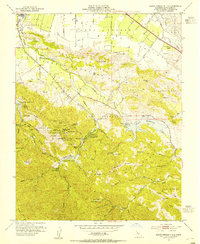 1953 Santa Teresa Hills1954 Print · USGSSanta Clara County during the early 1950s reveals a transition from mercury mining to valley reservoir development. Genealogists and historians can trace the foundations of New Almaden through English Town, Hidalgo Cemetery, and several named family ranches.6 unique versions available
Showing maps 1-25 of 118
Top cities near San Jose
- Fremont historical maps
- Sunnyvale historical maps
- Santa Clara historical maps
- Milpitas historical maps
- Cupertino historical maps
- Newark historical maps
See more
Top neighborhoods of San Jose
- Alviso historical maps
- Robertsville historical maps
- Wayne historical maps
- North San Jose historical maps
- Alamitos historical maps
- Almaden Valley historical maps
See more
Frequently asked questions
- What are the different types of historical maps available for San Jose?
- What is the oldest map of San Jose?
- Where can I purchase historical maps of San Jose for my home or office?
- Where can I download high-res historical maps of San Jose?
- Are there historical topographic maps available for San Jose?
- Is there historical aerial imagery available for San Jose?
- Where are historical maps of San Jose sourced from?