1980s Maps of Tennant, California
Explore 2 historic maps of Tennant from the 1980s. These maps offer a rare glimpse into what life looked like during the 1980s — showing old roads, neighborhoods, homes, and landmarks that have changed or disappeared over time.
Whether you're researching your family's past, planning a metal detecting trip, or studying how Tennant's landscape evolved across the 1980s, these high-resolution maps are a powerful tool for exploring the history of this region.
- Focus on a specific era: All maps on this page are from the 1980s, giving you a focused view of this time period.
- See what’s changed: Compare century-old streets, trails, and buildings to today's modern landscape using overlays and satellite layers.
- Research with precision: Use these maps for genealogy, historical research, land use analysis, or educational projects.
- View, download, or print: Maps are fully viewable online in high resolution, and can be downloaded or printed for your own records.
Start exploring Tennant's history through authentic maps from the 1980s. This is your window into the past.
Tennant, CA maps
(2)- 1984 Map of Tulelake, 1985 Print
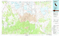 1984 Tulelake1985 Print · USGSThe high desert and volcanic basins of the California-Oregon border are captured here in the mid-eighties. Researchers can trace the legacy of the Southern Pacific railroad through settlements like Stronghold, Newell, and the sprawling Lava Beds National Monument.2 unique versions available
 - 1988 Map of Tennant
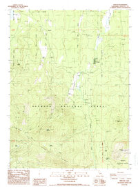 1988 Tennant1988 Print · USGSThe timber community of Tennant is captured in the late 1980s as a vital mountain outpost within the Klamath National Forest. Researchers can trace the legacy of the logging industry through the O.W.R.R. Grade and find local landmarks like the Cem and Tennant F.S. Station.
End of results
Showing maps 1-2 of 2
Frequently asked questions
- What are the different types of historical maps available for Tennant?
- What is the oldest map of Tennant?
- Where can I purchase historical maps of Tennant for my home or office?
- Where can I download high-res historical maps of Tennant?
- Are there historical topographic maps available for Tennant?
- Is there historical aerial imagery available for Tennant?
- Where are historical maps of Tennant sourced from?