1940s Maps of Seaview, California
Explore 4 historic maps of Seaview from the 1940s. These maps offer a rare glimpse into what life looked like during the 1940s — showing old roads, neighborhoods, homes, and landmarks that have changed or disappeared over time.
Whether you're researching your family's past, planning a metal detecting trip, or studying how Seaview's landscape evolved across the 1940s, these high-resolution maps are a powerful tool for exploring the history of this region.
- Focus on a specific era: All maps on this page are from the 1940s, giving you a focused view of this time period.
- See what’s changed: Compare century-old streets, trails, and buildings to today's modern landscape using overlays and satellite layers.
- Research with precision: Use these maps for genealogy, historical research, land use analysis, or educational projects.
- View, download, or print: Maps are fully viewable online in high resolution, and can be downloaded or printed for your own records.
Start exploring Seaview's history through authentic maps from the 1940s. This is your window into the past.
Seaview, CA maps
(4)- 1943 Map of Fort Ross, 1958 Print
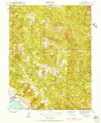 1943 Fort Ross1958 Print · USGSCoastal Sonoma County is captured during the early 1940s, showing the ridge-top ranches and early mining sites overlooking the Pacific. Family historians can trace holdings like Seafeldt Ranch, find the Creighton Ridge Sch, and locate the Layton Mine.2 unique versions available
 - 1944 Map of Fort Ross
 1944 Fort Ross1944 Print · USGSCoastal Sonoma County appears at the height of the Second World War, showing the transition from frontier industry to historic preservation. Genealogists and historians can locate family landmarks like Seafeldt Ranch, the Seaview Cem, and the Murphy Mill (Abandoned).2 unique versions available
 - 1947 Map of Santa Rosa
 1947 Santa Rosa1947 Print · USGSNorthern California in the late 1940s was a landscape of agricultural valleys and vital rail hubs. Trace the historic routes of the Northwestern Pacific through Healdsburg or explore the mid-century waterfronts of Vallejo and Benicia near Mare Island.
 - 1949 Map of Santa Rosa
 1949 Santa Rosa1949 Print · USGSThe North Bay and Wine Country appear here in the late 1940s, when the Northwestern Pacific RR still dominated regional transit. Genealogists and historians can trace old coastal outposts like Anchor Bay Settlement and the early layout of Santa Rosa.2 unique versions available
End of results
Showing maps 1-4 of 4
Top cities near Seaview
Frequently asked questions
- What are the different types of historical maps available for Seaview?
- What is the oldest map of Seaview?
- Where can I purchase historical maps of Seaview for my home or office?
- Where can I download high-res historical maps of Seaview?
- Are there historical topographic maps available for Seaview?
- Is there historical aerial imagery available for Seaview?
- Where are historical maps of Seaview sourced from?