Old Maps of Sonoma County, California
Explore 338 old maps of Sonoma County, spanning from 1902 to today. These high-resolution historic maps reveal how streets, neighborhoods, landmarks, and natural features evolved over time — perfect for genealogy, metal detecting, research, and local history exploration.
What you can do with these maps:
- See how Sonoma County changed over time: Compare historical maps to modern-day views to trace roads, homesites, rail lines & more.
- View detailed metadata: Each map includes creators, publishers, year, scale, and archive source.
- Overlay maps with satellite & LiDAR: Visualize the past alongside modern tools to explore terrain & human change.
- Trusted historical sources: Maps sourced from the USGS, Library of Congress, and other archives.
- Access maps your way: View online, download high-res files, or order prints for personal or research use.
Start exploring old maps of Sonoma County to uncover forgotten places, hidden landmarks, and the deep history beneath your feet.
Sonoma County, CA maps
(338)- 1902 Map of Napa
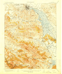
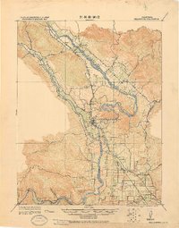
 1902 Napa1902 Print · USGSThe Napa Valley and Carquinez Strait are captured at the turn of the century, showing a landscape defined by maritime military posts and early vineyards. Genealogists and historians can trace the Mare Island Navy Yard, the Insane Asylum, and rail stops at Zinfandel and Rutherford.6 unique versions available
 - 1914 Map of Petaluma
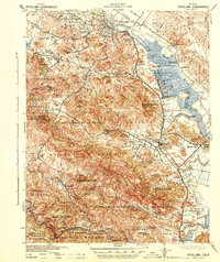
 1914 Petaluma1914 Print · USGSThe North Bay region near the turn of the century shows a landscape of tidal marshes and rising ridges connected by the Northwestern Pacific. Genealogists and historians can trace old family ranch sites like Freitas Ranch and numerous rural schoolhouses including Iowa School and Burdell School.5 unique versions available
 - 1916 Map of Mare Island
 1916 Mare Island1916 Print · USGSThe northern San Pablo Bay region comes alive in this survey, showcasing a landscape of tidal marshes and rail-driven growth during the mid-1910s. Researchers can trace the layout of the Mare Island Navy Yard, the remote rail stop at Wingo, and the rural classrooms of Fly School.4 unique versions available
 - 1916 Map of Santa Rosa
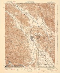
 1916 Santa Rosa1916 Print · USGSSonoma County in the mid-1910s is a landscape of established rail towns and historic land grants. Researchers can trace early infrastructure through sites like the Sonoma State Home, Adobe Fort, and rural landmarks such as Grangers Hall or the Winery.3 unique versions available
 - 1916 Map of Point Reyes
 1916 Point Reyes1916 Print · USGSCoastal Marin County during the mid-1910s reveals a working landscape of shorefront landings and family ranches. Researchers can trace early settlements and schools like Lairds Landing, Olema, and Franklin School before modern park designations.2 unique versions available
 - 1918 Map of Point Reyes
 1918 Point Reyes1918 Print · USGSMarin County's rugged coast appears here in the years following the turn of the century, showing a working landscape of ranches and rail. Genealogists can locate family landmarks like Lairds Landing, rural schoolhouses, and the Northwestern Pacific line.6 unique versions available
 - 1920 Map of Healdsburg
 1920 Healdsburg1920 Print · USGSThe Russian River valley in the early twentieth century was a landscape of expanding viticulture and rail transit. Genealogists and historians can trace the old depots and homesteads from Geyserville to Windsor, finding specific landmarks like the Orphans Home and Olive Hill Cem.
 - 1921 Map of Skaggs
 1921 Skaggs1921 Print · USGSCoastal Sonoma County is captured here in the early twenties, showing a landscape defined by remote mountain ranches and nascent rail towns. Researchers can locate family landmarks like Soules Ranch and Nobles Ranch or trace the N. W. P. R. R. near Guerneville.
 - 1921 Map of Kelseyville
 1921 Kelseyville1921 Print · USGSNorthern California's thermal springs and mining districts are in full view in this early twentieth-century survey of Lake and Sonoma counties. Researchers can trace historic ranch boundaries like Moulton Ranch or locate vanished operations at the Cloverdale Quicksilver Mine and the Geyser Hotel.
 - 1921 Map of Plantation
 1921 Plantation1921 Print · USGSCoastal Sonoma County in the early twenties shows a landscape of remote ranches and maritime landings. Genealogists can locate family landmarks like Ohlson Ranch or Tabers Ranch and trace the old coastal post office at Plantation PO.
 - 1927 Map of Calistoga
 1927 Calistoga1927 Print · USGSUpper Napa Valley and the surrounding peaks come alive in this 1920s tactical survey. Genealogists and researchers can trace the early mercury industry at the Oat Hill Mine, locate family roots near Langstry Ranch, or follow the old Southern Pacific line through Larkmead and Bale.2 unique versions available
 - 1933 Map of Healdsburg
 1933 Healdsburg1933 Print · USGSSonoma County's wine and river country comes alive in the early 1930s, showing the early footprints of HEALDSBURG and Geyserville. Researchers can trace the Northwestern Pacific rail line to vanished sidings and schools like Grape Sch and Sotoyome Sch.
 - 1935 Map of Sebastopol
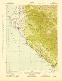
 1935 Sebastopol1935 Print · USGSThe Sonoma County hills and the Gold Ridge fruit district are captured here in the mid-1930s, just as the regional rail network still connected small agricultural hamlets. Genealogists can trace family footprints at Watson Sch, Two Rock Ch, and the rural community of Bloomfield.
 - 1938 Map of Hopland
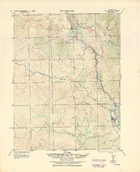 1938 Hopland1938 Print · USGSNorthern California’s Russian River valley is captured here in the 1920s, showing the early rail-and-road network between Hopland and Cloverdale. Trace old rail stops like Thorn Siding and historic locations such as Duncan Springs and Preston.
 - 1940 Map of Healdsburg
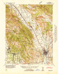
 1940 Healdsburg1940 Print · USGSSonoma County's wine and timber country is captured here just before the mid-century, following the winding Russian River through thriving valley towns. Genealogists can locate family-named landmarks and rural schoolhouses like Guilford Sch, Lytton Sch, and the Oak Mound Cem.3 unique versions available
 - 1942 Map of Mare Island
 1942 Mare Island1942 Print · USGSThe northern reaches of San Pablo Bay come alive in this wartime survey, showing a landscape of vital naval yards and marshland agriculture. Genealogists and historians can trace rail depots like Napa Junction, rural landmarks like American Canyon School, and the industrial waterfronts of Vallejo and Oleum.
 - 1942 Map of Sebastopol
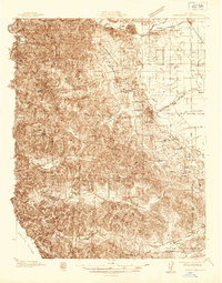
 1942 Sebastopol1942 Print · USGSWestern Sonoma County comes into focus in the early 1940s, showing a landscape defined by apple orchards and redwood groves. Genealogists can trace family footprints through rural sites like Gold Ridge Sch, the Northwestern Pacific RR line, and Bohemian Grove.3 unique versions available
 - 1942 Map of Sonoma
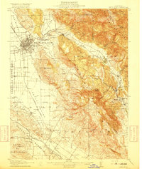
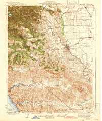
 1942 Sonoma1942 Print · USGSThe Napa and Sonoma valleys are captured here during the early 1940s, showing the established rail and agricultural networks of the North Bay. Researchers can trace historic landmarks like the Veterans Home, the Quick Silver Mine, and early vineyard sites at Zinfandel and Rutherford.
 - 1942 Map of Petaluma
 1942 Petaluma1942 Print · USGSThe Marin and Sonoma county line runs through this early 1940s landscape of tidal marshes and ranch lands. Genealogists can trace family names at Mt Oliver Cemetery or find historic rural institutions like the Olompali School and St Vincent Station.
 - 1942 Map of Bodega Head, 1956 Print
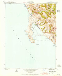 1942 Bodega Head1956 Print · USGSThe Sonoma coast during the early 1940s reveals a landscape of sheltered harbors and high coastal ridges. Genealogists and historians can trace the foundations of Bodega Bay, locate the Ocean View Sch, and explore landmarks from Arched Rock Beach to Swallow City.3 unique versions available
 - 1942 Map of Arched Rock, 1956 Print
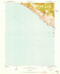 1942 Arched Rock1956 Print · USGSThe Sonoma coast at the start of the 1940s reveals a wild landscape of deep gulches and rocky outcroppings. Researchers can trace the rugged shoreline from Arched Rock to the Russian River and explore the hills surrounding Little Black Mountain.3 unique versions available
 - 1943 Map of Point Arena
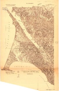
 1943 Point Arena1943 Print · USGSThe Mendocino coast in the early 1940s reveals a landscape of isolated ranching and seafaring communities. Genealogists and local historians can trace family holdings from the Iverson Indian Rancheria to the Bourns Family Cem and the Seaside School.2 unique versions available
 - 1943 Map of Tombs Creek
 1943 Tombs Creek1943 Print · USGSSonoma County ranching and timber lands are documented here during the mid-1940s. Genealogists and historians can trace family properties like Wickersham Ranch and Lee Nobles Ranch across ridges such as Sheep Repose Ridge.
 - 1943 Map of Calistoga, 1955 Print
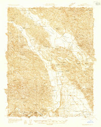
 1943 Calistoga1955 Print · USGSUpper Napa Valley and the rugged Lake County border are captured here during the 1940s, a period defined by mercury mining and early tourism. Researchers can trace family-named landmarks and industrial sites like the Oat Hill Mine, Mark West Springs, and the Petrified Forest.
 - 1943 Map of Stewarts Point, 1956 Print
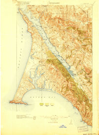
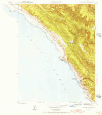 1943 Stewarts Point1956 Print · USGSCoastal Sonoma County appears here during the mid-1940s, highlighting a landscape of steep ridges and maritime landings. Researchers can trace old coastal settlements like Stewarts Point and Del Mar Landing or explore the rugged inland valleys of the Wheatfield Fork Gualala River.3 unique versions available
Showing maps 1-25 of 338
Top cities of Sonoma County
- Santa Rosa historical maps
- Petaluma historical maps
- Rohnert Park historical maps
- Windsor historical maps
- Villa Grande historical maps
- Healdsburg historical maps
See more
Frequently asked questions
- What are the different types of historical maps available for Sonoma County?
- What is the oldest map of Sonoma County?
- Where can I purchase historical maps of Sonoma County for my home or office?
- Where can I download high-res historical maps of Sonoma County?
- Are there historical topographic maps available for Sonoma County?
- Is there historical aerial imagery available for Sonoma County?
- Where are historical maps of Sonoma County sourced from?