1950s Maps of Sonoma County, California
Explore 43 historic maps of Sonoma County from the 1950s. These maps offer a rare glimpse into what life looked like during the 1950s — showing old roads, neighborhoods, homes, and landmarks that have changed or disappeared over time.
Whether you're researching your family's past, planning a metal detecting trip, or studying how Sonoma County's landscape evolved across the 1950s, these high-resolution maps are a powerful tool for exploring the history of this region.
- Focus on a specific era: All maps on this page are from the 1950s, giving you a focused view of this time period.
- See what’s changed: Compare century-old streets, trails, and buildings to today's modern landscape using overlays and satellite layers.
- Research with precision: Use these maps for genealogy, historical research, land use analysis, or educational projects.
- View, download, or print: Maps are fully viewable online in high resolution, and can be downloaded or printed for your own records.
Start exploring Sonoma County's history through authentic maps from the 1950s. This is your window into the past.
Sonoma County, CA maps
(43)- 1951 Map of Petaluma Point
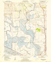
 1951 Petaluma Point1951 Print · USGSSan Pablo Bay and the Marin shoreline are captured here in the early fifties, detailing the transition from tidal marsh to inland hills. Trace the path of the Northwestern Pacific railroad past Rose or explore the historic site at China Camp.2 unique versions available
 - 1951 Map of Mare Island
 1951 Mare Island1951 Print · USGSThe industrial and naval might of the East Bay is on full display in the early fifties, centering on the massive Mare Island Naval Reservation. Trace the growth of Vallejo and the waterfront towns of Rodeo and Hercules along the Southern Pacific rail line.
 - 1951 Map of Cuttings Wharf
 1951 Cuttings Wharf1951 Print · USGSThe Napa River delta and San Pablo Bay marshes come to life in this early 1950s survey of the California waterfront. Genealogists and historians can trace the development of Cuttings Wharf and Dutton Landing, or locate the Lachman Club among the sloughs.
 - 1951 Map of Sears Point, 1952 Print
 1951 Sears Point1952 Print · USGSThe northern edge of San Pablo Bay comes alive in the early fifties, showing a landscape of tidal sloughs and rail junctions. Genealogists and historians can trace the tracks of the Southern Pacific to settlements like Schellville, Wingo, and the Tule Vista School.5 unique versions available
 - 1951 Map of Sonoma, 1952 Print
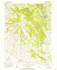
 1951 Sonoma1952 Print · USGSSonoma and its surrounding vineyards and thermal springs are captured in the early fifties, before modern expansion altered the valley floor. Genealogists can trace early homesteads and landmarks like the Vallejo Home State Historical Monument, Mountain Cem, and Vineburg.4 unique versions available
 - 1951 Map of Rutherford, 1952 Print
 1951 Rutherford1952 Print · USGSNapa Valley during the early fifties reveals a landscape of rural viticulture and mountain mining operations. Local researchers can trace the rail corridor through Rutherford and Oakville or locate historical sites like La Joya Quicksilver Mine and Enterprise Sch.6 unique versions available
 - 1951 Map of Sonoma, 1958 Print
 1951 Sonoma1958 Print · USGSWine country was already maturing in the mid-twentieth century as rail lines and early wineries shaped the valley landscape. Researchers can trace the legacy of established vineyards at Thomann Winery and Buena Vista or locate old burial grounds like Yountville Cem.3 unique versions available
 - 1952 Map of Duncans Mills, 1980 Print
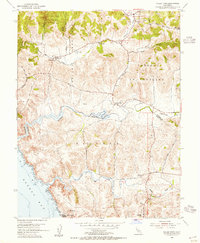
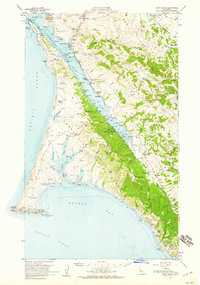
 1952 Duncans Mills1980 Print · USGSThe Russian River valley in the early 1970s is shown here as a landscape of riverside resorts and rugged Pacific coastline. Genealogists and hikers can trace old routes like Old Duncans Grade Road or locate family sites near Monte Rio and Duncans Mills.
 - 1953 Map of Petaluma, 1955 Print
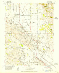
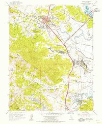
 1953 Petaluma1955 Print · USGSPetaluma and the surrounding Sonoma and Marin county borderlands are shown here in the early fifties, caught between their agricultural roots and modern growth. Genealogists and historians can trace numerous rural schoolhouses like Iowa School and Union Sch or the path of the Northwestern Pacific railroad.3 unique versions available
 - 1954 Map of Two Rock, 1955 Print
 1954 Two Rock1955 Print · USGSDairies and small ranching communities define this Sonoma County landscape in the mid-fifties, just as the military presence at Two Rock Ranch Station was well-established. Genealogists can trace family footprints near Bloomfield, Knowles Corner, and rural schoolhouses like the Eucalyptus School.3 unique versions available
 - 1954 Map of Point Reyes NE, 1955 Print
 1954 Point Reyes NE1955 Print · USGSThe rangelands of northern Marin and southern Sonoma counties are documented here in the mid-1950s. Genealogists can trace family-named land divisions like Soulajule (Gormley) or Nicasio (Halleck) and see the Two Rock Ranch Station.6 unique versions available
 - 1954 Map of Glen Ellen, 1955 Print
 1954 Glen Ellen1955 Print · USGSGlen Ellen and the slopes of Sonoma Mountain are captured here in the mid-fifties, showing the region's transition from historic ranches to institutional grounds. Researchers can trace the legacy of the Jack London Ranch, the Sonoma State Home, and the old Mountain Sch.6 unique versions available
 - 1954 Map of Cotati, 1955 Print
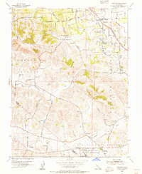
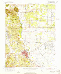
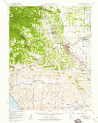
 1954 Cotati1955 Print · USGSSonoma County agriculture and early aviation meet in the mid-fifties as the Redwood Highway begins to shape the valley. Trace the legacy of the Cotati Naval Auxiliary Air Station or locate family roots near Liberty Cemetery and Waugh Sch.8 unique versions available
 - 1954 Map of Sebastopol, 1955 Print
 1954 Sebastopol1955 Print · USGSMid-century Sonoma County comes alive here, showcasing the rail-and-orchard landscape around Sebastopol and the Laguna de Santa Rosa wetlands. Genealogists can trace early landmarks like Sousas Corner, Graton, and numerous rural schools from Vine Hill Sch to Piner Sch.6 unique versions available
 - 1954 Map of Valley Ford, 1955 Print
 1954 Valley Ford1955 Print · USGSThe Sonoma and Marin county line comes alive in the mid-1950s, showing the rolling ranchlands and coastal estuaries of the North Coast. Genealogists and researchers can trace rural school districts like Watson Sch and Burnside Sch or explore the historic settlements of Bodega and Fallon.4 unique versions available
 - 1954 Map of Santa Rosa, 1955 Print
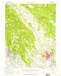
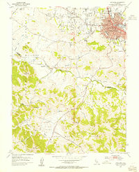
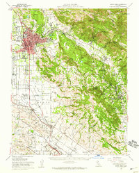
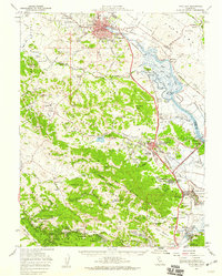
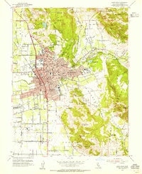 1954 Santa Rosa1955 Print · USGSSanta Rosa in the mid-fifties is a thriving hub of civic life and new suburban development set against the backdrop of Sonoma County’s mountains. Researchers can trace the legacy of local landmarks like the Luther Burbank Gardens, the Rural Cemetery, and the Bennett Valley Grange Hall.6 unique versions available
 - 1954 Map of Petaluma Creek, 1955 Print
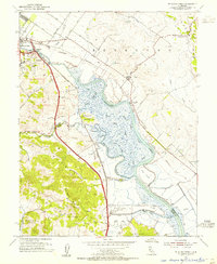 1954 Petaluma Creek1955 Print · USGSThe Sonoma-Marin borderlands appear here in the mid-fifties, dominated by the winding tidal marshes of the Petaluma Creek. Genealogists and historians can trace the Northwestern Pacific rail line through rural stops like Haystack and Lakeville.7 unique versions available
 - 1954 Map of Kenwood, 1955 Print
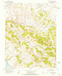
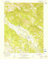 1954 Kenwood1955 Print · USGSSonoma Valley's rural character is preserved here in the mid-fifties, showing the intersection of valley ranching and early mountain industry. Researchers can trace the Northwestern Pacific Railroad Grade and locate historic landmarks like the Los Guilicos School For Girls and McCormack Ranch.7 unique versions available
 - 1954 Map of Camp Meeker, 1955 Print
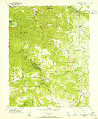 1954 Camp Meeker1955 Print · USGSWestern Sonoma County's timbered ridges and river resorts are shown here in the mid-fifties, just as the region's mid-century identity was taking shape. Researchers can trace historic property lines and community landmarks from Bohemian Grove to the Meeker Sch and Baumert Sprs.5 unique versions available
 - 1954 Map of Novato, 1955 Print
 1954 Novato1955 Print · USGSMarin County's mid-century landscape is transitioning from a rural railroad corridor to a postwar suburban hub. Researchers can trace the layout of Hamilton Air Force Base, old schoolhouses like Dixie Sch, and the winding Northwestern Pacific line.6 unique versions available
 - 1954 Map of Point Reyes, 1959 Print
 1954 Point Reyes1959 Print · USGSCoastal Marin County in the mid-fifties is a landscape of sprawling dairy ranches and tidal inlets before it became a national park. Genealogists can trace family holdings like Upper Pierce Ranch and Laguna Ranch or find sites like the Olema Cam and Marshall Sch.5 unique versions available
 - 1954 Map of Sebastopol, 1959 Print
 1954 Sebastopol1959 Print · USGSSonoma County's mid-century orchard lands and redwood groves are captured here just as the post-war era reshaped the region's rural character. Researchers can trace family homesteads near dozens of country schools like Vine Hill School or locate operations at the Naval Auxiliary Air Station and Two Rock Ranch Sta Military Res.
 - 1954 Map of Santa Rosa, 1959 Print
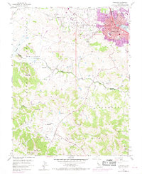
 1954 Santa Rosa1959 Print · USGSSonoma County at the mid-century shows a landscape of expanding valley towns and military infrastructure. Researchers can locate the Cotati Naval Auxiliary Air Station or trace the Jack London Ranch and Penngrove rail stops.2 unique versions available
 - 1954 Map of Petaluma, 1959 Print
 1954 Petaluma1959 Print · USGSCoastal mountains and river sloughs define the Marin and Sonoma borderlands in the mid-1950s, a period of military expansion and rural transition. Genealogists and historians can trace family-named schools like Iowa School or Wilson Sch and the extensive infrastructure of Hamilton Air Force Base.3 unique versions available
 - 1954 Map of Petaluma, 1969 Print
 1954 Petaluma1969 Print · USGSPetaluma and its surrounding ranch lands are shown in the mid-twentieth century as the urban area begins to expand along the Petaluma River. Researchers can trace old property lines and rural schoolhouses like Union Sch and the Northwestern Pacific rail line.
Showing maps 1-25 of 43
Top cities of Sonoma County
- Santa Rosa historical maps
- Petaluma historical maps
- Rohnert Park historical maps
- Windsor historical maps
- Villa Grande historical maps
- Healdsburg historical maps
See more
Frequently asked questions
- What are the different types of historical maps available for Sonoma County?
- What is the oldest map of Sonoma County?
- Where can I purchase historical maps of Sonoma County for my home or office?
- Where can I download high-res historical maps of Sonoma County?
- Are there historical topographic maps available for Sonoma County?
- Is there historical aerial imagery available for Sonoma County?
- Where are historical maps of Sonoma County sourced from?