Old Maps of Eugene, California
Explore 13 old maps of Eugene, spanning from 1916 to today. These high-resolution historic maps reveal how streets, neighborhoods, landmarks, and natural features evolved over time — perfect for genealogy, metal detecting, research, and local history exploration.
What you can do with these maps:
- See how Eugene changed over time: Compare historical maps to modern-day views to trace roads, homesites, rail lines & more.
- View detailed metadata: Each map includes creators, publishers, year, scale, and archive source.
- Overlay maps with satellite & LiDAR: Visualize the past alongside modern tools to explore terrain & human change.
- Trusted historical sources: Maps sourced from the USGS, Library of Congress, and other archives.
- Access maps your way: View online, download high-res files, or order prints for personal or research use.
Start exploring old maps of Eugene to uncover forgotten places, hidden landmarks, and the deep history beneath your feet.
Eugene, CA maps
(13)- 1916 Map of Bachelor Valley
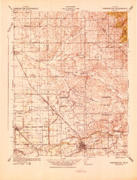
 1916 Bachelor Valley1916 Print · USGSBachelor Valley and the surrounding ranchos are captured here in the early twentieth century during a period of rural development. Researchers can trace early school sites like Bachelor Valley School, the operations at Quail Hill Mine, and the village of Eugene.
 - 1942 Map of Farmington
 1942 Farmington1942 Print · USGSThe San Joaquin and Stanislaus border country is revealed in the early 1940s as a complex network of rail lines and irrigation canals. Genealogists and historians can trace old school districts like Burwood Sch, the tracks of the Southern Pacific, and the early layout of Escalon.
 - 1947 Map of San Jose, 1948 Print
 1947 San Jose1948 Print · USGSNorthern California's heartland is captured here just after the war, showing the rapid growth of the Santa Clara and Central Valleys. Researchers can trace the legacy of rail and water at Castle Air Force Base, Stockton, and the Hetch Hetchy Aqueduct.
 - 1953 Map of Bachelor Valley, 1955 Print
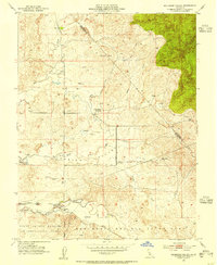 1953 Bachelor Valley1955 Print · USGSThe ranchlands of Stanislaus and Calaveras counties are captured here in the early 1950s as flood control projects began reshaping the landscape. Genealogists and local historians can locate Eugene, St Joseph Ch, and the sprawling Rancheria Del Rio Estanislao land grant.
 - 1956 Map of San Jose
 1956 San Jose1956 Print · USGSCentral California in the mid-fifties reveals the transition from sprawling orchards to growing urban hubs like San Jose and Stockton. Genealogists and historians can trace the rail-era landscape of the Mother Lode through Chinese Camp and Tuttletown, or follow the water through the Joaquin River and Calaveras Reservoir.
 - 1962 Map of San Jose
 1962 San Jose1962 Print · USGSCentral California in the early sixties showcases the expansion of the San Joaquin and Santa Clara valleys. Researchers can trace the rail-to-road transition along the Southern Pacific RR or locate landmarks like Castle USAF Base and Loma Prieta.4 unique versions available
 - 1966 Map of San Jose
 1966 San Jose1966 Print · USGSCentral California in the mid-1960s reveals a landscape of massive irrigation projects and expanding Cold War military footprints. Researchers can trace the rail-and-river network of the San Joaquin Valley or locate specialized sites like Castle Air Force Base and the Sharp General Depot (Military).
 - 1968 Map of Bachelor Valley, 1971 Print
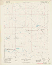 1968 Bachelor Valley1971 Print · USGSStanislaus County ranch lands and seasonal watercourses are captured here in the late sixties. Researchers can trace rural landmarks like St Joseph Cem, the settlement of Eugene, and family-named locations such as Snow Ranch.3 unique versions available
 - 1994 Map of Oakdale, 1995 Print
 1994 Oakdale1995 Print · USGSThe San Joaquin Valley meets the Sierra foothills in the mid-1990s, where massive reservoirs and canal networks fueled California's agricultural heartland. Researchers can trace the Hetch Hetchy Aqueduct, find the Sierra RR, and locate the Riverbank Army Ammunition Plant.2 unique versions available
 - 2012 Map of Bachelor Valley, 2012 Print
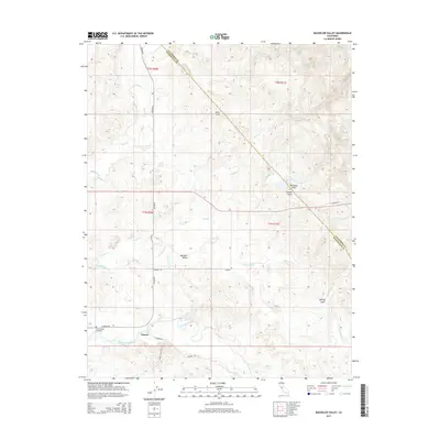
 2012 Bachelor Valley2012 Print · USGSCovers Eugene, including Stanislaus County, Calaveras County, and other nearby areas
 - 2015 Map of Bachelor Valley, 2015 Print
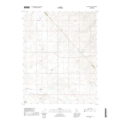
 2015 Bachelor Valley2015 Print · USGSCovers Eugene, including Stanislaus County, Calaveras County, and other nearby areas
 - 2018 Map of Bachelor Valley, 2018 Print
 2018 Bachelor Valley2018 Print · USGSCovers Eugene, including Stanislaus County, Calaveras County, and other nearby areas
 - 2021 Map of Bachelor Valley, 2021 Print
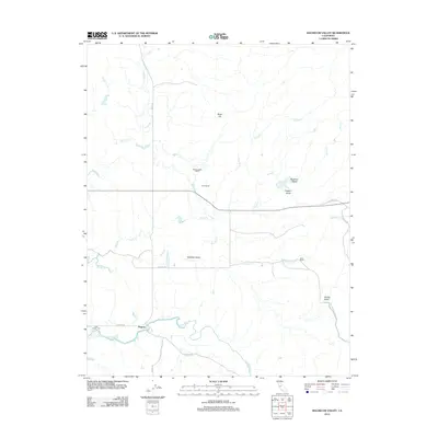
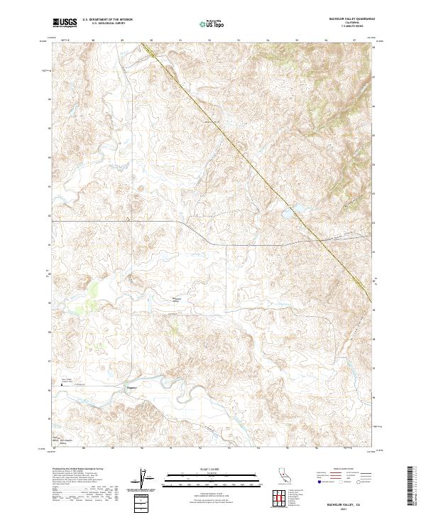 2021 Bachelor Valley2021 Print · USGSBachelor Valley and the settlement of Eugene appear here as the foothills meet the San Joaquin Valley floor. Researchers can locate the Saint Joseph Catholic Cem and trace seasonal waterways like Littlejohns Creek or the Thalheim Lateral.
End of results
Showing maps 1-13 of 13
Top cities near Eugene
- Modesto historical maps
- Riverbank historical maps
- Oakdale historical maps
- Escalon historical maps
- Telegraph City historical maps
Frequently asked questions
- What are the different types of historical maps available for Eugene?
- What is the oldest map of Eugene?
- Where can I purchase historical maps of Eugene for my home or office?
- Where can I download high-res historical maps of Eugene?
- Are there historical topographic maps available for Eugene?
- Is there historical aerial imagery available for Eugene?
- Where are historical maps of Eugene sourced from?