1960s Maps of Turlock, California
Explore 8 historic maps of Turlock from the 1960s. These maps offer a rare glimpse into what life looked like during the 1960s — showing old roads, neighborhoods, homes, and landmarks that have changed or disappeared over time.
Whether you're researching your family's past, planning a metal detecting trip, or studying how Turlock's landscape evolved across the 1960s, these high-resolution maps are a powerful tool for exploring the history of this region.
- Focus on a specific era: All maps on this page are from the 1960s, giving you a focused view of this time period.
- See what’s changed: Compare century-old streets, trails, and buildings to today's modern landscape using overlays and satellite layers.
- Research with precision: Use these maps for genealogy, historical research, land use analysis, or educational projects.
- View, download, or print: Maps are fully viewable online in high resolution, and can be downloaded or printed for your own records.
Start exploring Turlock's history through authentic maps from the 1960s. This is your window into the past.
Turlock, CA maps
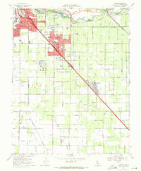
(8)- 1961 Map of Turlock, 1962 Print
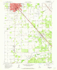 1961 Turlock1962 Print · USGSIn the early sixties, the agricultural heart of the San Joaquin Valley revolved around the rail-and-canal network surrounding Turlock. Genealogists and local historians can trace family-named roads and schools like Roselawn Sch or locate the old commercial corridors of Delhi and Irwin.3 unique versions available
 - 1962 Map of Hatch
 1962 Hatch1962 Print · USGSCentral Valley farm life and irrigation networks are shown here in the early sixties. Researchers can find old rural institutions like Grange Hall, Mtn View Sch, and family burial sites at North Hilmar Cem.2 unique versions available
 - 1962 Map of San Jose
 1962 San Jose1962 Print · USGSCentral California in the early sixties showcases the expansion of the San Joaquin and Santa Clara valleys. Researchers can trace the rail-to-road transition along the Southern Pacific RR or locate landmarks like Castle USAF Base and Loma Prieta.4 unique versions available
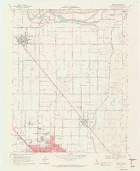
 - 1962 Map of Turlock, 1963 Print
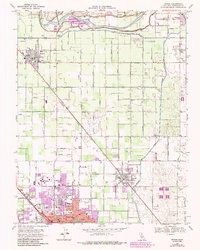
 1962 Turlock1963 Print · USGSThe San Joaquin Valley's agricultural heartland is documented here during the early sixties. Trace historical landmarks like the Hilmar High Sch, find family plots at Stevinson Sunnyside Cem, and follow the Southern Pacific rail line.2 unique versions available
 - 1963 Map of Denair, 1987 Print
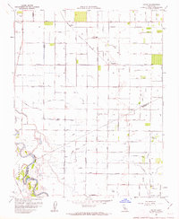
 1963 Denair1987 Print · USGSThe northern San Joaquin Valley thrived in the 1960s as a hub of rail transport and irrigated agriculture. You can trace the growth of Turlock and Denair while locating landmarks like Stanislaus State College and the Denair Cem.
 - 1966 Map of San Jose
 1966 San Jose1966 Print · USGSCentral California in the mid-1960s reveals a landscape of massive irrigation projects and expanding Cold War military footprints. Researchers can trace the rail-and-river network of the San Joaquin Valley or locate specialized sites like Castle Air Force Base and the Sharp General Depot (Military).
 - 1969 Map of Ceres, 1971 Print
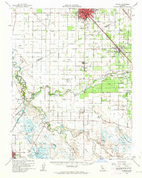
 1969 Ceres1971 Print · USGSStanislaus County's agricultural heartland is documented here in the late sixties as the rail-side towns of Ceres and Keyes expanded. Genealogy and local history researchers can locate Lakewood Memorial Park (Cem), the Modesto Union Academy, and the Tidewater Southern rail line.5 unique versions available
 - 1969 Map of Denair, 1971 Print
 1969 Denair1971 Print · USGSStanislaus County agriculture and early collegiate growth meet in this late-sixties survey of the Central Valley. Genealogists and local historians can trace the foundations of Stanislaus State College and rural landmarks like the Denair Cem and Gratton Sch.5 unique versions available
End of results
Showing maps 1-8 of 8
Top cities near Turlock
- Modesto historical maps
- Ceres historical maps
- Riverbank historical maps
- Livingston historical maps
- Delhi historical maps
- Newman historical maps
See more
Frequently asked questions
- What are the different types of historical maps available for Turlock?
- What is the oldest map of Turlock?
- Where can I purchase historical maps of Turlock for my home or office?
- Where can I download high-res historical maps of Turlock?
- Are there historical topographic maps available for Turlock?
- Is there historical aerial imagery available for Turlock?
- Where are historical maps of Turlock sourced from?