Old Maps of Tudor, California for Hiking & Exploration
Hike through history with 14 historic maps of Tudor. Explore old trails, ghost towns, and forgotten backroads — perfect for outdoor adventurers and local explorers.
- Rediscover forgotten places: Map out old mining camps, roads, and footpaths that no longer exist on modern maps.
- Layer with modern tools: Combine with LiDAR or satellite views to plan hikes through historical terrain.
- Made for exploration: Popular among hikers, overlanders, and local history lovers.
Use these maps to find adventure and explore the hidden past of Tudor.
Tudor, CA maps
(14)- 1888 Map of Marysville
 1888 Marysville1888 Print · USGSThe Sacramento Valley in the late nineteenth century was a landscape of fertile river bottoms and emerging rail towns. Researchers can trace the river economy through Moons Ferry and Eddys Ferry or locate early family holdings like Hock Farm and Butte House.
 - 1891 Map of Marysville
 1891 Marysville1891 Print · USGSThe Sacramento Valley in the late nineteenth century centers on the volcanic peaks of the Marysville Buttes. Genealogists and historians can trace pioneer landings and river crossings such as Hock Farm, Princeton Ferry, and the early street grids of Sutter City.
 - 1894 Map of Marysville
 1894 Marysville1894 Print · USGSThe Sacramento Valley in the 1890s is captured here as a landscape of river ferries and expanding rail lines. Genealogists can trace family footprints in Sutter City, identify old river crossings like Moons Ferry, or locate the historic Hock Farm.
 - 1895 Map of Marysville
 1895 Marysville1895 Print · USGSThe Sacramento Valley in the 1890s centered on the dramatic profile of the Marysville Buttes and a bustling river-and-rail economy. Researchers can trace early river crossings like Moons Ferry, the historic Hock Farm, and the early footprints of Marysville and Yuba City.6 unique versions available
 - 1911 Map of Ostrom
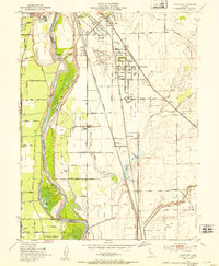
 1911 Ostrom1911 Print · USGSThe Yuba County lowlands were a hub of competing rail lines and river transport in the years before the Great War. Genealogists can trace family footprints near Ella School, the stop at Alicia, or the historic wetlands of Plumas Lake.
 - 1952 Map of Olivehurst, 1953 Print
 1952 Olivehurst1953 Print · USGSThe Yuba and Feather River floodplains in the early fifties show a fascinating mix of orchard land, rail corridors, and new suburban growth. Genealogists can locate family landmarks like Boardman Ranch or trace the early foundations of Ella Sch and Olivehurst School.5 unique versions available
 - 1952 Map of Marysville, 1959 Print
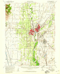 1952 Marysville1959 Print · USGSThe Yuba-Sutter region at mid-century reveals a landscape of river-driven agriculture and expanding rail hubs. Researchers can trace the development of Yuba City and Marysville alongside rural landmarks like Plumas Lake and the Sutter Nat Wildlife Refuge.3 unique versions available
 - 1958 Map of Chico, 1962 Print
 1958 Chico1962 Print · USGSMid-century Northern California comes to life across the Central Valley and high Sierras as the postwar economy transformed the landscape. Trace the rail lines of the Southern Pacific RR, locate family roots near Chico Cem, or explore the early layout of Paradise and Beale Air Force Base.4 unique versions available
 - 1960 Map of Chico
 1960 Chico1960 Print · USGSThe Northern California high country and Sacramento Valley meet in this 1960s-era landscape of mining towns and river settlements. Trace the rail-and-water economy of the gold country through the Empire Mine, Beale Air Force Base, and the Western Pacific Railroad.
 - 1993 Map of Yuba City, 1994 Print
 1993 Yuba City1994 Print · USGSThe Sacramento Valley and Sierra Nevada foothills meet in the 1990s, where agricultural bypasses and river networks surround the iconic Sutter Buttes. Researchers can trace the rail corridors of the Southern Pacific and Western Pacific through hubs like Marysville and Gridley.
 - 2012 Map of Olivehurst, 2012 Print
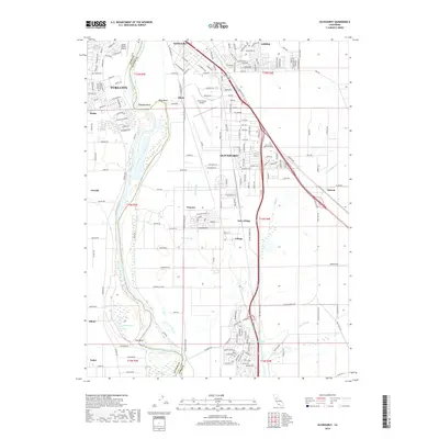
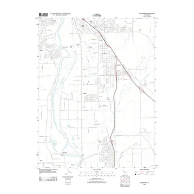 2012 Olivehurst2012 Print · USGSCovers Tudor, including Yuba City, Linda, and other nearby areas
 - 2015 Map of Olivehurst, 2015 Print
 2015 Olivehurst2015 Print · USGSCovers Tudor, including Yuba City, Linda, and other nearby areas
 - 2018 Map of Olivehurst, 2018 Print
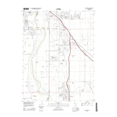
 2018 Olivehurst2018 Print · USGSCovers Tudor, including Yuba City, Linda, and other nearby areas
 - 2021 Map of Olivehurst, 2021 Print
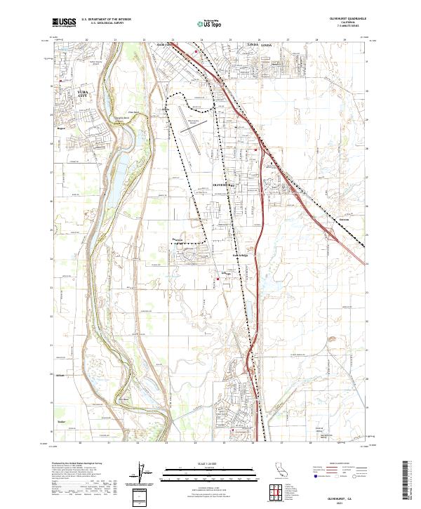 2021 Olivehurst2021 Print · USGSThe Feather River valley comes to life in this survey of the communities south of Marysville in the early 2020s. Researchers can trace the river's path through Shanghai Bend or locate family sites near Olivehurst, Arboga, and Abbott Lake.
End of results
Showing maps 1-14 of 14
Top cities near Tudor
- Roseville historical maps
- Yuba City historical maps
- Linda historical maps
- Olivehurst historical maps
- Marysville historical maps
- Plumas Lake historical maps
See more
Frequently asked questions
- What are the different types of historical maps available for Tudor?
- What is the oldest map of Tudor?
- Where can I purchase historical maps of Tudor for my home or office?
- Where can I download high-res historical maps of Tudor?
- Are there historical topographic maps available for Tudor?
- Is there historical aerial imagery available for Tudor?
- Where are historical maps of Tudor sourced from?