Old Maps of Bend, California for Genealogy
Trace your family roots with 12 historic maps of Bend. These high-res maps reveal old neighborhoods, homesites, landmarks, and streets — helping you uncover where your ancestors lived and how the area evolved over time.
- Explore historic neighborhoods: Identify where your relatives may have lived in the 1800s or 1900s.
- Compare maps over time: Trace the changes in streets, buildings, and landmarks for multi-generational research.
- Perfect for genealogy & ancestry research: Used by family historians and researchers to map out lineage and migration.
These maps are an incredible resource for exploring your personal connection to Bend's past.
Bend, CA maps
(12)- 1890 Map of Red Bluff
 1890 Red Bluff1890 Print · USGSNorthern California in the late nineteenth century was a hub of river-and-rail activity where the Central Pacific Railroad met the rugged Klamath Mountains. Researchers can trace old ferry crossings like Ball's Ferry, locate the U.S. Fishery, or find early mining camps and stations such as Minersville and Buck Horn Station.
 - 1894 Map of Red Bluff, 1896 Print
 1894 Red Bluff1896 Print · USGSNorthern California's mining and river-trading frontier comes alive in this survey of the late nineteenth century. Genealogists and historians can trace the growth of rail hubs like Redding or locate early river crossings and industrial sites such as Jelley's Ferry and the Copper Mine.6 unique versions available
 - 1944 Map of Tuscan Buttes, 1960 Print
 1944 Tuscan Buttes1960 Print · USGSTehama and Shasta Counties are captured here in the mid-1940s, a landscape defined by the winding Sacramento River and the legacy of frontier outposts. Genealogists can trace family-named properties like Armstrong Ranch and locate vanished rural schoolhouses such as Jelly Sch and Parkville Sch.3 unique versions available
 - 1947 Map of Tuscan Buttes
 1947 Tuscan Buttes1947 Print · USGSThe Sacramento River valley in the late 1940s reveals a landscape rich in early pioneer history and river-driven industry. Researchers can locate the Site of Ft Reading, trace the Coleman Canal to its power house, and find family names at Dersch Ranch or Ekelund Ranch.2 unique versions available
 - 1958 Map of Redding
 1958 Redding1958 Print · USGSNorthern California's valley and mountain landscapes are captured in the late fifties, showing the region as new reservoirs reshaped the river systems. Genealogists and historians can trace rail-side towns like Cottonwood, the military presence at Red Bluff Air Force Station, and mountain outposts like Weaverville.5 unique versions available
 - 1965 Map of Bend, 1966 Print
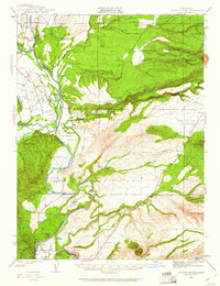
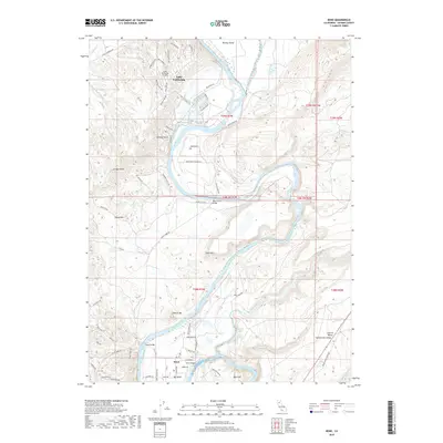
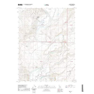
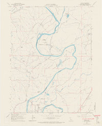 1965 Bend1966 Print · USGSTehama County's riverfront life is captured here in the mid-sixties, centered on the sweeping curves of the Sacramento River. Researchers can trace local landmarks like Jellys Ferry Bridge, the community of Bend, and the grounds of Jelly Ranch.6 unique versions available
 - 1979 Map of Red Bluff
 1979 Red Bluff1979 Print · USGSTehama and Shasta counties come alive in the late seventies as the agricultural heart of the northern valley meets the high wilderness. Genealogists and local historians can trace the rail-and-river corridor from Red Bluff to Los Molinos, finding sites like Balls Ferry and the Southern Pacific line.3 unique versions available
 - 2012 Map of Bend, 2012 Print
 2012 Bend2012 Print · USGSCovers Bend, including Tehama County, United States, and other nearby areas
 - 2015 Map of Bend, 2015 Print
 2015 Bend2015 Print · USGSCovers Bend, including Tehama County, United States, and other nearby areas
 - 2018 Map of Bend, 2018 Print
 2018 Bend2018 Print · USGSCovers Bend, including Tehama County, United States, and other nearby areas
 - 2021 Map of Bend, 2021 Print
 2021 Bend2021 Print · USGSCovers Bend, including Tehama County, United States, and other nearby areas
 - 2023 Map of Bend, 2023 Print
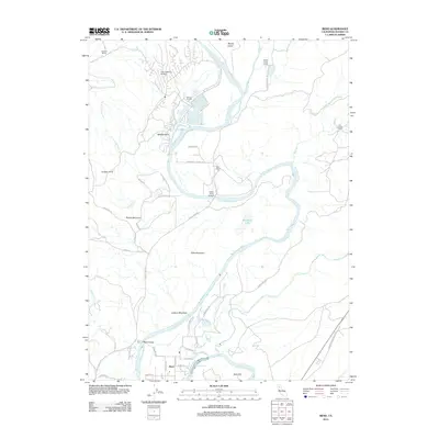
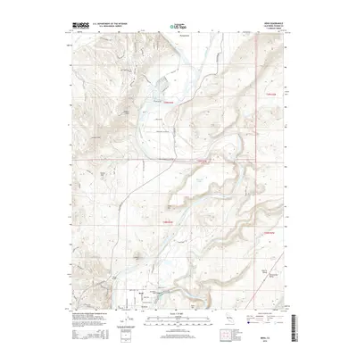
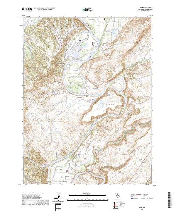 2023 Bend2023 Print · USGSIn the Sacramento River valley of Tehama County, this modern survey shows the area's transition from traditional river crossings to contemporary residential aviation. Genealogists and hikers can trace the paths around Jellys Ferry, the residential streets of Lake California, and the rugged trails surrounding Iron Canyon and Table Mtn.
End of results
Showing maps 1-12 of 12
Top cities near Bend
- Redding historical maps
- Red Bluff historical maps
- Anderson historical maps
- Cottonwood historical maps
- Cottonwood historical maps
- Los Molinos historical maps
See more
Frequently asked questions
- What are the different types of historical maps available for Bend?
- What is the oldest map of Bend?
- Where can I purchase historical maps of Bend for my home or office?
- Where can I download high-res historical maps of Bend?
- Are there historical topographic maps available for Bend?
- Is there historical aerial imagery available for Bend?
- Where are historical maps of Bend sourced from?