Old Maps of Sonora, California
Explore 27 old maps of Sonora, spanning from 1891 to today. These high-resolution historic maps reveal how streets, neighborhoods, landmarks, and natural features evolved over time — perfect for genealogy, metal detecting, research, and local history exploration.
What you can do with these maps:
- See how Sonora changed over time: Compare historical maps to modern-day views to trace roads, homesites, rail lines & more.
- View detailed metadata: Each map includes creators, publishers, year, scale, and archive source.
- Overlay maps with satellite & LiDAR: Visualize the past alongside modern tools to explore terrain & human change.
- Trusted historical sources: Maps sourced from the USGS, Library of Congress, and other archives.
- Access maps your way: View online, download high-res files, or order prints for personal or research use.
Start exploring old maps of Sonora to uncover forgotten places, hidden landmarks, and the deep history beneath your feet.
Sonora, CA maps
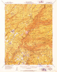
(27)- 1891 Map of Big Trees
 1891 Big Trees1891 Print · USGSCovers Sonora, including Sonora Meadows, Bear Valley, and other nearby areas
 - 1893 Map of Sonora
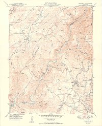
 1893 Sonora1893 Print · USGSCovers Sonora, including Jamestown, Groveland, and other nearby areas
 - 1894 Map of Big Trees
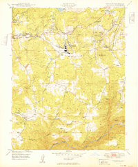
 1894 Big Trees1894 Print · USGSCovers Sonora, including Sonora Meadows, Bear Valley, and other nearby areas
 - 1896 Map of Sonora
 1896 Sonora1896 Print · USGSCovers Sonora, including Jamestown, Groveland, and other nearby areas
 - 1897 Map of Sonora
 1897 Sonora1897 Print · USGSCovers Sonora, including Jamestown, Groveland, and other nearby areas8 unique versions available
 - 1897 Map of Big Trees
 1897 Big Trees1897 Print · USGSCovers Sonora, including Sonora Meadows, Bear Valley, and other nearby areas
 - 1898 Map of Sonora, 1932 Print
 1898 Sonora1932 Print · USGSCovers Sonora, including Jamestown, Groveland, and other nearby areas
 - 1901 Map of Big Trees
 1901 Big Trees1901 Print · USGSCovers Sonora, including Sonora Meadows, Bear Valley, and other nearby areas9 unique versions available
 - 1947 Map of Sacramento, 1948 Print
 1947 Sacramento1948 Print · USGSCovers Sonora, including Sacramento, Stockton, and other nearby areas2 unique versions available
 - 1947 Map of San Jose, 1948 Print
 1947 San Jose1948 Print · USGSCovers Sonora, including San Jose, Stockton, and other nearby areas
 - 1948 Map of Sacramento, 1951 Print
 1948 Sacramento1951 Print · USGSCovers Sonora, including Sacramento, Stockton, and other nearby areas
 - 1948 Map of Columbia, 1953 Print
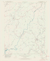
 1948 Columbia1953 Print · USGSCovers Sonora, including Sonora Meadows, Fisher Place, and other nearby areas6 unique versions available
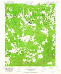
 - 1948 Map of Sonora, 1953 Print
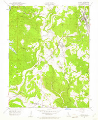 1948 Sonora1953 Print · USGSCovers Sonora, including Jamestown, Algerine, and other nearby areas5 unique versions available
 - 1948 Map of Columbia, 1956 Print
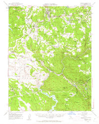
 1948 Columbia1956 Print · USGSCovers Sonora, including Columbia, Columbia, and other nearby areas5 unique versions available
 - 1948 Map of Sonora, 1962 Print
 1948 Sonora1962 Print · USGSCovers Sonora, including Jamestown, Algerine, and other nearby areas2 unique versions available
 - 1948 Map of Standard, 1964 Print
 1948 Standard1964 Print · USGSCovers Sonora, including Mono Village, Diamond Bar B Ranch, and other nearby areas3 unique versions available
 - 1949 Map of Columbia
 1949 Columbia1949 Print · USGSCovers Sonora, including Columbia, Columbia, and other nearby areas2 unique versions available
 - 1949 Map of Sonora
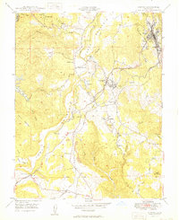 1949 Sonora1949 Print · USGSCovers Sonora, including Jamestown, Algerine, and other nearby areas
 - 1949 Map of Standard
 1949 Standard1949 Print · USGSCovers Sonora, including Mono Village, Diamond Bar B Ranch, and other nearby areas2 unique versions available
 - 1956 Map of San Jose
 1956 San Jose1956 Print · USGSCovers Sonora, including San Jose, Stockton, and other nearby areas
 - 1956 Map of Sacramento
 1956 Sacramento1956 Print · USGSCovers Sonora, including Sacramento, Stockton, and other nearby areas2 unique versions available
 - 1957 Map of Sacramento, 1966 Print
 1957 Sacramento1966 Print · USGSCovers Sonora, including Sacramento, Stockton, and other nearby areas4 unique versions available
 - 1962 Map of San Jose
 1962 San Jose1962 Print · USGSCovers Sonora, including San Jose, Stockton, and other nearby areas4 unique versions available
 - 1966 Map of San Jose
 1966 San Jose1966 Print · USGSCovers Sonora, including San Jose, Stockton, and other nearby areas
 - 1993 Map of San Andreas, 1994 Print
 1993 San Andreas1994 Print · USGSCovers Sonora, including Ione, Jackson, and other nearby areas
Showing maps 1-25 of 27
Top cities near Sonora
Top neighborhoods of Sonora
Frequently asked questions
- What are the different types of historical maps available for Sonora?
- What is the oldest map of Sonora?
- Where can I purchase historical maps of Sonora for my home or office?
- Where can I download high-res historical maps of Sonora?
- Are there historical topographic maps available for Sonora?
- Is there historical aerial imagery available for Sonora?
- Where are historical maps of Sonora sourced from?