Old Maps of Sonora, California for Hiking & Exploration
Hike through history with 39 historic maps of Sonora. Explore old trails, ghost towns, and forgotten backroads — perfect for outdoor adventurers and local explorers.
- Rediscover forgotten places: Map out old mining camps, roads, and footpaths that no longer exist on modern maps.
- Layer with modern tools: Combine with LiDAR or satellite views to plan hikes through historical terrain.
- Made for exploration: Popular among hikers, overlanders, and local history lovers.
Use these maps to find adventure and explore the hidden past of Sonora.
Sonora, CA maps
(39)- 1891 Map of Big Trees
 1891 Big Trees1891 Print · USGSThe Sierra Nevada high country and gold country are seen here in the 1890s, a period defined by the mining economy and early mountain passage. Historians can trace early routes like the Bloods Toll Road and locate sites such as Sheep Ranch, the Keltz Mine, and Swiss Ranch.
 - 1893 Map of Sonora
 1893 Sonora1893 Print · USGSThe Mother Lode region comes alive in the early 1890s, showing a landscape defined by mining camps and early river crossings before the big dams. Genealogists and historians can trace old settlements like Chinese Camp and Big Oak Flat, or locate industrial sites like the Olsen Mine and Hobron Mill.
 - 1894 Map of Big Trees
 1894 Big Trees1894 Print · USGSCentral California's high Sierra region is documented here in the 1890s, where river crossings and giant sequoia groves defined the landscape. Researchers can trace old mountain routes through Abbott Ferry and Parrott Ferry or locate early mining sites like the Riverside Mine.
 - 1896 Map of Sonora
 1896 Sonora1896 Print · USGSThe Mother Lode gold country is shown in the late nineteenth century as mining towns and river crossings defined the Sierra Nevada foothills. Genealogists and researchers can trace early routes through Chinese Camp and Coulterville, or locate industrial sites like the Red Cloud Mine and Benton Mill.
 - 1897 Map of Sonora
 1897 Sonora1897 Print · USGSThe Mother Lode region at the close of the nineteenth century is revealed here through its gold-country towns and rugged mining infrastructure. Trace the early footprints of Sonora, Coulterville, and Hornitos alongside sites like the Red Cloud Mine and Ward Ferry.8 unique versions available
 - 1897 Map of Big Trees
 1897 Big Trees1897 Print · USGSThe Sierra Nevada foothills and deep river canyons of the late nineteenth century are mapped here in detail before modern development. Genealogists and historians can trace early mountain life through landmarks like Bloods Toll, the Riverside Mine, and historic crossings at Abbott Ferry.
 - 1898 Map of Sonora, 1932 Print
 1898 Sonora1932 Print · USGSThe Mother Lode region at the close of the nineteenth century reveals a complex world of river dams and mining camps. Genealogists can trace family names at Chinese Camp or Soulsbyville and locate early industry at the Red Cloud Mine and Bandarita Mine.
 - 1901 Map of Big Trees
 1901 Big Trees1901 Print · USGSThe High Sierra and Gold Country meet in this turn-of-the-century look at the groves and mining camps of the Mokelumne and Stanislaus watersheds. Trace the early boundaries of the Calaveras Grove, locate the Riverside Mine, or find river crossings like Parrott Ferry.9 unique versions available
 - 1947 Map of Sacramento, 1948 Print
 1947 Sacramento1948 Print · USGSThe Sacramento Valley meets the high Sierra during a period of post-war expansion. Trace the historic river delta islands like Grand Island or locate early airfield footprints at McClellan Air Force Base and Mather Air Force Base.2 unique versions available
 - 1947 Map of San Jose, 1948 Print
 1947 San Jose1948 Print · USGSNorthern California's heartland is captured here just after the war, showing the rapid growth of the Santa Clara and Central Valleys. Researchers can trace the legacy of rail and water at Castle Air Force Base, Stockton, and the Hetch Hetchy Aqueduct.
 - 1948 Map of Sacramento, 1951 Print
 1948 Sacramento1951 Print · USGSPost-war Northern California comes alive in this regional survey, capturing the era of expansion between the Central Valley and the High Sierra. Researchers can trace the rail networks of the Central California Traction and Sacramento Northern RR or locate landmarks like the State Capitol and University of California Davis.
 - 1948 Map of Columbia, 1953 Print
 1948 Columbia1953 Print · USGSTuolumne and Calaveras counties in the late 1940s reveal a landscape shaped by the gold rush and emerging state preservation. Genealogists can trace family homesteads near Columbia and Murphys, or locate industrial sites like the Sheep Ranch Mine and Experimental Mine.6 unique versions available
 - 1948 Map of Sonora, 1953 Print
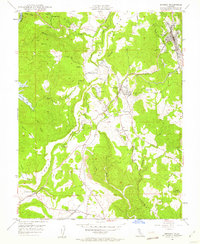 1948 Sonora1953 Print · USGSTuolumne County’s historic mining district is documented here in the late 1940s, centered on the corridor between the county seat and the Sierra foothills. Genealogists and historians can trace family locations from the Mark Twain Cabin to the Harvard Mine and the rail stops of the Sierra RR.5 unique versions available
 - 1948 Map of Columbia, 1956 Print
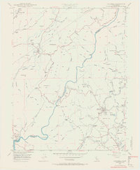 1948 Columbia1956 Print · USGSTuolumne County's gold rush heartland is documented here in the late 1940s, showing the preservation of Columbia before modern expansion. You can trace early mining claims and water routes like the Utica Ditch, Carson Hill Mine, and the now-familiar Moaning Caves.5 unique versions available
 - 1948 Map of Sonora, 1962 Print
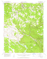 1948 Sonora1962 Print · USGSTuolumne County's Mother Lode country comes alive in this post-war survey of the Sierra Foothills. Researchers can trace the path of the Sierra RR, locate the Harvard Mine, and explore historic communities from Chinese Camp to Soulsbyville.2 unique versions available
 - 1948 Map of Standard, 1964 Print
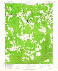 1948 Standard1964 Print · USGSTuolumne County’s timber and mining heritage is on full display in the late 1940s. Genealogists and historians can trace the Sierra RR through Standard, locate family landmarks like Gandolfo Ranch, and find old sites such as Morgan Chapel.3 unique versions available
 - 1949 Map of Columbia
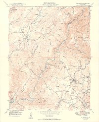 1949 Columbia1949 Print · USGSThe Gold Country of Tuolumne and Calaveras counties is captured here just after World War II, showing a landscape defined by deep canyons and mining history. Researchers can trace the legacy of the 1849 rush through sites like Columbia State Park, the Vine Spring Mine, and the now-quiet settlement of Squabbletown.2 unique versions available
 - 1949 Map of Sonora
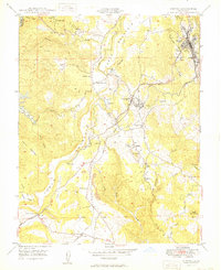 1949 Sonora1949 Print · USGSTuolumne County's mining heartland is captured here in the late 1940s, showing the intricate network of camps and mines around Sonora. Researchers can trace old family sites and mining claims near Jamestown, Tuttletown, and the Harvard Mine.
 - 1949 Map of Standard
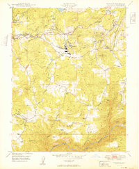 1949 Standard1949 Print · USGSThe Sierra Nevada foothills come alive in the late 1940s, highlighting the industrial intersections of Tuolumne County. Genealogists and historians can trace family-named sites like McNutt Ranch and the mining legacy of Soulsbyville or the Chickenfeed Mine.2 unique versions available
 - 1956 Map of San Jose
 1956 San Jose1956 Print · USGSCentral California in the mid-fifties reveals the transition from sprawling orchards to growing urban hubs like San Jose and Stockton. Genealogists and historians can trace the rail-era landscape of the Mother Lode through Chinese Camp and Tuttletown, or follow the water through the Joaquin River and Calaveras Reservoir.
 - 1956 Map of Sacramento
 1956 Sacramento1956 Print · USGSMid-century California unfolds from the delta to the high Sierra, capturing a landscape of growing valley cities and burgeoning military airbases. Genealogists and historians can trace the rail lines and river towns from Woodland to Lodi, or explore the foothill settlements of Placerville and Jackson.2 unique versions available
 - 1957 Map of Sacramento, 1966 Print
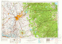 1957 Sacramento1966 Print · USGSIn the mid-twentieth century, the California heartland was a hub of river transport, rail lines, and military airbases. Genealogists and historians can trace the development of Gold Country towns like Angels Camp and Sonora or follow the path of the Southern Pacific RR through the growing suburbs of Sacramento.4 unique versions available
 - 1962 Map of San Jose
 1962 San Jose1962 Print · USGSCentral California in the early sixties showcases the expansion of the San Joaquin and Santa Clara valleys. Researchers can trace the rail-to-road transition along the Southern Pacific RR or locate landmarks like Castle USAF Base and Loma Prieta.4 unique versions available
 - 1966 Map of San Jose
 1966 San Jose1966 Print · USGSCentral California in the mid-1960s reveals a landscape of massive irrigation projects and expanding Cold War military footprints. Researchers can trace the rail-and-river network of the San Joaquin Valley or locate specialized sites like Castle Air Force Base and the Sharp General Depot (Military).
 - 1993 Map of San Andreas, 1994 Print
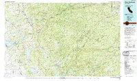 1993 San Andreas1994 Print · USGSThe Mother Lode and High Sierra foothills come alive in the 1990s, showcasing a region defined by historic gold mining and massive water projects. Genealogists and historians can locate old mining sites and rural settlements like Volcano, San Andreas, and Mokelumne Hill.
Showing maps 1-25 of 39
Top cities near Sonora
Top neighborhoods of Sonora
Frequently asked questions
- What are the different types of historical maps available for Sonora?
- What is the oldest map of Sonora?
- Where can I purchase historical maps of Sonora for my home or office?
- Where can I download high-res historical maps of Sonora?
- Are there historical topographic maps available for Sonora?
- Is there historical aerial imagery available for Sonora?
- Where are historical maps of Sonora sourced from?