Old Maps of Eastlake, Thornton for Genealogy
Trace your family roots with 15 historic maps of Eastlake. These high-res maps reveal old neighborhoods, homesites, landmarks, and streets — helping you uncover where your ancestors lived and how the area evolved over time.
- Explore historic neighborhoods: Identify where your relatives may have lived in the 1800s or 1900s.
- Compare maps over time: Trace the changes in streets, buildings, and landmarks for multi-generational research.
- Perfect for genealogy & ancestry research: Used by family historians and researchers to map out lineage and migration.
These maps are an incredible resource for exploring your personal connection to Eastlake's past.
Eastlake, Thornton maps
(15)- 1890 Map of East Denver
 1890 East Denver1890 Print · USGSDenver and the surrounding plains are captured in the late frontier era as a complex web of irrigation canals and iron rails. Researchers can trace early water systems like the High Line Ditch or locate early settlements such as Parker's and Scranton.
 - 1940 Map of Eastlake
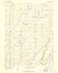
 1940 Eastlake1940 Print · USGSAdams County at the end of the 1930s shows a landscape of rail-side settlements and intensive irrigation. Genealogists can locate family landmarks like Wesley Chapel, rural school sites such as Moreland Sch, and the water networks of the Brantner Ditch.
 - 1944 Map of Eastlake
 1944 Eastlake1944 Print · USGSThe South Platte River valley and the agricultural plains of Adams County appear here in the years before the Denver suburbs arrived. Genealogists and historians can trace rural family life through locations like Wesley Chapel, the local Cemetery, and early school sites like Brantner Sch.
 - 1953 Map of Denver, 1964 Print
 1953 Denver1964 Print · USGSDenver and the Colorado Front Range are captured here during a decade of post-war growth and military expansion. Researchers can trace the sprawling rail lines of the Union Pacific, locate the State Capitol, and explore historic mountain mining hubs like Central City.6 unique versions available
 - 1957 Map of Denver
 1957 Denver1957 Print · USGSDenver and the Colorado Front Range are seen here during a mid-century period of intense military and urban expansion. Trace the footprints of the Rocky Mountain Arsenal, the early United States Air Force Academy, and the Lowry AF Base.
 - 1957 Map of Eastlake, 1958 Print
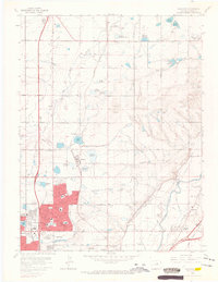
 1957 Eastlake1958 Print · USGSAdams County’s farming and irrigation heartland is frozen in time in the late fifties, just as the metropolitan area began its northward shift. Researchers can trace historic water rights and small-town roots through landmarks like Eastlake, the Wesley Cem, and the Union Pacific rail siding at Hazeltine.2 unique versions available
 - 1958 Map of Denver
 1958 Denver1958 Print · USGSDenver and the Colorado Front Range are captured here during the mid-century suburban boom. Trace the footprints of military installations like Buckley Air Force Base alongside the established rail networks of the Colorado & Southern Ry.
 - 1960 Map of Denver
 1960 Denver1960 Print · USGSDenver and the Colorado Front Range are seen here at a pivotal moment of postwar expansion into the plains and foothills. Researchers can trace the mid-century rail network of the Denver & Rio Grande Western RR and locate historic institutional landmarks like Buckley Field and the Colorado School of Mines.
 - 1965 Map of Eastlake, 1967 Print
 1965 Eastlake1967 Print · USGSThe northern Denver suburbs were rapidly transforming in the mid-sixties as new housing developments pushed into traditional farmland. Genealogists can locate family sites at Wesley Chapel Cem or Swanson Memorial Gardens and trace the rail-side industry of Eastlake.8 unique versions available
 - 1981 Map of Denver East
 1981 Denver East1981 Print · USGSEastern Colorado comes alive in the early eighties as the Front Range urban corridor pushes into the plains. Genealogists and historians can trace the growth of Aurora and Brighton alongside the historic Union Pacific line and the massive Rocky Mountain Arsenal.2 unique versions available
 - 2010 Map of Eastlake, 2010 Print
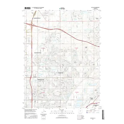
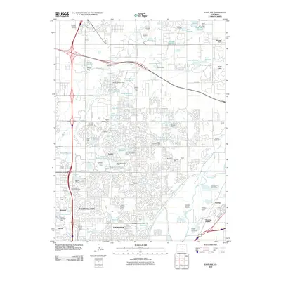 2010 Eastlake2010 Print · USGSCovers Eastlake, including Thornton, Westminster, and other nearby areas
 - 2013 Map of Eastlake, 2013 Print
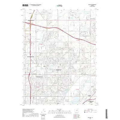
 2013 Eastlake2013 Print · USGSCovers Eastlake, including Thornton, Westminster, and other nearby areas
 - 2016 Map of Eastlake, 2016 Print
 2016 Eastlake2016 Print · USGSCovers Eastlake, including Thornton, Westminster, and other nearby areas
 - 2019 Map of Eastlake, 2019 Print
 2019 Eastlake2019 Print · USGSCovers Eastlake, including Thornton, Westminster, and other nearby areas
 - 2022 Map of Eastlake, 2022 Print
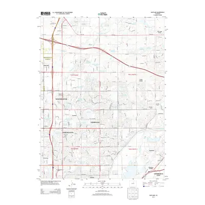
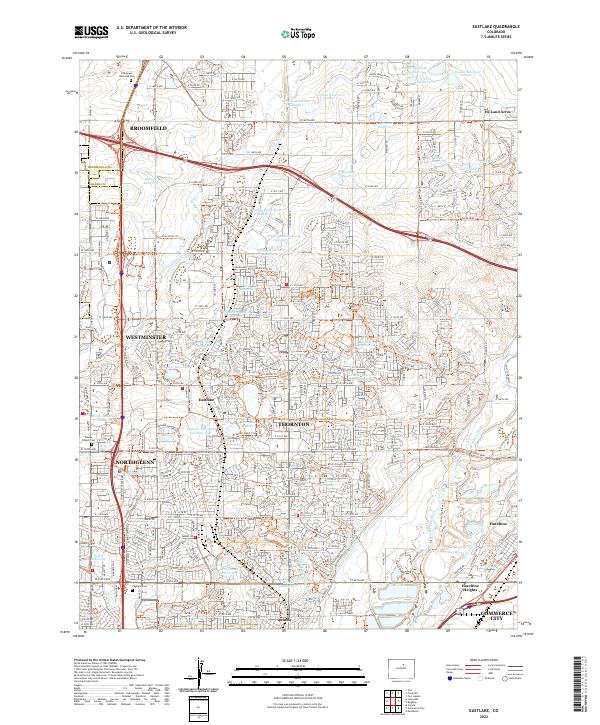 2022 Eastlake2022 Print · USGSThornton and the surrounding northern Denver suburbs are shown here during a period of significant growth, where historical water systems meet modern development. Trace the evolution of neighborhoods around Eastlake and Hunters Glen Lake, or locate sites like Wesley Chapel Cem and the South Platte River.
End of results
Showing maps 1-15 of 15
Top cities near Eastlake
- Denver historical maps
- Aurora historical maps
- Lakewood historical maps
- Thornton historical maps
- Arvada historical maps
- Westminster historical maps
See more
Frequently asked questions
- What are the different types of historical maps available for Eastlake?
- What is the oldest map of Eastlake?
- Where can I purchase historical maps of Eastlake for my home or office?
- Where can I download high-res historical maps of Eastlake?
- Are there historical topographic maps available for Eastlake?
- Is there historical aerial imagery available for Eastlake?
- Where are historical maps of Eastlake sourced from?