Old Maps of Baker, Denver for Metal Detecting
Plan your next treasure hunt with 19 historic maps of Baker. Find old homesites, ghost towns, trails, and gathering spots that may be lost to time — perfect for identifying promising metal detecting locations.
- Locate forgotten sites: Uncover places like long-lost settlements, abandoned rail lines, or gathering spots.
- Plan better hunts: Use map overlays combined with LiDAR or satellite views to narrow in on historically rich areas.
- Made for detectorists: Thousands of hobbyists use these maps to discover relics, coins, and hidden history.
Use these historic maps to boost your research and find new opportunities beneath the surface of Baker.
Baker, Denver maps
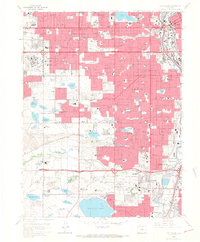
(19)- 1890 Map of East Denver
 1890 East Denver1890 Print · USGSCovers Baker, including Denver, Aurora, and other nearby areas
 - 1899 Map of West Denver
 1899 West Denver1899 Print · USGSCovers Baker, including Lakewood, Thornton, and other nearby areas
 - 1935 Map of East Denver Nos. 3 and 4
 1935 East Denver Nos. 3 and 41935 Print · USGSCovers Baker, including Denver, Aurora, and other nearby areas
 - 1940 Map of Englewood
 1940 Englewood1940 Print · USGSCovers Baker, including Denver, Aurora, and other nearby areas
 - 1941 Map of Fort Logan
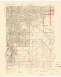
 1941 Fort Logan1941 Print · USGSCovers Baker, including Lakewood, Littleton, and other nearby areas
 - 1944 Map of Englewood
 1944 Englewood1944 Print · USGSCovers Baker, including Denver, Aurora, and other nearby areas
 - 1948 Map of Fort Logan
 1948 Fort Logan1948 Print · USGSCovers Baker, including Lakewood, Littleton, and other nearby areas
 - 1950 Map of Englewood
 1950 Englewood1950 Print · USGSCovers Baker, including Denver, Aurora, and other nearby areas
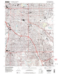
 - 1953 Map of Denver, 1964 Print
 1953 Denver1964 Print · USGSCovers Baker, including Denver, Colorado Springs, and other nearby areas6 unique versions available
 - 1957 Map of Denver
 1957 Denver1957 Print · USGSCovers Baker, including Denver, Colorado Springs, and other nearby areas
 - 1957 Map of Fort Logan, 1958 Print
 1957 Fort Logan1958 Print · USGSCovers Baker, including Lakewood, Littleton, and other nearby areas
 - 1957 Map of Englewood, 1958 Print
 1957 Englewood1958 Print · USGSCovers Baker, including Denver, Aurora, and other nearby areas
 - 1958 Map of Denver
 1958 Denver1958 Print · USGSCovers Baker, including Denver, Colorado Springs, and other nearby areas
 - 1960 Map of Denver
 1960 Denver1960 Print · USGSCovers Baker, including Denver, Colorado Springs, and other nearby areas
 - 1965 Map of Englewood, 1967 Print
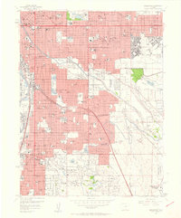
 1965 Englewood1967 Print · USGSCovers Baker, including Denver, Aurora, and other nearby areas9 unique versions available
 - 1965 Map of Fort Logan, 1967 Print
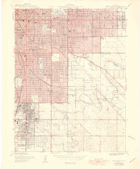
 1965 Fort Logan1967 Print · USGSCovers Baker, including Lakewood, Littleton, and other nearby areas5 unique versions available
 - 1981 Map of Denver East
 1981 Denver East1981 Print · USGSCovers Baker, including Denver, Aurora, and other nearby areas2 unique versions available
 - 1983 Map of Denver West
 1983 Denver West1983 Print · USGSCovers Baker, including Lakewood, Thornton, and other nearby areas2 unique versions available
 - 1997 Map of Englewood, 1999 Print
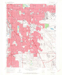
 1997 Englewood1999 Print · USGSCovers Baker, including Denver, Aurora, and other nearby areas
End of results
Showing maps 1-19 of 19
Frequently asked questions
- What are the different types of historical maps available for Baker?
- What is the oldest map of Baker?
- Where can I purchase historical maps of Baker for my home or office?
- Where can I download high-res historical maps of Baker?
- Are there historical topographic maps available for Baker?
- Is there historical aerial imagery available for Baker?
- Where are historical maps of Baker sourced from?