2020s Maps of Gypsum, Colorado
Explore 3 historic maps of Gypsum from the 2020s. These maps offer a rare glimpse into what life looked like during the 2020s — showing old roads, neighborhoods, homes, and landmarks that have changed or disappeared over time.
Whether you're researching your family's past, planning a metal detecting trip, or studying how Gypsum's landscape evolved across the 2020s, these high-resolution maps are a powerful tool for exploring the history of this region.
- Focus on a specific era: All maps on this page are from the 2020s, giving you a focused view of this time period.
- See what’s changed: Compare century-old streets, trails, and buildings to today's modern landscape using overlays and satellite layers.
- Research with precision: Use these maps for genealogy, historical research, land use analysis, or educational projects.
- View, download, or print: Maps are fully viewable online in high resolution, and can be downloaded or printed for your own records.
Start exploring Gypsum's history through authentic maps from the 2020s. This is your window into the past.
Gypsum, CO maps
(3)- 2022 Map of Gypsum, 2022 Print
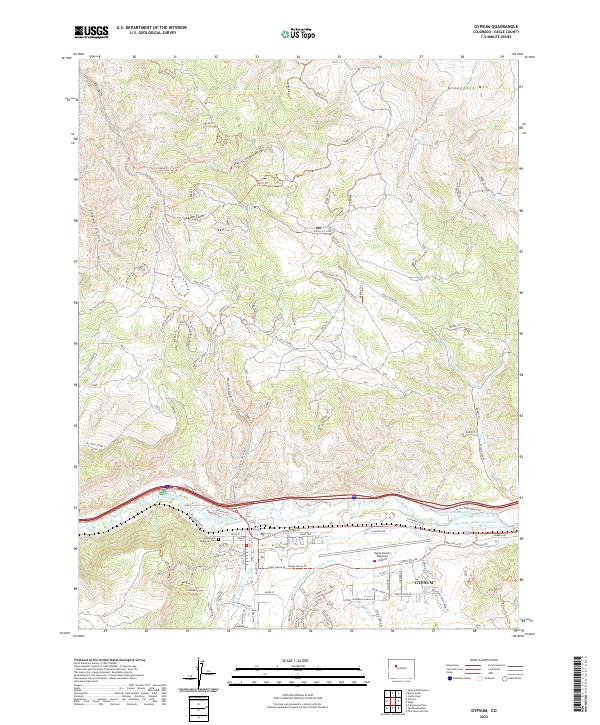 2022 Gypsum2022 Print · USGSGypsum and the Eagle River valley appear in high detail during this era of modern mountain development. Genealogists and hikers can trace local landmarks like Cedar Hill Memorial Cem and the extensive trail systems of Greenhorn Mtn.
 - 2022 Map of Suicide Mountain, 2022 Print
 2022 Suicide Mountain2022 Print · USGSGypsum and the surrounding Eagle County high country are captured here in the early twenty-first century. Outdoor researchers and local historians can trace high-altitude water systems and trails through White River National Forest and Hardscrabble Mtn.
 - 2022 Map of Eagle, 2022 Print
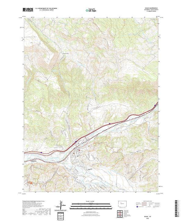 2022 Eagle2022 Print · USGSThe Eagle River valley in the early 2020s shows a landscape defined by its mountain transit corridors and vital water infrastructure. Trace local genealogy and geography through landmarks like Sunset View Cem, Fivemile Rock, and the historic Hollingsworth Ditch.
End of results
Showing maps 1-3 of 3
Top cities near Gypsum
Frequently asked questions
- What are the different types of historical maps available for Gypsum?
- What is the oldest map of Gypsum?
- Where can I purchase historical maps of Gypsum for my home or office?
- Where can I download high-res historical maps of Gypsum?
- Are there historical topographic maps available for Gypsum?
- Is there historical aerial imagery available for Gypsum?
- Where are historical maps of Gypsum sourced from?