1980s Maps of Whitehorn, Colorado
Explore 3 historic maps of Whitehorn from the 1980s. These maps offer a rare glimpse into what life looked like during the 1980s — showing old roads, neighborhoods, homes, and landmarks that have changed or disappeared over time.
Whether you're researching your family's past, planning a metal detecting trip, or studying how Whitehorn's landscape evolved across the 1980s, these high-resolution maps are a powerful tool for exploring the history of this region.
- Focus on a specific era: All maps on this page are from the 1980s, giving you a focused view of this time period.
- See what’s changed: Compare century-old streets, trails, and buildings to today's modern landscape using overlays and satellite layers.
- Research with precision: Use these maps for genealogy, historical research, land use analysis, or educational projects.
- View, download, or print: Maps are fully viewable online in high resolution, and can be downloaded or printed for your own records.
Start exploring Whitehorn's history through authentic maps from the 1980s. This is your window into the past.
Whitehorn, CO maps
(3)- 1983 Map of Cameron Mountain
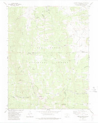 1983 Cameron Mountain1983 Print · USGSHigh-country mining and timber lands at the border of Chaffee, Park, and Fremont counties are documented here in the early 1980s. Local researchers can trace old mining sites like the Marble Quarry or locate landmarks such as Bassam Guard Station and Manoa Springs.
 - 1983 Map of Pikes Peak
 1983 Pikes Peak1983 Print · USGSIn the early eighties, the high-altitude mining districts of Teller County remained deeply etched into the mountain landscape. Researchers can trace the legacy of the Gold Belt through sites like the Stratton Mine and vanished rail stops near Cripple Creek or Altman.
 - 1989 Map of Pueblo
 1989 Pueblo1989 Print · USGSIn the late eighties, the Colorado Front Range balanced its deep mining history with massive military expansion and water development. Researchers can trace the rail lines of the AT & SF RR or locate remote high-altitude settlements like Rosita and Querida.
End of results
Showing maps 1-3 of 3
Top cities near Whitehorn
- Salida historical maps
- Poncha Springs historical maps
- Howard historical maps
- Nathrop historical maps
- Smeltertown historical maps
Frequently asked questions
- What are the different types of historical maps available for Whitehorn?
- What is the oldest map of Whitehorn?
- Where can I purchase historical maps of Whitehorn for my home or office?
- Where can I download high-res historical maps of Whitehorn?
- Are there historical topographic maps available for Whitehorn?
- Is there historical aerial imagery available for Whitehorn?
- Where are historical maps of Whitehorn sourced from?