Old Maps of Smith Hill, Colorado for Genealogy
Trace your family roots with 16 historic maps of Smith Hill. These high-res maps reveal old neighborhoods, homesites, landmarks, and streets — helping you uncover where your ancestors lived and how the area evolved over time.
- Explore historic neighborhoods: Identify where your relatives may have lived in the 1800s or 1900s.
- Compare maps over time: Trace the changes in streets, buildings, and landmarks for multi-generational research.
- Perfect for genealogy & ancestry research: Used by family historians and researchers to map out lineage and migration.
These maps are an incredible resource for exploring your personal connection to Smith Hill's past.
Smith Hill, CO maps
(16)- 1899 Map of West Denver
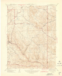
 1899 West Denver1899 Print · USGSThe Denver metropolitan area and its western foothills appear in the late Victorian era as a burgeoning rail and irrigation hub. Researchers can trace the early footprints of Denver, Golden, and Littleton, alongside industrial sites like the Louisville Coal Mine and the grounds of Fort Logan.
 - 1906 Map of Blackhawk
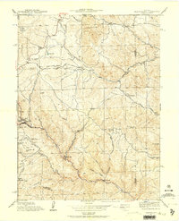
 1906 Blackhawk1906 Print · USGSThe Front Range foothills and mining districts come alive in this early century survey, showing the transition from mountain ranching to industrial rail. Genealogists and historians can trace family holdings like Winiger Ranch, find the Pine Glade School, and follow the Denver Northwestern and Pacific RR.5 unique versions available
 - 1942 Map of Black Hawk, 1957 Print
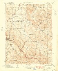
 1942 Black Hawk1957 Print · USGSThe Colorado high country around Gilpin and Jefferson counties comes into sharp focus during the early 1940s. Genealogists and historians can trace the mining-era roots of Black Hawk and Central City, while finding local landmarks like the Mountain House Sch and Summit Mine.4 unique versions available
 - 1944 Map of Black Hawk
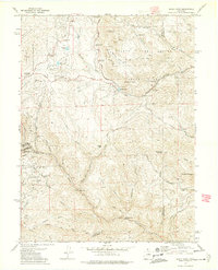
 1944 Black Hawk1944 Print · USGSThe mining heart of Gilpin County is frozen in time during the mid-1940s, showing the early layouts of two famous gold-rush towns. Genealogists and historians can trace family-named terrain and remote sites like the Summit Mine, Bay State Sch, and Russell Gulch.2 unique versions available
 - 1948 Map of Black Hawk
 1948 Black Hawk1948 Print · USGSThe Gilpin County mining districts are captured here in the late 1940s as the high-country landscape balanced industrial roots with modern road expansion. Researchers can trace the steep streets of Black Hawk or locate remote landmarks like the Summit Mine and the Mountain House Sch.
 - 1953 Map of Denver, 1964 Print
 1953 Denver1964 Print · USGSDenver and the Colorado Front Range are captured here during a decade of post-war growth and military expansion. Researchers can trace the sprawling rail lines of the Union Pacific, locate the State Capitol, and explore historic mountain mining hubs like Central City.6 unique versions available
 - 1957 Map of Denver
 1957 Denver1957 Print · USGSDenver and the Colorado Front Range are seen here during a mid-century period of intense military and urban expansion. Trace the footprints of the Rocky Mountain Arsenal, the early United States Air Force Academy, and the Lowry AF Base.
 - 1958 Map of Denver
 1958 Denver1958 Print · USGSDenver and the Colorado Front Range are captured here during the mid-century suburban boom. Trace the footprints of military installations like Buckley Air Force Base alongside the established rail networks of the Colorado & Southern Ry.
 - 1960 Map of Denver
 1960 Denver1960 Print · USGSDenver and the Colorado Front Range are seen here at a pivotal moment of postwar expansion into the plains and foothills. Researchers can trace the mid-century rail network of the Denver & Rio Grande Western RR and locate historic institutional landmarks like Buckley Field and the Colorado School of Mines.
 - 1972 Map of Black Hawk, 1975 Print
 1972 Black Hawk1975 Print · USGSThe Colorado Front Range comes into focus in the early 1970s, revealing a landscape where historic mining claims meet newly established state parks. Researchers can trace local history through prominent sites like the Baltimore Mine, the Clear Creek Dredge Tailings, and Golden Gate Canyon State Park.5 unique versions available
 - 1983 Map of Denver West
 1983 Denver West1983 Print · USGSThe Front Range and Denver's western suburbs meet in the early 1980s, documenting the era's growth from the mountain peaks to the valley floor. Genealogists and historians can trace the foundations of Lakewood and Golden, or locate high-altitude landmarks like the Moffat Tunnel and Mount Olivet Cem.2 unique versions available
 - 2011 Map of Black Hawk, 2011 Print
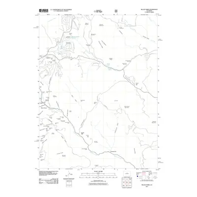 2011 Black Hawk2011 Print · USGSCovers Smith Hill, including Idaho Springs, Black Hawk, and other nearby areas
 - 2013 Map of Black Hawk, 2013 Print
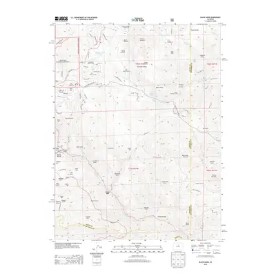 2013 Black Hawk2013 Print · USGSCovers Smith Hill, including Idaho Springs, Black Hawk, and other nearby areas
 - 2016 Map of Black Hawk, 2016 Print
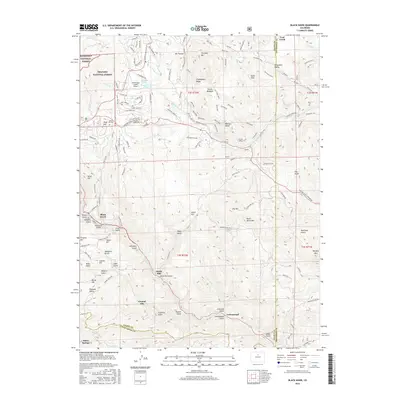 2016 Black Hawk2016 Print · USGSCovers Smith Hill, including Idaho Springs, Black Hawk, and other nearby areas
 - 2019 Map of Black Hawk, 2019 Print
 2019 Black Hawk2019 Print · USGSCovers Smith Hill, including Idaho Springs, Black Hawk, and other nearby areas
 - 2022 Map of Black Hawk, 2022 Print
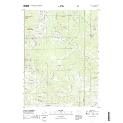
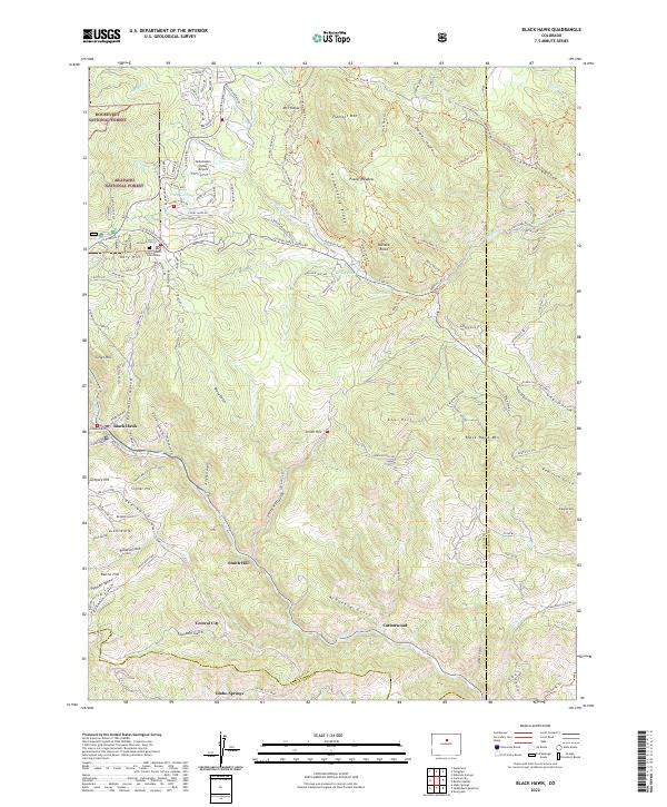 2022 Black Hawk2022 Print · USGSThe mining centers of Black Hawk and Central City are shown at the start of the 2020s amidst the high peaks of the Front Range. Genealogists and researchers can locate the Gilpin County Courthouse, Dory Hill Cem, and named landmarks like Justice Hill.
End of results
Showing maps 1-16 of 16
Top cities near Smith Hill
- Arvada historical maps
- Boulder historical maps
- Golden historical maps
- Evergreen historical maps
- Idaho Springs historical maps
- Nederland historical maps
See more
Frequently asked questions
- What are the different types of historical maps available for Smith Hill?
- What is the oldest map of Smith Hill?
- Where can I purchase historical maps of Smith Hill for my home or office?
- Where can I download high-res historical maps of Smith Hill?
- Are there historical topographic maps available for Smith Hill?
- Is there historical aerial imagery available for Smith Hill?
- Where are historical maps of Smith Hill sourced from?