2020s Maps of Jefferson County, Colorado
Explore 26 historic maps of Jefferson County from the 2020s. These maps offer a rare glimpse into what life looked like during the 2020s — showing old roads, neighborhoods, homes, and landmarks that have changed or disappeared over time.
Whether you're researching your family's past, planning a metal detecting trip, or studying how Jefferson County's landscape evolved across the 2020s, these high-resolution maps are a powerful tool for exploring the history of this region.
- Focus on a specific era: All maps on this page are from the 2020s, giving you a focused view of this time period.
- See what’s changed: Compare century-old streets, trails, and buildings to today's modern landscape using overlays and satellite layers.
- Research with precision: Use these maps for genealogy, historical research, land use analysis, or educational projects.
- View, download, or print: Maps are fully viewable online in high resolution, and can be downloaded or printed for your own records.
Start exploring Jefferson County's history through authentic maps from the 2020s. This is your window into the past.
Jefferson County, CO maps
(26)- 2022 Map of McCurdy Mountain, 2022 Print
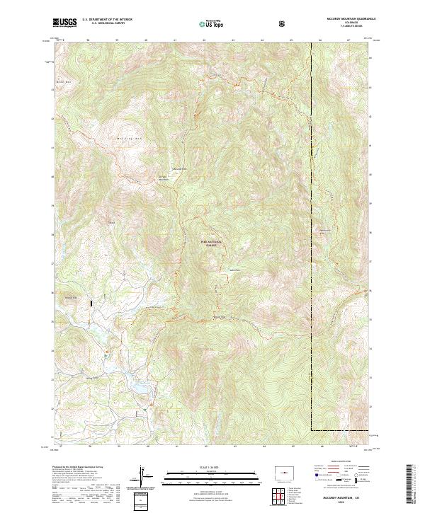 2022 McCurdy Mountain2022 Print · USGSThe Tarryall Mountains in Park County are shown in great detail during the early 2020s. Hikers and researchers can trace the Brookside-McCurdy Trl past landmarks like Harmonica Arch and the Bayou Salado Reservoir.
 - 2022 Map of Conifer, 2022 Print
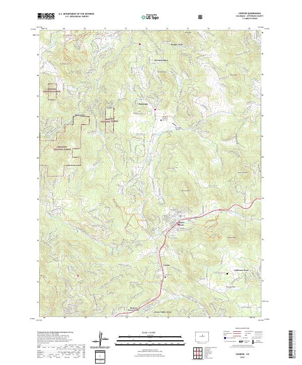 2022 Conifer2022 Print · USGSThe foothills of Jefferson County come into focus during the early 2020s as residential expansion meets the high-altitude forest. Researchers can trace family history at the Conifer Cem or explore the area around the Marshdale Airport and Aspen Park.
 - 2022 Map of Pine, 2022 Print
 2022 Pine2022 Print · USGSJefferson County mountain life and transit are captured here in the early twenty-first century as the North Fork South Platte River flows through Pine Grove. Researchers can trace old routes like the Narrow Gauge Trl or locate family sites at the Pine Cem and Buffalo Creek Cem.
 - 2022 Map of Deckers, 2022 Print
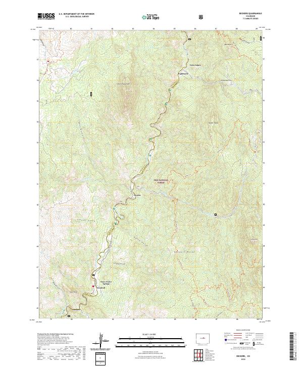 2022 Deckers2022 Print · USGSThe South Platte River corridor north of the Rampart Range comes into focus in the 2020s, showing mountain life along the county line. Trace the small settlements of Deckers and Trumbull or follow backcountry routes like the Colorado Trl and Log Jumper Trl.
 - 2022 Map of Ralston Buttes, 2022 Print
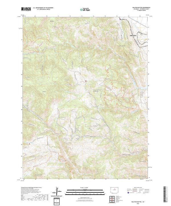 2022 Ralston Buttes2022 Print · USGSThe Front Range foothills rise sharply toward Ralston Buttes and Centennial Cone in this 2022 survey. Researchers can trace the winding paths of Golden Gate Canyon Rd and locate the historic settlement of Guy Hill.
 - 2022 Map of Meridian Hill, 2022 Print
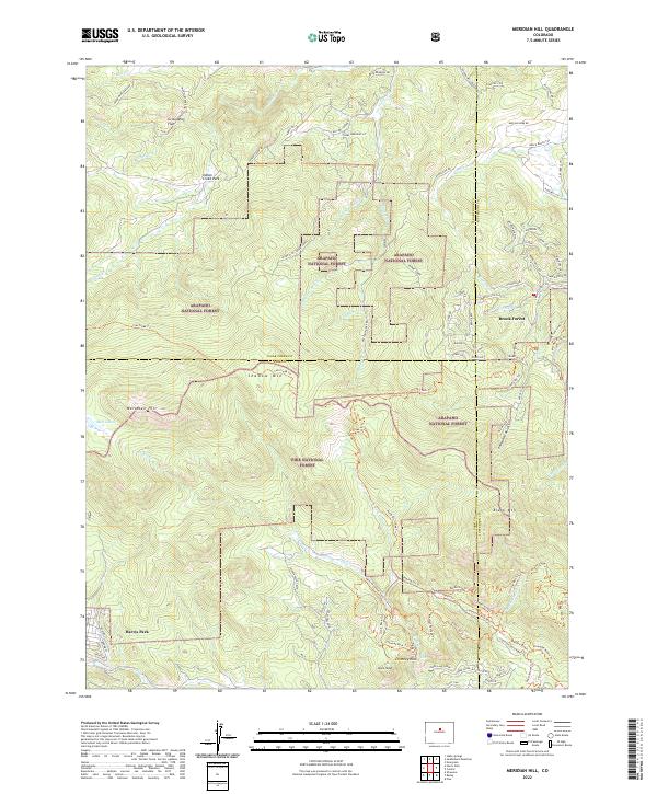 2022 Meridian Hill2022 Print · USGSThe high Front Range near the borders of Clear Creek, Jefferson, and Park counties is shown here during a period of modern forest management and residential growth. Researchers can trace the layout of Harris Park and Brook Forest or locate landmarks like Meridian Hill and Elk Falls.
 - 2022 Map of Indian Hills, 2022 Print
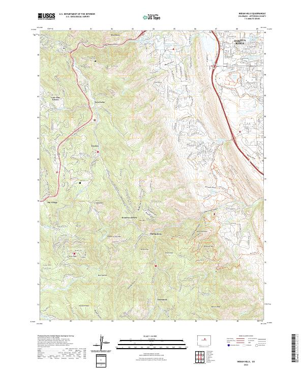 2022 Indian Hills2022 Print · USGSJefferson County foothills life is documented here in the early twenty-first century as suburban growth meets the mountains. Trace family history at Olinger Mount Lindo Cem or locate old settlements like Phillipsburg and Homewood Park.
 - 2022 Map of Platte Canyon, 2022 Print
 2022 Platte Canyon2022 Print · USGSThe confluence of the North Fork and main stem of the South Platte River highlights this Jefferson County landscape in 2022. Trace mountain settlements and geologic landmarks from Foxton and South Platte to the massive formations of Dome Rock and Chair Rocks.
 - 2022 Map of Green Mountain, 2022 Print
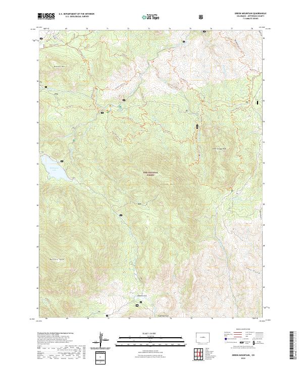 2022 Green Mountain2022 Print · USGSJefferson County’s high forest terrain is documented here in the early 2020s, showing a landscape defined by deep gulches and steep summits. Researchers can trace historic routes like the Colorado Trail or locate landmarks such as Webster Park and Wellington Lake.
 - 2022 Map of Evergreen, 2022 Print
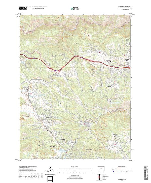 2022 Evergreen2022 Print · USGSJefferson County’s mountain communities are captured in the early 2020s, showing the modern interface of residential growth and high-country terrain. Researchers can locate family sites near Evergreen Cemetery or trace recreational corridors like the Chief Hosa Loop Trail and Peaks To Plains Trail.
 - 2022 Map of Bailey, 2022 Print
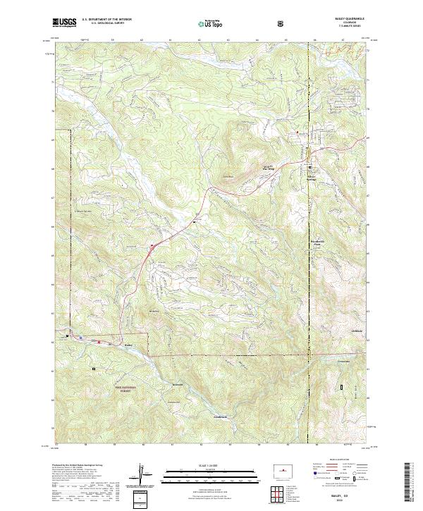 2022 Bailey2022 Print · USGSThe Park and Jefferson County mountains come into focus in 2022, showing the modern layout of riverside settlements and forest boundaries. Genealogists and local historians can trace family plots at Pine Gulch Cem or locate the old footprints of Insmont and Estabrook.
 - 2022 Map of Black Hawk, 2022 Print
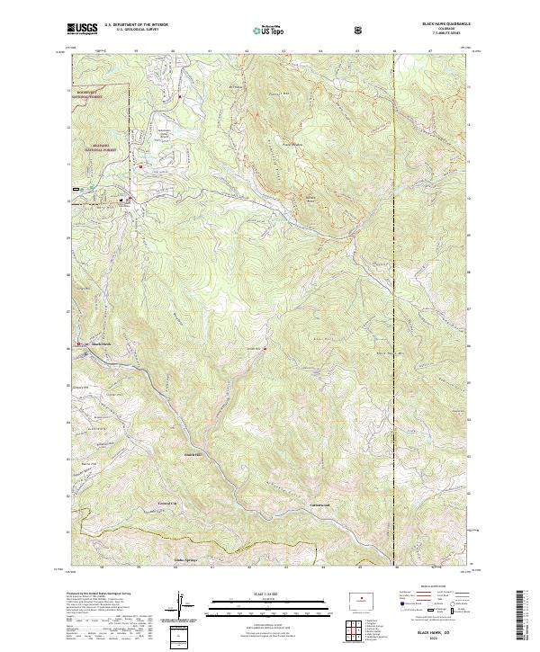 2022 Black Hawk2022 Print · USGSThe mining centers of Black Hawk and Central City are shown at the start of the 2020s amidst the high peaks of the Front Range. Genealogists and researchers can locate the Gilpin County Courthouse, Dory Hill Cem, and named landmarks like Justice Hill.
 - 2022 Map of Westcreek, 2022 Print
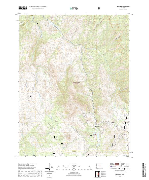 2022 Westcreek2022 Print · USGSWestcreek and the surrounding Pike National Forest appear in fine detail in the early 2020s as modern mapping captures this high-mountain landscape. Genealogists and hikers can trace local landmarks like Thunder Butte, Bell Rock, and the waters of J-O-Hill Reservoir.
 - 2022 Map of Littleton, 2022 Print
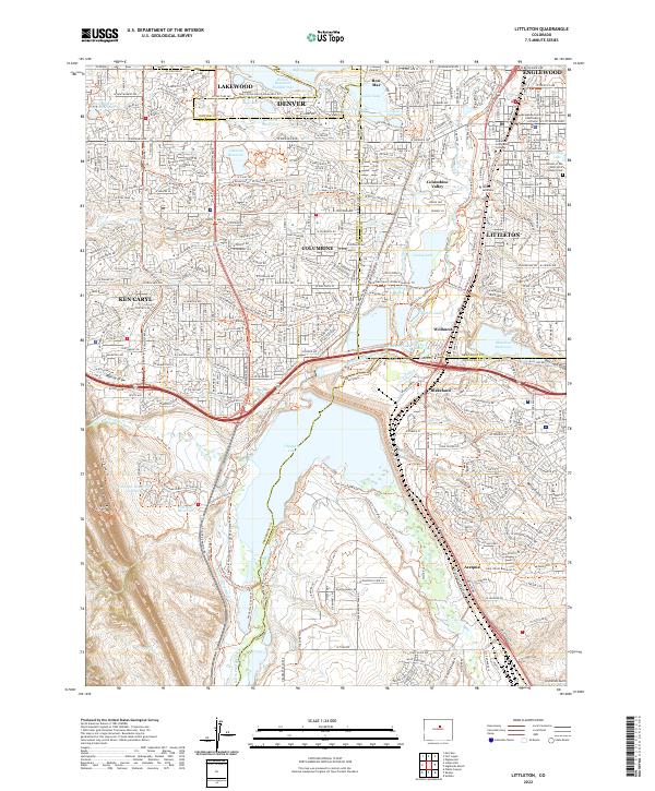 2022 Littleton2022 Print · USGSThe South Platte River valley and the southern Denver suburbs are shown in high detail during a period of significant suburban density. Genealogists and local historians can locate the Littleton Cem, the Arapahoe County Courthouse, and the historic Highline Canal.
 - 2022 Map of Louisville, 2022 Print
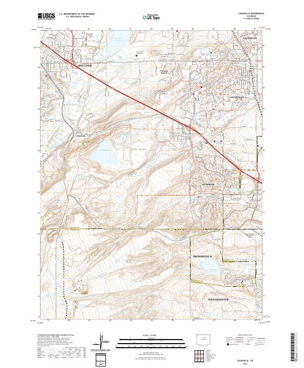 2022 Louisville2022 Print · USGSThe suburbs of Boulder and Louisville meet the industrial Front Range at the start of the 2020s. Researchers can trace the extensive canal networks like the Goodhue Ditch and find local landmarks such as Marshall and the Sacred Heart of Mary Cem.
 - 2022 Map of Fort Logan, 2022 Print
 2022 Fort Logan2022 Print · USGSThe Denver metro area and its southern suburbs are shown here in the early twenty-first century, featuring a landscape defined by historic water ditches and national landmarks. Researchers can trace the layout of Fort Logan National Cem and locate institutions like Colorado Christian University.
 - 2022 Map of Morrison, 2022 Print
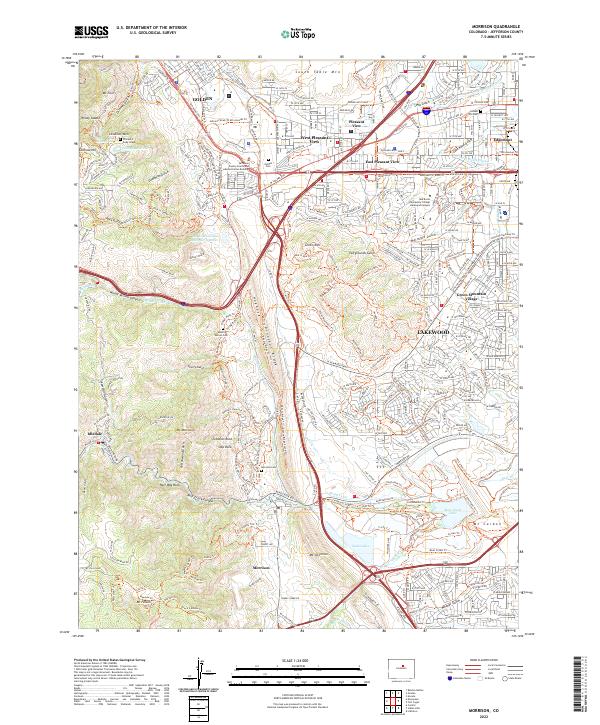 2022 Morrison2022 Print · USGSThe foothills of the Front Range meet the western edge of the Denver metro area in this contemporary survey of the Jefferson County landscape. Genealogists and local historians can locate the William F Cody Grave, Golden Cem, and the old town site of Morrison.
 - 2022 Map of Eldorado Springs, 2022 Print
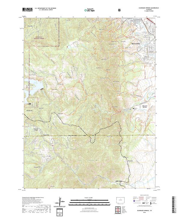 2022 Eldorado Springs2022 Print · USGSThe Front Range foothills in the modern era reveal a landscape where early mountain settlements meet suburban growth. Genealogists and hikers can trace family sites near Eldorado Springs Cemetery or follow the Union Pacific RR past Copperdale and Magnolia.
 - 2022 Map of Cheesman Lake, 2022 Print
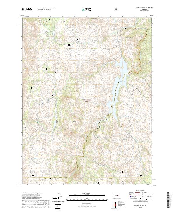 2022 Cheesman Lake2022 Print · USGSThe northern Colorado mountains come into focus in 2022 at the intersection of four counties within the Pike National Forest. Explore the high-country drainages around Cheesman Lake, following the South Platte River past landmarks like Sheeprock and the Gill Trl.
 - 2022 Map of Windy Peak, 2022 Print
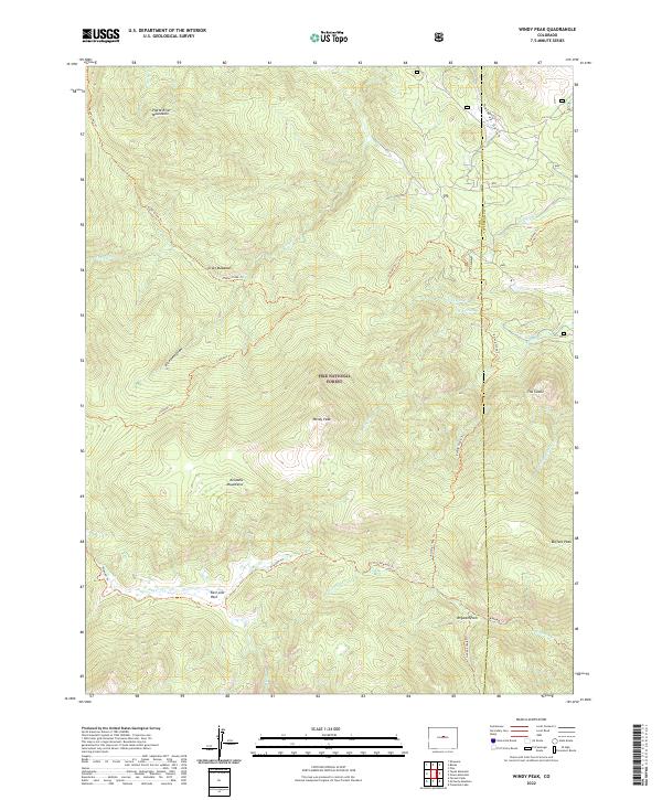 2022 Windy Peak2022 Print · USGSThe high country of the Pike National Forest remains a pristine wilderness of named peaks and mountain meadows in the 2020s. Hikers and historians can trace the paths of the Colorado Trl and Wigwam Trl as they pass Windy Peak and East Lost Park.
 - 2022 Map of Tungsten, 2022 Print
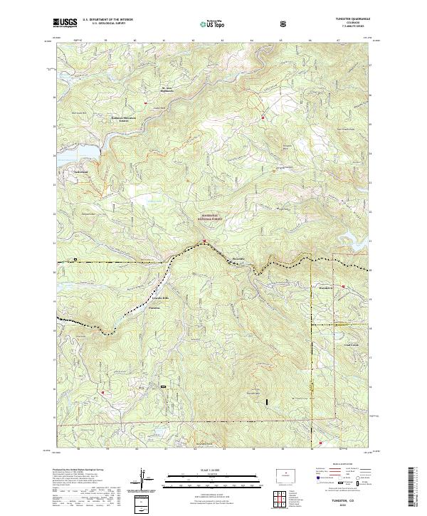 2022 Tungsten2022 Print · USGSThe Front Range high country around Nederland comes alive in this contemporary topographical study. Genealogists and hikers can trace property lines and access routes near Pinecliffe, Wondervu, and the historic recreational area of Lincoln Hills.
 - 2022 Map of Lafayette, 2022 Print
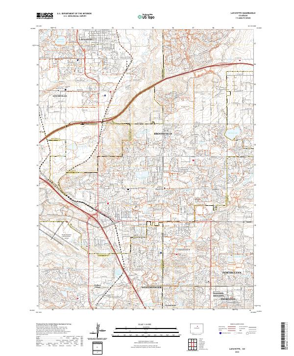 2022 Lafayette2022 Print · USGSModern suburban development meets early water management in the 2020s north of Denver. Researchers can trace the layout of Wallace Village and find local landmarks like Louisville Cem and the Broomfield County Courthouse.
 - 2022 Map of Golden, 2022 Print
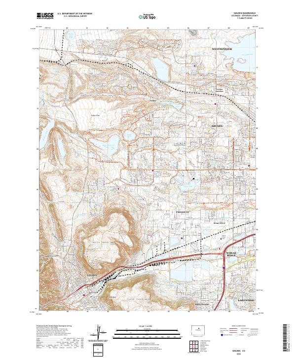 2022 Golden2022 Print · USGSThe Front Range communities of Golden and Arvada are captured here in the early twenty-first century. Genealogists and researchers can trace local burials at Mount Olivet Cem or locate the historic Colorado School of Mines.
 - 2022 Map of Arvada, 2022 Print
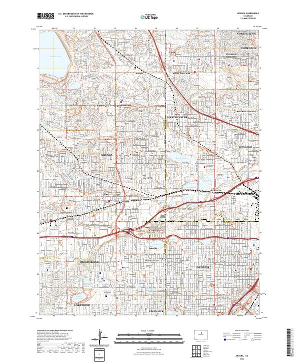 2022 Arvada2022 Print · USGSThe northern Denver suburbs and the Arvada corridor are shown in high detail during their modern expansion. Researchers can trace historic irrigation routes like the Croke Canal or locate local landmarks including Regis University and the Olinger Crown Hill Mortuary and Cem.
 - 2023 Map of Kassler, 2023 Print
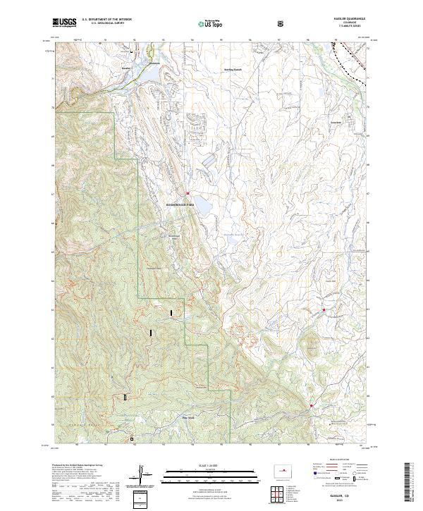 2023 Kassler2023 Print · USGSDouglas County's transition from river canyon to residential foothills is captured here in the early 2020s. Researchers can trace historic water routes like the High Line Canal or locate the Lehow Cem and Brotherhood of the White Temple School.
Showing maps 1-25 of 26
Top cities of Jefferson County
- Lakewood historical maps
- Arvada historical maps
- Wheat Ridge historical maps
- Golden historical maps
- Evergreen historical maps
- Edgewater historical maps
See more
Frequently asked questions
- What are the different types of historical maps available for Jefferson County?
- What is the oldest map of Jefferson County?
- Where can I purchase historical maps of Jefferson County for my home or office?
- Where can I download high-res historical maps of Jefferson County?
- Are there historical topographic maps available for Jefferson County?
- Is there historical aerial imagery available for Jefferson County?
- Where are historical maps of Jefferson County sourced from?