Old Maps of Burlington, Colorado
Explore 16 old maps of Burlington, spanning from 1954 to today. These high-resolution historic maps reveal how streets, neighborhoods, landmarks, and natural features evolved over time — perfect for genealogy, metal detecting, research, and local history exploration.
What you can do with these maps:
- See how Burlington changed over time: Compare historical maps to modern-day views to trace roads, homesites, rail lines & more.
- View detailed metadata: Each map includes creators, publishers, year, scale, and archive source.
- Overlay maps with satellite & LiDAR: Visualize the past alongside modern tools to explore terrain & human change.
- Trusted historical sources: Maps sourced from the USGS, Library of Congress, and other archives.
- Access maps your way: View online, download high-res files, or order prints for personal or research use.
Start exploring old maps of Burlington to uncover forgotten places, hidden landmarks, and the deep history beneath your feet.
Burlington, CO maps
(16)- 1954 Map of Limon
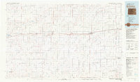
 1954 Limon1954 Print · USGSThe Eastern Colorado plains and the Kansas borderlands come alive in the mid-fifties, showing the vital rail-and-road corridor through Limon. Genealogists and historians can trace the Chicago Rock Island & Pacific line through Burlington and find remote outposts like Arickaree and Anton.4 unique versions available
 - 1957 Map of Limon
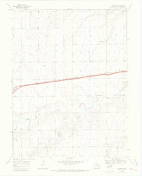
 1957 Limon1957 Print · USGSThe High Plains of Eastern Colorado and Western Kansas come alive in the mid-1950s, showing the vital rail-and-road connections of the era. You can trace the path of the Chicago Rock Island and Pacific through towns like Limon, Stratton, and Burlington or find the early footprint of Bonny Reservoir.
 - 1958 Map of Limon
 1958 Limon1958 Print · USGSEastern Colorado and the Kansas border meet in this late-fifties study of High Plains rail and river systems. Researchers can trace the path of the Chicago Rock Island and Pacific through Limon and Burlington, or locate the Bonny Dam and Bonny Reservoir.
 - 1969 Map of Burlington, 1972 Print
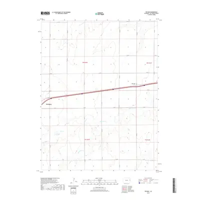
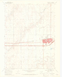 1969 Burlington1972 Print · USGSEastern Colorado during the late sixties shows the agricultural and transit importance of this plains hub. Trace the development of Burlington along the Chicago Rock Island and Pacific railroad, finding landmarks like the Rodeo Ground and Fairview Cem.3 unique versions available
 - 1969 Map of Peconic, 1972 Print
 1969 Peconic1972 Print · USGSEastern Colorado ranching and rail infrastructure are captured here in the late sixties as the high plains economy hummed along. Researchers can trace the path of the Chicago Rock Island and Pacific and locate the small settlement of Peconic.3 unique versions available
 - 1981 Map of Burlington
 1981 Burlington1981 Print · USGSEastern Colorado and the Kansas borderland come into focus during the early 1980s, centered on the rail corridor and farming hubs. Researchers can trace the Chicago Rock Island and Pacific route through Burlington, Stratton, and Vona, or locate Mount Sunflower near the state line.
 - 2010 Map of Peconic, 2010 Print
 2010 Peconic2010 Print · USGSCovers Burlington, including Peconic, Kit Carson County, and other nearby areas
 - 2010 Map of Burlington, 2010 Print
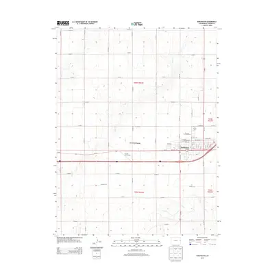
 2010 Burlington2010 Print · USGSCovers Burlington, including West Burlington, Kit Carson County, and other nearby areas
 - 2013 Map of Burlington, 2013 Print
 2013 Burlington2013 Print · USGSCovers Burlington, including West Burlington, Kit Carson County, and other nearby areas
 - 2013 Map of Peconic, 2013 Print
 2013 Peconic2013 Print · USGSCovers Burlington, including Peconic, Kit Carson County, and other nearby areas
 - 2016 Map of Peconic, 2016 Print
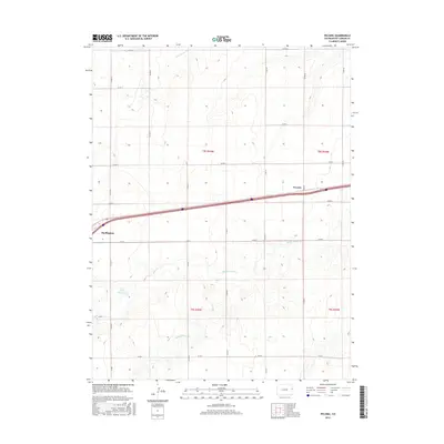 2016 Peconic2016 Print · USGSCovers Burlington, including Peconic, Kit Carson County, and other nearby areas
 - 2016 Map of Burlington, 2016 Print
 2016 Burlington2016 Print · USGSCovers Burlington, including West Burlington, Kit Carson County, and other nearby areas
 - 2019 Map of Peconic, 2019 Print
 2019 Peconic2019 Print · USGSCovers Burlington, including Peconic, Kit Carson County, and other nearby areas
 - 2019 Map of Burlington, 2019 Print
 2019 Burlington2019 Print · USGSCovers Burlington, including West Burlington, Kit Carson County, and other nearby areas
 - 2022 Map of Burlington, 2022 Print
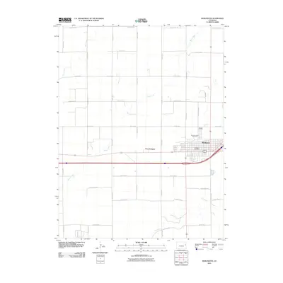
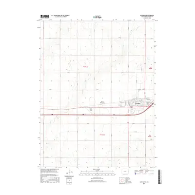
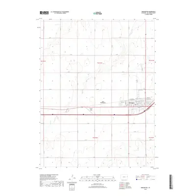
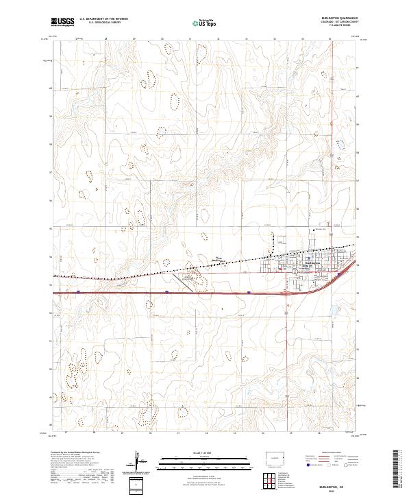 2022 Burlington2022 Print · USGSBurlington thrives as a high plains agricultural hub in the early twenty-first century. Genealogists and historians can locate the Kit Carson County Courthouse, Fairview Cem, and Morgan Community College Burlington Center.
 - 2022 Map of Peconic, 2022 Print
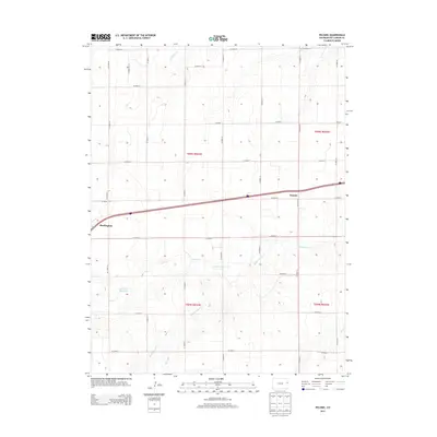
 2022 Peconic2022 Print · USGSThe High Plains of Kit Carson County come into focus during this recent survey of the prairie landscape. Genealogists and local historians can trace family-named landmarks like C H Parks Reservoir and the drainage of Middle Beaver Cr near Peconic.
End of results
Showing maps 1-16 of 16
Top cities near Burlington
Frequently asked questions
- What are the different types of historical maps available for Burlington?
- What is the oldest map of Burlington?
- Where can I purchase historical maps of Burlington for my home or office?
- Where can I download high-res historical maps of Burlington?
- Are there historical topographic maps available for Burlington?
- Is there historical aerial imagery available for Burlington?
- Where are historical maps of Burlington sourced from?