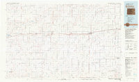
1981 Map of Burlington
USGS Topo · Published 1981About this map
Burlington and its neighboring High Plains communities are defined by the linear progress of the Chicago Rock Island and Pacific railroad, which strings together the grain-handling towns of Bethune, Stratton, and Vona across eastern Kit Carson County. This early 1980s landscape illustrates a high-plains economy organized around rail transport and sparse water resources, such as the South Fork Republican River and Landsman Creek. To the east, the state line is marked by Kanorado, while further south, the terrain rises toward Mount Sunflower on the Kansas border. The map also records civil infrastructure like the Municipal Airport and the State Rec Area at Flagler Reservoir, showing how water management and aviation supported these agricultural hubs. The presence of the namesake Settlement and Tuttle reflects the late-century rural footprint of this Colorado-Kansas borderland.
Find a feature on this map
34 named features on this map. Tap any name to fly to it.
Don’t see what you’re looking for? This feature index may not catch every label — zoom into the map to look around manually.
Map Details
Editions of this 1981 Burlington Map
This is the sole edition of this map. No revisions or reprints were ever made.
Other maps of this area

1891 · Arroyo
USGS Topo · 1:125,000

1891 · Kit Carson
USGS Topo · 1:125,000

1892 · Cheyenne Wells
USGS Topo · 1:125,000

1893 · Arroyo
USGS Topo · 1:125,000

1893 · Kit Carson
USGS Topo · 1:125,000

1894 · Cheyenne Wells
USGS Topo · 1:125,000

1950 · Bonny Reservoir
USGS Topo · 1:62,500

1952 · St Francis 3
USGS Topo · 1:62,500

1954 · Limon
USGS Topo · 1:250,000

1954 · Lamar
USGS Topo · 1:250,000