
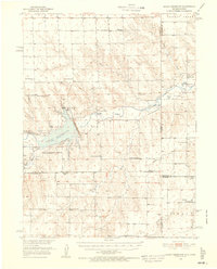
1950 Map of Bonny Reservoir
USGS Topo · Published 1952About this map
Bonny Reservoir and the Bonny Dam dominate this landscape on the Colorado-Kansas border just as the reservoir was reaching its operational capacity. Built as part of a larger effort by the Bureau of Reclamation to control the Missouri River Basin, the project flooded the valley of the South Fork Republican River. The map captures the agricultural infrastructure of the era, recording numerous family holdings such as the Moellenberg Ranch, Foster Ranch, and O'Brien Ranch. Small rural communities and school districts define the social geography, with sites like Hale, the Armel High Sch, and the Gospel Hall Ch serving as focal points for the high plains population. A State Game Refuge and the Bonny Reservation Boundary highlight the shift toward conservation and recreation alongside the region's traditional ranching economy.
Find a feature on this map
40 named features on this map. Tap any name to fly to it.
Don’t see what you’re looking for? This feature index may not catch every label — zoom into the map to look around manually.
Map Details
Editions of this 1950 Bonny Reservoir Map
3 editions found
Other maps of this area

1942 · St. Francis
USGS Topo · 1:62,500

1943 · St. Francis
USGS Topo · 1:62,500

1951 · St Francis
USGS Topo · 1:62,500

1952 · St Francis 3
USGS Topo · 1:62,500

1954 · Limon
USGS Topo · 1:250,000

1954 · Goodland
USGS Topo · 1:250,000

1956 · Goodland
USGS Topo · 1:250,000

1957 · Limon
USGS Topo · 1:250,000

1957 · Goodland
USGS Topo · 1:250,000

1958 · Limon
USGS Topo · 1:250,000