Old Maps of La Plata, Colorado for Hiking & Exploration
Hike through history with 16 historic maps of La Plata. Explore old trails, ghost towns, and forgotten backroads — perfect for outdoor adventurers and local explorers.
- Rediscover forgotten places: Map out old mining camps, roads, and footpaths that no longer exist on modern maps.
- Layer with modern tools: Combine with LiDAR or satellite views to plan hikes through historical terrain.
- Made for exploration: Popular among hikers, overlanders, and local history lovers.
Use these maps to find adventure and explore the hidden past of La Plata.
La Plata, CO maps
(16)- 1895 Map of La Plata, 1966 Print
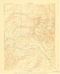
 1895 La Plata1966 Print · USGSThe high peaks and mining basins of Southwest Colorado are captured here in the 1890s, when ore mills and mountain rail lines defined the economy. Trace the route of the Rio Grande Southern R. R. past the Columbus Mine and the remote settlement of Mayday.
 - 1897 Map of La Plata
 1897 La Plata1897 Print · USGSThe high peaks and mining camps of Southwest Colorado are captured here in the late nineteenth century. Genealogists and historians can trace early ranching at Menefee Ranch or locate rail stops along the Rio Grande Southern R. R. like Hesperus and Cima.
 - 1899 Map of La Plata
 1899 La Plata1899 Print · USGSThe high peaks of southwestern Colorado were a hive of industrial activity in the 1890s as railroads and mines pushed into the mountains. Researchers can trace the winding Rio Grande Southern R. R. and locate historic sites like Menefee Ranch, the Ute Coal Mine, and Parrott.
 - 1908 Map of La Plata
 1908 La Plata1908 Print · USGSThe Rio Grande Southern Railroad and high-altitude mining operations define this mountain landscape at the turn of the century. Genealogists and industrial historians can trace the paths to the Columbus Mine, Hesperus, and the Menefee Ranch.3 unique versions available
 - 1956 Map of Cortez, 1972 Print
 1956 Cortez1972 Print · USGSThe Four Corners region comes alive in this mid-century study of the high plateaus and deep canyons surrounding Cortez. Trace the development of desert outposts like Towaoc or follow the historic Laramie Trail across a landscape dotted with ancient sites at Mesa Verde National Park.2 unique versions available
 - 1958 Map of Cortez
 1958 Cortez1958 Print · USGSThe Four Corners region comes alive in the late fifties, showing the interplay between expanding mountain settlements and ancient archeological sites. Trace the layout of Cortez, Monticello, and Blanding alongside landmarks like Mesa Verde National Park and Fort Lewis A&M College.
 - 1959 Map of Cortez
 1959 Cortez1959 Print · USGSThe Four Corners region in the late fifties was a landscape of ancestral sites and isolated ranching outposts. Genealogists and historians can trace the early footprints of Cortez, Towaoc, and Mexican Hat alongside the canyons of the San Juan River.2 unique versions available
 - 1962 Map of Cortez
 1962 Cortez1962 Print · USGSThe Four Corners region comes alive in the early sixties, showing a landscape defined by reservation lands and federal forests. Trace the route of the Rio Grande Southern RR or locate the Uranium and vanadium mines near Monticello.
 - 1963 Map of La Plata, 1965 Print
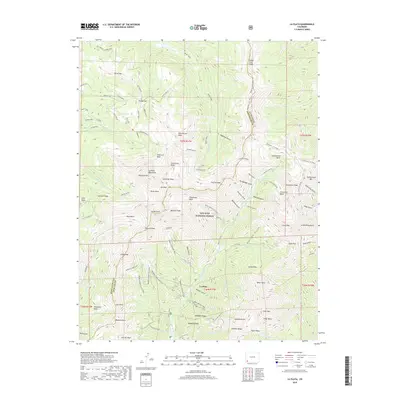
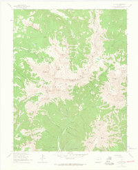 1963 La Plata1965 Print · USGSThe high peaks of the San Juan Mountains are documented here in the early 1960s, showing a landscape defined by mining exploration and national forest management. Researchers can trace historic operations like the Gold King Mill, Tomahawk Mine, and Columbus Mine.5 unique versions available
 - 1966 Map of Cortez
 1966 Cortez1966 Print · USGSThe Four Corners region in the mid-sixties reveals a landscape of high mesas, tribal lands, and archaeological preserves. Researchers can trace the ancient sites at Hovenweep National Monument, follow the Denver & Rio Grande Western Railroad, or locate old settlements like Ginger Hill and Yellow Jacket.
 - 1982 Map of Cortez, 1992 Print
 1982 Cortez1992 Print · USGSMontezuma County at the start of the eighties shows a landscape defined by federal and tribal lands, from the archaeological sites of Mesa Verde National Park to the Ute Mountain Indian Reservation. Trace local history through small settlements like Lebanon and Marvel or follow the path of an Old Railroad Grade.
 - 2011 Map of La Plata, 2011 Print
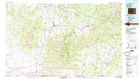
 2011 La Plata2011 Print · USGSCovers La Plata, including La Plata County, Montezuma County, and other nearby areas
 - 2013 Map of La Plata, 2013 Print
 2013 La Plata2013 Print · USGSCovers La Plata, including La Plata County, Montezuma County, and other nearby areas
 - 2016 Map of La Plata, 2016 Print
 2016 La Plata2016 Print · USGSCovers La Plata, including La Plata County, Montezuma County, and other nearby areas
 - 2019 Map of La Plata, 2019 Print
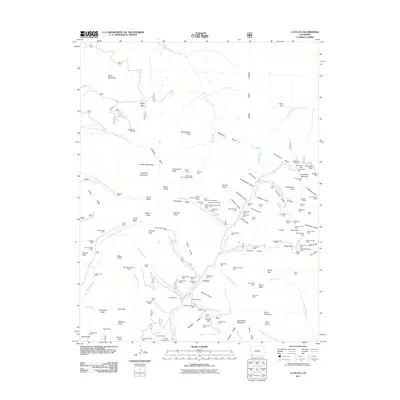
 2019 La Plata2019 Print · USGSCovers La Plata, including La Plata County, Montezuma County, and other nearby areas
 - 2022 Map of La Plata, 2022 Print
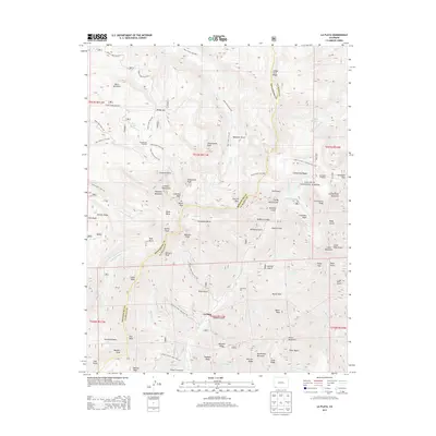
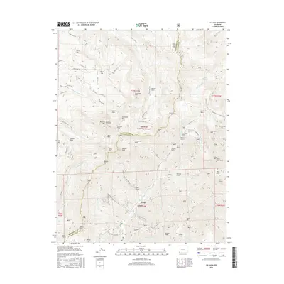
 2022 La Plata2022 Print · USGSThe high peaks of the San Juan Mountains are documented here in the early twenty-first century, showing the crossroads of Montezuma and La Plata counties. Trace the mountain geography around La Plata and search for landmarks like Hesperus Mtn and Twin Lakes.
End of results
Showing maps 1-16 of 16
Top cities near La Plata
Frequently asked questions
- What are the different types of historical maps available for La Plata?
- What is the oldest map of La Plata?
- Where can I purchase historical maps of La Plata for my home or office?
- Where can I download high-res historical maps of La Plata?
- Are there historical topographic maps available for La Plata?
- Is there historical aerial imagery available for La Plata?
- Where are historical maps of La Plata sourced from?