Old Maps of Sterling, Colorado for Hiking & Exploration
Hike through history with 15 historic maps of Sterling. Explore old trails, ghost towns, and forgotten backroads — perfect for outdoor adventurers and local explorers.
- Rediscover forgotten places: Map out old mining camps, roads, and footpaths that no longer exist on modern maps.
- Layer with modern tools: Combine with LiDAR or satellite views to plan hikes through historical terrain.
- Made for exploration: Popular among hikers, overlanders, and local history lovers.
Use these maps to find adventure and explore the hidden past of Sterling.
Sterling, CO maps
(15)- 1951 Map of Sterling South, 1952 Print
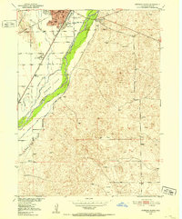 1951 Sterling South1952 Print · USGSThe South Platte River valley and the city of Sterling are shown here in the early fifties, at the height of the sugar beet era. Genealogists and researchers can trace the rail corridors of the Union Pacific and identify landmarks like Riverside Cemetery, Columbine Sch, and the Sugar Factory.4 unique versions available
 - 1951 Map of Sterling North, 1952 Print
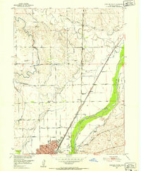 1951 Sterling North1952 Print · USGSLogan County in the early fifties shows a thriving agricultural hub centered on the South Platte River. Genealogists and local historians can trace rural school districts like Springdale Valley School and the early campus of Sterling Junior College.4 unique versions available
 - 1954 Map of Sterling
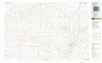
 1954 Sterling1954 Print · USGSNortheastern Colorado and the Nebraska borderlands are defined by the river-and-rail corridors of the mid-twentieth century. Researchers can trace the development of agricultural hubs from Sterling and Fort Morgan to smaller rail stops along the Union Pacific and Burlington Northern lines.3 unique versions available
 - 1958 Map of Sterling
 1958 Sterling1958 Print · USGSNortheastern Colorado thrived along the river and rail corridors during the late fifties. Genealogists and historians can trace family-named irrigation works like Davis Brothers Ditch and agricultural hubs from Peetz to Fort Morgan.
 - 1983 Map of Sterling
 1983 Sterling1983 Print · USGSThe Colorado high plains and the South Platte River valley come into focus in the early 1980s, centered on the hub of Sterling. Researchers can trace old transport routes like the Old Railroad Grade or locate remote outposts like Avalo and Westplains.
 - 2010 Map of Sterling South, 2010 Print
 2010 Sterling South2010 Print · USGSCovers Sterling, including Twin Mills, Logan County, and other nearby areas
 - 2010 Map of Sterling North, 2010 Print
 2010 Sterling North2010 Print · USGSCovers Sterling, including Logan County, United States, and other nearby areas
 - 2013 Map of Sterling South, 2013 Print
 2013 Sterling South2013 Print · USGSCovers Sterling, including Twin Mills, Logan County, and other nearby areas
 - 2013 Map of Sterling North, 2013 Print
 2013 Sterling North2013 Print · USGSCovers Sterling, including Logan County, United States, and other nearby areas
 - 2016 Map of Sterling South, 2016 Print
 2016 Sterling South2016 Print · USGSCovers Sterling, including Twin Mills, Logan County, and other nearby areas
 - 2016 Map of Sterling North, 2016 Print
 2016 Sterling North2016 Print · USGSCovers Sterling, including Logan County, United States, and other nearby areas
 - 2019 Map of Sterling South, 2019 Print
 2019 Sterling South2019 Print · USGSCovers Sterling, including Twin Mills, Logan County, and other nearby areas
 - 2019 Map of Sterling North, 2019 Print
 2019 Sterling North2019 Print · USGSCovers Sterling, including Logan County, United States, and other nearby areas
 - 2022 Map of Sterling North, 2022 Print
 2022 Sterling North2022 Print · USGSThe northern edge of Sterling and the South Platte River valley are captured in this recent survey of Logan County. Researchers can trace land use around Northeastern Junior College or locate family plots near the Sunset Memorial Gardens Cem.
 - 2022 Map of Sterling South, 2022 Print
 2022 Sterling South2022 Print · USGSThe South Platte River valley and the city of Sterling are captured in this contemporary survey, showing a landscape defined by irrigation and early transport routes. Researchers can trace the layout of the city near the Logan County Courthouse or locate rural landmarks like Riverside Cem and Twin Mills.
End of results
Showing maps 1-15 of 15
Top cities near Sterling
Frequently asked questions
- What are the different types of historical maps available for Sterling?
- What is the oldest map of Sterling?
- Where can I purchase historical maps of Sterling for my home or office?
- Where can I download high-res historical maps of Sterling?
- Are there historical topographic maps available for Sterling?
- Is there historical aerial imagery available for Sterling?
- Where are historical maps of Sterling sourced from?