2020s Maps of Collbran, Colorado
Explore 2 historic maps of Collbran from the 2020s. These maps offer a rare glimpse into what life looked like during the 2020s — showing old roads, neighborhoods, homes, and landmarks that have changed or disappeared over time.
Whether you're researching your family's past, planning a metal detecting trip, or studying how Collbran's landscape evolved across the 2020s, these high-resolution maps are a powerful tool for exploring the history of this region.
- Focus on a specific era: All maps on this page are from the 2020s, giving you a focused view of this time period.
- See what’s changed: Compare century-old streets, trails, and buildings to today's modern landscape using overlays and satellite layers.
- Research with precision: Use these maps for genealogy, historical research, land use analysis, or educational projects.
- View, download, or print: Maps are fully viewable online in high resolution, and can be downloaded or printed for your own records.
Start exploring Collbran's history through authentic maps from the 2020s. This is your window into the past.
Collbran, CO maps
(2)- 2022 Map of Collbran, 2022 Print
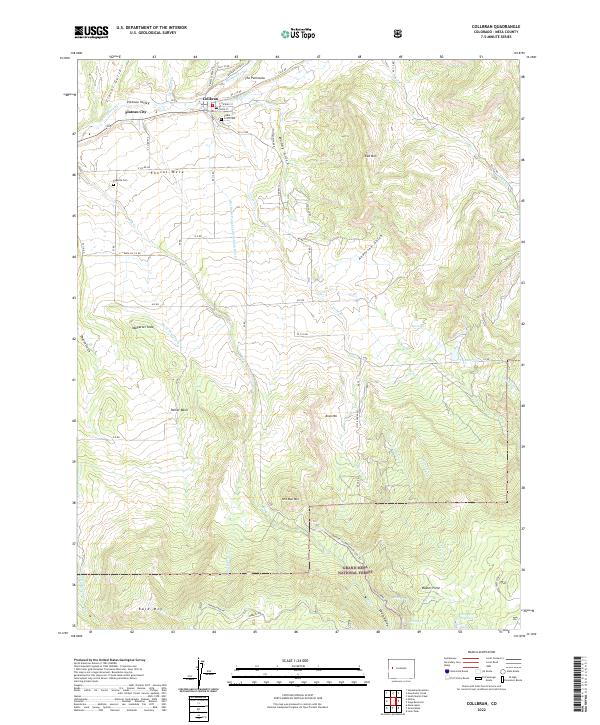 2022 Collbran2022 Print · USGSSettlement in the Plateau Creek valley comes into focus in this contemporary survey of northern Mesa County. Genealogists and local historians can trace family sites from Collbran to Plateau City, including the Cedar Crest Cem and Eagalite Cem.
 - 2022 Map of Hawxhurst Creek, 2022 Print
 2022 Hawxhurst Creek2022 Print · USGSThe Colorado mountain valleys north of Collbran come into focus in the early 2020s, showing the intersection of national forest boundaries and high-country water systems. Genealogists and hikers can trace the Clover Cem or follow the historical Battlement Tri past McCurry Reservoir.
End of results
Showing maps 1-2 of 2
Top cities near Collbran
Frequently asked questions
- What are the different types of historical maps available for Collbran?
- What is the oldest map of Collbran?
- Where can I purchase historical maps of Collbran for my home or office?
- Where can I download high-res historical maps of Collbran?
- Are there historical topographic maps available for Collbran?
- Is there historical aerial imagery available for Collbran?
- Where are historical maps of Collbran sourced from?