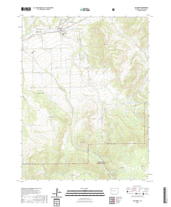
2022 Map of Collbran
USGS Topo · Published 2022About this map
Collbran serves as the hub of this high-elevation landscape, situated at the junction of Plateau Cr, Kimball Cr, and Buzzard Cr. The town's grid is defined by Spring St and High St, with the Cedar Crest Cem overlooking the valley from a nearby rise. To the west, the smaller settlement of Plateau City marks the entrance to the broader canyon system. The mapping reveals a complex network of water management essential to the region's ranching history, including the Berthold-Updyke and Landon Ditch and the Silver Gage Ditch.
Find a feature on this map
58 named features on this map. Tap any name to fly to it.
Don’t see what you’re looking for? This feature index may not catch every label — zoom into the map to look around manually.
Map Details
Editions of this 2022 Collbran Map
This is the sole edition of this map. No revisions or reprints were ever made.
Other maps of this area

1929 · Grand Valley
USGS Topo · 1:62,500

1955 · Collbran
USGS Topo · 1:24,000

1955 · Grand Mesa
USGS Topo · 1:24,000

1955 · Molina
USGS Topo · 1:24,000

1955 · Skyway
USGS Topo · 1:24,000

1955 · The Meadows
USGS Topo · 1:24,000

1956 · Grand Junction
USGS Topo · 1:250,000

1957 · Leadville
USGS Topo · 1:250,000

1959 · Grand Junction
USGS Topo · 1:250,000

1959 · Leadville
USGS Topo · 1:250,000