2020s Maps of Ridgway, Colorado
Explore 2 historic maps of Ridgway from the 2020s. These maps offer a rare glimpse into what life looked like during the 2020s — showing old roads, neighborhoods, homes, and landmarks that have changed or disappeared over time.
Whether you're researching your family's past, planning a metal detecting trip, or studying how Ridgway's landscape evolved across the 2020s, these high-resolution maps are a powerful tool for exploring the history of this region.
- Focus on a specific era: All maps on this page are from the 2020s, giving you a focused view of this time period.
- See what’s changed: Compare century-old streets, trails, and buildings to today's modern landscape using overlays and satellite layers.
- Research with precision: Use these maps for genealogy, historical research, land use analysis, or educational projects.
- View, download, or print: Maps are fully viewable online in high resolution, and can be downloaded or printed for your own records.
Start exploring Ridgway's history through authentic maps from the 2020s. This is your window into the past.
Ridgway, CO maps
(2)- 2022 Map of Ridgway, 2022 Print
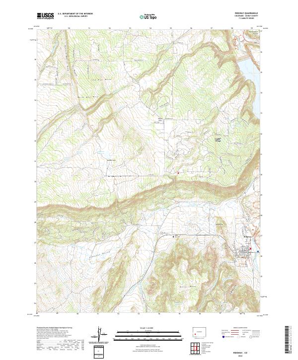 2022 Ridgway2022 Print · USGSRidgway and the mesas of the Uncompahgre valley are captured here in the early twenty-first century. Genealogists and hikers can trace the Dallas Park Cem, the Blue Stem mine, and landmarks like Elephant Reservoir or the Knife Edge.
 - 2022 Map of Dallas, 2022 Print
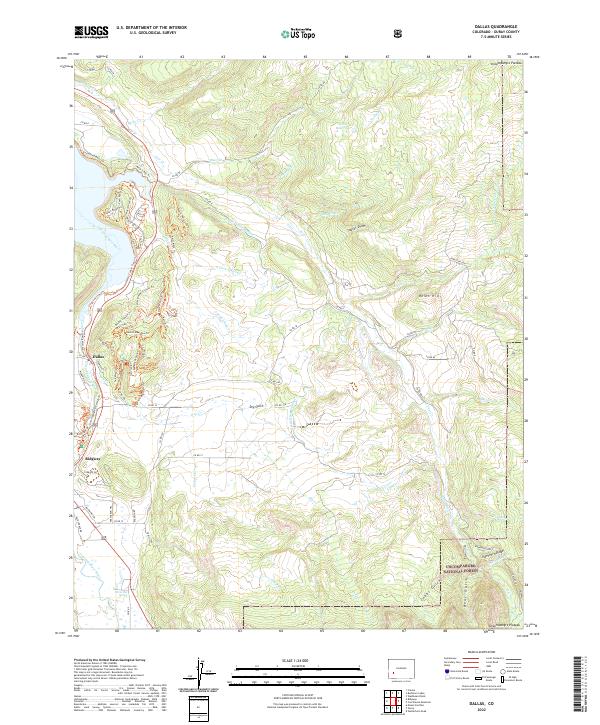 2022 Dallas2022 Print · USGSThe Uncompahgre River valley and the town of Ridgway are documented here in the early twenty-first century, showing a mix of agricultural heritage and modern mountain recreation. You can trace local landmarks like Orvis Hot Spring, the site of Dallas, and the complex irrigation network of Sneva Ditch.
End of results
Showing maps 1-2 of 2
Top cities near Ridgway
Frequently asked questions
- What are the different types of historical maps available for Ridgway?
- What is the oldest map of Ridgway?
- Where can I purchase historical maps of Ridgway for my home or office?
- Where can I download high-res historical maps of Ridgway?
- Are there historical topographic maps available for Ridgway?
- Is there historical aerial imagery available for Ridgway?
- Where are historical maps of Ridgway sourced from?