1950s Maps of Bruno Gulch Campground, Colorado
Explore 7 historic maps of Bruno Gulch Campground from the 1950s. These maps offer a rare glimpse into what life looked like during the 1950s — showing old roads, neighborhoods, homes, and landmarks that have changed or disappeared over time.
Whether you're researching your family's past, planning a metal detecting trip, or studying how Bruno Gulch Campground's landscape evolved across the 1950s, these high-resolution maps are a powerful tool for exploring the history of this region.
- Focus on a specific era: All maps on this page are from the 1950s, giving you a focused view of this time period.
- See what’s changed: Compare century-old streets, trails, and buildings to today's modern landscape using overlays and satellite layers.
- Research with precision: Use these maps for genealogy, historical research, land use analysis, or educational projects.
- View, download, or print: Maps are fully viewable online in high resolution, and can be downloaded or printed for your own records.
Start exploring Bruno Gulch Campground's history through authentic maps from the 1950s. This is your window into the past.
Bruno Gulch Campground, CO maps
(7)- 1953 Map of Denver, 1964 Print
 1953 Denver1964 Print · USGSDenver and the Colorado Front Range are captured here during a decade of post-war growth and military expansion. Researchers can trace the sprawling rail lines of the Union Pacific, locate the State Capitol, and explore historic mountain mining hubs like Central City.6 unique versions available
 - 1957 Map of Denver
 1957 Denver1957 Print · USGSDenver and the Colorado Front Range are seen here during a mid-century period of intense military and urban expansion. Trace the footprints of the Rocky Mountain Arsenal, the early United States Air Force Academy, and the Lowry AF Base.
 - 1957 Map of Mount Evans, 1959 Print
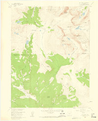 1957 Mount Evans1959 Print · USGSThe Front Range high peaks are captured here in the late fifties, showing the divide between the Arapaho and Pike National Forests. Researchers can trace historic access routes like Guanella Pass and the Pack Trail, or locate the Shelter Cabin near Summit Lake.5 unique versions available
 - 1957 Map of Georgetown, 1960 Print
 1957 Georgetown1960 Print · USGSGeorgetown and the high peaks of the Front Range are captured here during a period of transition between its mining peak and modern recreation. Researchers can trace the heritage of the silver boom through Silver Plume, the Lamartine Tunnel, and the Old RR Grade.5 unique versions available
 - 1958 Map of Denver
 1958 Denver1958 Print · USGSDenver and the Colorado Front Range are captured here during the mid-century suburban boom. Trace the footprints of military installations like Buckley Air Force Base alongside the established rail networks of the Colorado & Southern Ry.
 - 1958 Map of Montezuma, 1960 Print
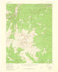
 1958 Montezuma1960 Print · USGSMontezuma and the surrounding high-country mining districts are captured here during the late fifties, just as post-war exploration revitalized these peaks. Researchers can locate dozens of named lode workings like the Pennsylvania Mine and Whale Mine, or trace routes over Webster Pass.5 unique versions available
 - 1958 Map of Montezuma, 1961 Print
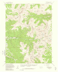 1958 Montezuma1961 Print · USGSThe Colorado high country in the late fifties was a landscape of shifting industry, where old silver mines met emerging ski resorts. Researchers can trace historic claims like the Saints John Mine and explore high passes from Loveland Pass to Argentine Pass.5 unique versions available
End of results
Showing maps 1-7 of 7
Top cities near Bruno Gulch Campground
- Idaho Springs historical maps
- Georgetown historical maps
- Silver Plume historical maps
- Montezuma historical maps
- Saints John historical maps
- Wild Irishman historical maps
Frequently asked questions
- What are the different types of historical maps available for Bruno Gulch Campground?
- What is the oldest map of Bruno Gulch Campground?
- Where can I purchase historical maps of Bruno Gulch Campground for my home or office?
- Where can I download high-res historical maps of Bruno Gulch Campground?
- Are there historical topographic maps available for Bruno Gulch Campground?
- Is there historical aerial imagery available for Bruno Gulch Campground?
- Where are historical maps of Bruno Gulch Campground sourced from?