1980s Maps of Estabrook, Colorado
Explore 2 historic maps of Estabrook from the 1980s. These maps offer a rare glimpse into what life looked like during the 1980s — showing old roads, neighborhoods, homes, and landmarks that have changed or disappeared over time.
Whether you're researching your family's past, planning a metal detecting trip, or studying how Estabrook's landscape evolved across the 1980s, these high-resolution maps are a powerful tool for exploring the history of this region.
- Focus on a specific era: All maps on this page are from the 1980s, giving you a focused view of this time period.
- See what’s changed: Compare century-old streets, trails, and buildings to today's modern landscape using overlays and satellite layers.
- Research with precision: Use these maps for genealogy, historical research, land use analysis, or educational projects.
- View, download, or print: Maps are fully viewable online in high resolution, and can be downloaded or printed for your own records.
Start exploring Estabrook's history through authentic maps from the 1980s. This is your window into the past.
Estabrook, CO maps
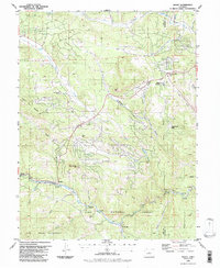
(2)- 1983 Map of Bailey
 1983 Bailey1983 Print · USGSPark County and the high Front Range are captured here during the early 1980s as traditional mountain settlements met new development patterns. Genealogists and researchers can trace the Denver and Rio Grande Western Railroad and old mountain hamlets like Bailey, Webster, and Garo.2 unique versions available
 - 1987 Map of Bailey
 1987 Bailey1987 Print · USGSPark and Jefferson County mountain life in the late 1980s is centered on the river canyons and timbered slopes. Trace the historic route along the North Fork South Platte River to find Bailey, the old resort at Glenisle, and local landmarks like the Observatory.2 unique versions available
End of results
Showing maps 1-2 of 2
Top cities near Estabrook
Frequently asked questions
- What are the different types of historical maps available for Estabrook?
- What is the oldest map of Estabrook?
- Where can I purchase historical maps of Estabrook for my home or office?
- Where can I download high-res historical maps of Estabrook?
- Are there historical topographic maps available for Estabrook?
- Is there historical aerial imagery available for Estabrook?
- Where are historical maps of Estabrook sourced from?