Old Maps of Glenisle, Colorado for Genealogy
Trace your family roots with 15 historic maps of Glenisle. These high-res maps reveal old neighborhoods, homesites, landmarks, and streets — helping you uncover where your ancestors lived and how the area evolved over time.
- Explore historic neighborhoods: Identify where your relatives may have lived in the 1800s or 1900s.
- Compare maps over time: Trace the changes in streets, buildings, and landmarks for multi-generational research.
- Perfect for genealogy & ancestry research: Used by family historians and researchers to map out lineage and migration.
These maps are an incredible resource for exploring your personal connection to Glenisle's past.
Glenisle, CO maps
(15)- 1893 Map of Platte Canyon
 1893 Platte Canyon1893 Print · USGSThe Front Range highlands come to life in the 1890s as the narrow-gauge Denver South Park and Pacific RR snakes through the mountains. Trace early mountain settlements like Pine Grove and Estabrook along the steep turns of South Platte Canyon.8 unique versions available
 - 1945 Map of Bailey, 1956 Print
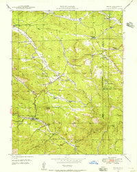 1945 Bailey1956 Print · USGSThe North Fork South Platte River valley comes alive in the mid-1940s, showing a landscape of family ranches and early mountain retreats. Researchers can trace the lineage of the canyon through Bailey, Horn Cem, and historic schools like Dry Creek Sch.5 unique versions available
 - 1949 Map of Bailey
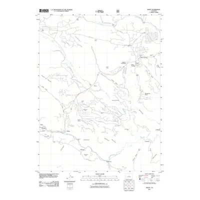
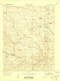 1949 Bailey1949 Print · USGSPark County mountain life in the late 1940s centers on the river valley settlements and family ranchlands. Genealogists and historians can trace lineage through landmarks like Potter Ranch, Pine Gl Cem, and the old Dry Creek Sch.2 unique versions available
 - 1953 Map of Denver, 1964 Print
 1953 Denver1964 Print · USGSDenver and the Colorado Front Range are captured here during a decade of post-war growth and military expansion. Researchers can trace the sprawling rail lines of the Union Pacific, locate the State Capitol, and explore historic mountain mining hubs like Central City.6 unique versions available
 - 1957 Map of Denver
 1957 Denver1957 Print · USGSDenver and the Colorado Front Range are seen here during a mid-century period of intense military and urban expansion. Trace the footprints of the Rocky Mountain Arsenal, the early United States Air Force Academy, and the Lowry AF Base.
 - 1958 Map of Denver
 1958 Denver1958 Print · USGSDenver and the Colorado Front Range are captured here during the mid-century suburban boom. Trace the footprints of military installations like Buckley Air Force Base alongside the established rail networks of the Colorado & Southern Ry.
 - 1960 Map of Denver
 1960 Denver1960 Print · USGSDenver and the Colorado Front Range are seen here at a pivotal moment of postwar expansion into the plains and foothills. Researchers can trace the mid-century rail network of the Denver & Rio Grande Western RR and locate historic institutional landmarks like Buckley Field and the Colorado School of Mines.
 - 1983 Map of Bailey
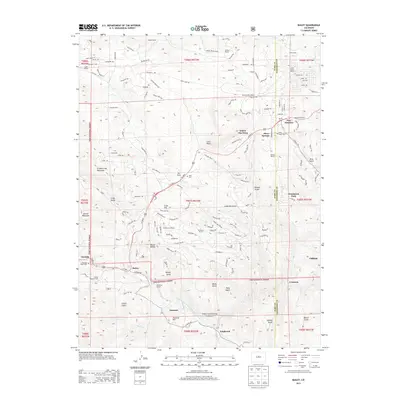
 1983 Bailey1983 Print · USGSPark County and the high Front Range are captured here during the early 1980s as traditional mountain settlements met new development patterns. Genealogists and researchers can trace the Denver and Rio Grande Western Railroad and old mountain hamlets like Bailey, Webster, and Garo.2 unique versions available
 - 1987 Map of Bailey
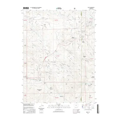
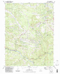 1987 Bailey1987 Print · USGSPark and Jefferson County mountain life in the late 1980s is centered on the river canyons and timbered slopes. Trace the historic route along the North Fork South Platte River to find Bailey, the old resort at Glenisle, and local landmarks like the Observatory.2 unique versions available
 - 1994 Map of Bailey, 2001 Print
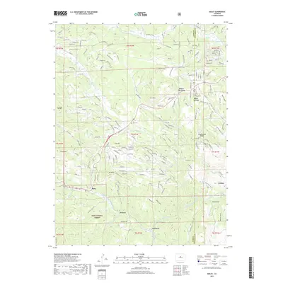
 1994 Bailey2001 Print · USGSThe North Fork South Platte River canyon in the 1990s shows a landscape of mountain settlements and national forest land. Genealogists and hikers can trace early sites like Deer Creek School, the Cem at Roland, and old railroad stops like Estabrook and Insmont.
 - 2011 Map of Bailey, 2011 Print
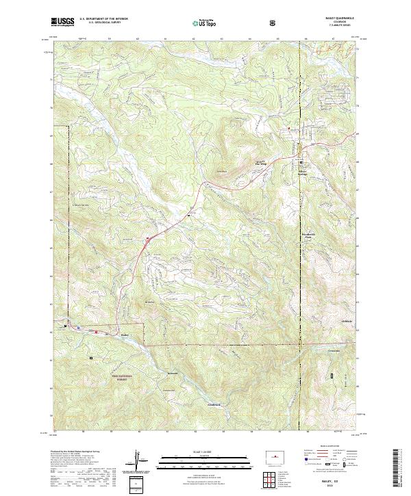
 2011 Bailey2011 Print · USGSCovers Glenisle, including Insmont, Cliffdale, and other nearby areas
 - 2013 Map of Bailey, 2013 Print
 2013 Bailey2013 Print · USGSCovers Glenisle, including Insmont, Cliffdale, and other nearby areas
 - 2016 Map of Bailey, 2016 Print
 2016 Bailey2016 Print · USGSCovers Glenisle, including Insmont, Cliffdale, and other nearby areas
 - 2019 Map of Bailey, 2019 Print
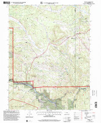
 2019 Bailey2019 Print · USGSCovers Glenisle, including Insmont, Cliffdale, and other nearby areas
 - 2022 Map of Bailey, 2022 Print
 2022 Bailey2022 Print · USGSThe Park and Jefferson County mountains come into focus in 2022, showing the modern layout of riverside settlements and forest boundaries. Genealogists and local historians can trace family plots at Pine Gulch Cem or locate the old footprints of Insmont and Estabrook.
End of results
Showing maps 1-15 of 15
Top cities near Glenisle
Frequently asked questions
- What are the different types of historical maps available for Glenisle?
- What is the oldest map of Glenisle?
- Where can I purchase historical maps of Glenisle for my home or office?
- Where can I download high-res historical maps of Glenisle?
- Are there historical topographic maps available for Glenisle?
- Is there historical aerial imagery available for Glenisle?
- Where are historical maps of Glenisle sourced from?