2000s (21st Century) Maps of Slavonia, Colorado
Explore 6 historic maps of Slavonia from the 2000s (21st Century). These maps offer a rare glimpse into what life looked like during the 2000s — showing old roads, neighborhoods, homes, and landmarks that have changed or disappeared over time.
Whether you're researching your family's past, planning a metal detecting trip, or studying how Slavonia's landscape evolved across the 2000s, these high-resolution maps are a powerful tool for exploring the history of this region.
- Focus on a specific era: All maps on this page are from the 2000s, giving you a focused view of this time period.
- See what’s changed: Compare century-old streets, trails, and buildings to today's modern landscape using overlays and satellite layers.
- Research with precision: Use these maps for genealogy, historical research, land use analysis, or educational projects.
- View, download, or print: Maps are fully viewable online in high resolution, and can be downloaded or printed for your own records.
Start exploring Slavonia's history through authentic maps from the 2000s. This is your window into the past.
Slavonia, CO maps
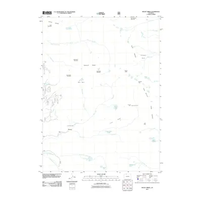
(6)- 2000 Map of Mount Zirkel, 2004 Print
 2000 Mount Zirkel2004 Print · USGSThe high peaks of the Park Range and the Sawtooth Range are captured here at the turn of the millennium. Hikers and historians can trace the paths to the Gilpin Mine, the settlement at Slavonia, and remote alpine waters like Mica Lake.
 - 2011 Map of Mount Zirkel, 2011 Print
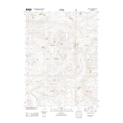
 2011 Mount Zirkel2011 Print · USGSCovers Slavonia, including Routt County, Jackson County, and other nearby areas
 - 2013 Map of Mount Zirkel, 2013 Print
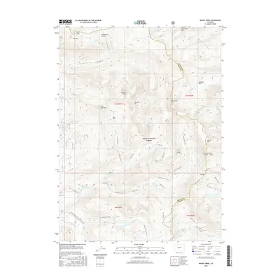
 2013 Mount Zirkel2013 Print · USGSCovers Slavonia, including Routt County, Jackson County, and other nearby areas
 - 2016 Map of Mount Zirkel, 2016 Print
 2016 Mount Zirkel2016 Print · USGSCovers Slavonia, including Routt County, Jackson County, and other nearby areas
 - 2019 Map of Mount Zirkel, 2019 Print
 2019 Mount Zirkel2019 Print · USGSCovers Slavonia, including Routt County, Jackson County, and other nearby areas
 - 2022 Map of Mount Zirkel, 2022 Print
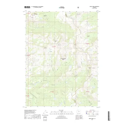
 2022 Mount Zirkel2022 Print · USGSHigh in the Park Range during the early twenty-first century, this alpine terrain is defined by the crest of the Continental Divide. Hikers and researchers can trace the intricate network of the Continental Divide National Scenic Trl and remote waters like Mica Lake and Bighorn Lake.
End of results
Showing maps 1-6 of 6
Frequently asked questions
- What are the different types of historical maps available for Slavonia?
- What is the oldest map of Slavonia?
- Where can I purchase historical maps of Slavonia for my home or office?
- Where can I download high-res historical maps of Slavonia?
- Are there historical topographic maps available for Slavonia?
- Is there historical aerial imagery available for Slavonia?
- Where are historical maps of Slavonia sourced from?