1900s (20th Century) Maps of Raymer, Colorado
Explore 5 historic maps of Raymer from the 1900s (20th Century). These maps offer a rare glimpse into what life looked like during the 1900s — showing old roads, neighborhoods, homes, and landmarks that have changed or disappeared over time.
Whether you're researching your family's past, planning a metal detecting trip, or studying how Raymer's landscape evolved across the 1900s, these high-resolution maps are a powerful tool for exploring the history of this region.
- Focus on a specific era: All maps on this page are from the 1900s, giving you a focused view of this time period.
- See what’s changed: Compare century-old streets, trails, and buildings to today's modern landscape using overlays and satellite layers.
- Research with precision: Use these maps for genealogy, historical research, land use analysis, or educational projects.
- View, download, or print: Maps are fully viewable online in high resolution, and can be downloaded or printed for your own records.
Start exploring Raymer's history through authentic maps from the 1900s. This is your window into the past.
Raymer, CO maps
(5)- 1954 Map of Sterling
 1954 Sterling1954 Print · USGSNortheastern Colorado and the Nebraska borderlands are defined by the river-and-rail corridors of the mid-twentieth century. Researchers can trace the development of agricultural hubs from Sterling and Fort Morgan to smaller rail stops along the Union Pacific and Burlington Northern lines.3 unique versions available
 - 1958 Map of Sterling
 1958 Sterling1958 Print · USGSNortheastern Colorado thrived along the river and rail corridors during the late fifties. Genealogists and historians can trace family-named irrigation works like Davis Brothers Ditch and agricultural hubs from Peetz to Fort Morgan.
 - 1978 Map of Raymer
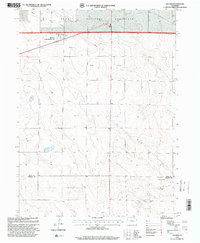
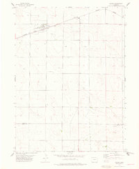 1978 Raymer1978 Print · USGSThe high plains of Weld County come into focus during the late 1970s as agricultural life and early energy development intersected. Genealogists and local historians can trace the foundations of Raymer, including its Rodeo Ground, the Prairie Sch, and the southern rail outpost of Townsend.
 - 1983 Map of Sterling
 1983 Sterling1983 Print · USGSThe Colorado high plains and the South Platte River valley come into focus in the early 1980s, centered on the hub of Sterling. Researchers can trace old transport routes like the Old Railroad Grade or locate remote outposts like Avalo and Westplains.
 - 1997 Map of Raymer, 2000 Print
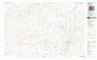
 1997 Raymer2000 Print · USGSThe high plains of Colorado come alive in the late nineties, centered on the ranching and energy-producing landscape of Raymer. Genealogists and local historians can trace landmarks like the Prairie School, the Rodeo Ground, and the small settlement of Townsend.
End of results
Showing maps 1-5 of 5
Frequently asked questions
- What are the different types of historical maps available for Raymer?
- What is the oldest map of Raymer?
- Where can I purchase historical maps of Raymer for my home or office?
- Where can I download high-res historical maps of Raymer?
- Are there historical topographic maps available for Raymer?
- Is there historical aerial imagery available for Raymer?
- Where are historical maps of Raymer sourced from?