Old Maps of Armel, Colorado for Academic Research
Study the evolution of Armel with 10 high-resolution historic maps. Whether you're teaching, researching, or modeling changes in land use, these maps provide essential visual documentation of urban, environmental, and geographic change.
- Analyze long-term change: Track patterns in development, transportation, and natural features.
- Ideal for environmental or urban studies: Support academic projects with primary historical map data.
- Use in the classroom or lab: Educators and researchers rely on these maps to bring historical context to life.
These maps are a powerful tool for teaching, research, and visualizing how Armel has changed over the decades.
Armel, CO maps
(10)- 1954 Map of Limon
 1954 Limon1954 Print · USGSThe Eastern Colorado plains and the Kansas borderlands come alive in the mid-fifties, showing the vital rail-and-road corridor through Limon. Genealogists and historians can trace the Chicago Rock Island & Pacific line through Burlington and find remote outposts like Arickaree and Anton.4 unique versions available
 - 1957 Map of Limon
 1957 Limon1957 Print · USGSThe High Plains of Eastern Colorado and Western Kansas come alive in the mid-1950s, showing the vital rail-and-road connections of the era. You can trace the path of the Chicago Rock Island and Pacific through towns like Limon, Stratton, and Burlington or find the early footprint of Bonny Reservoir.
 - 1958 Map of Limon
 1958 Limon1958 Print · USGSEastern Colorado and the Kansas border meet in this late-fifties study of High Plains rail and river systems. Researchers can trace the path of the Chicago Rock Island and Pacific through Limon and Burlington, or locate the Bonny Dam and Bonny Reservoir.
 - 1963 Map of Armel, 1965 Print
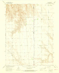 1963 Armel1965 Print · USGSThe Colorado-Kansas borderlands in the early sixties reveal a high-plains landscape of deep valleys and scattered ranching communities. Trace family roots at the Armel Cemetery, the Blue Ridge School, or the Lansing Valley Ranch.3 unique versions available
 - 1983 Map of Bonny Reservoir, 1984 Print
 1983 Bonny Reservoir1984 Print · USGSThe high plains of eastern Colorado and western Kansas appear here in the early eighties, centered on the vital waters of Bonny Reservoir. Genealogists and local historians can trace small prairie settlements like Idalia, Kirk, and the historic site of Beecher Island.
 - 2010 Map of Armel, 2010 Print
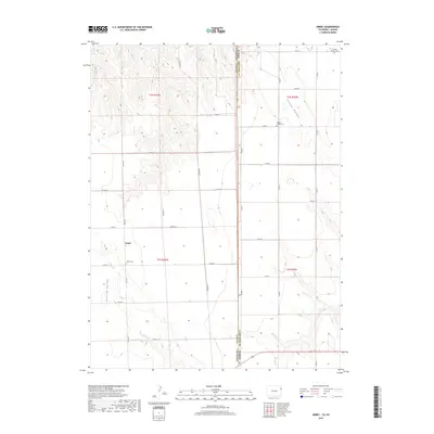
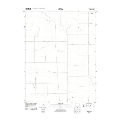 2010 Armel2010 Print · USGSCovers Armel, including Yuma County, Cheyenne County, and other nearby areas
 - 2013 Map of Armel, 2013 Print
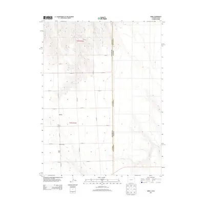 2013 Armel2013 Print · USGSCovers Armel, including Yuma County, Cheyenne County, and other nearby areas
 - 2016 Map of Armel, 2016 Print
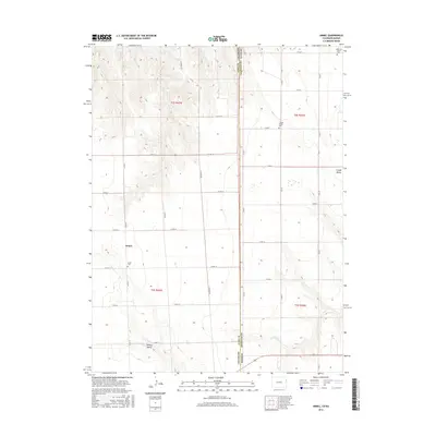 2016 Armel2016 Print · USGSCovers Armel, including Yuma County, Cheyenne County, and other nearby areas
 - 2019 Map of Armel, 2019 Print
 2019 Armel2019 Print · USGSCovers Armel, including Yuma County, Cheyenne County, and other nearby areas
 - 2022 Map of Armel, 2022 Print
 2022 Armel2022 Print · USGSThe borderlands of eastern Colorado and western Kansas are captured here in the early twenty-first century. Genealogists can trace family roots at Armel Cem, Clough Valley Cem, and German Plains Cem scattered across this high plains landscape.
End of results
Showing maps 1-10 of 10
Top cities near Armel
Frequently asked questions
- What are the different types of historical maps available for Armel?
- What is the oldest map of Armel?
- Where can I purchase historical maps of Armel for my home or office?
- Where can I download high-res historical maps of Armel?
- Are there historical topographic maps available for Armel?
- Is there historical aerial imagery available for Armel?
- Where are historical maps of Armel sourced from?