1960s Maps of East Hartford, Connecticut
Explore 7 historic maps of East Hartford from the 1960s. These maps offer a rare glimpse into what life looked like during the 1960s — showing old roads, neighborhoods, homes, and landmarks that have changed or disappeared over time.
Whether you're researching your family's past, planning a metal detecting trip, or studying how East Hartford's landscape evolved across the 1960s, these high-resolution maps are a powerful tool for exploring the history of this region.
- Focus on a specific era: All maps on this page are from the 1960s, giving you a focused view of this time period.
- See what’s changed: Compare century-old streets, trails, and buildings to today's modern landscape using overlays and satellite layers.
- Research with precision: Use these maps for genealogy, historical research, land use analysis, or educational projects.
- View, download, or print: Maps are fully viewable online in high resolution, and can be downloaded or printed for your own records.
Start exploring East Hartford's history through authentic maps from the 1960s. This is your window into the past.
East Hartford, CT maps
(7)- 1961 Map of Hartford
 1961 Hartford1961 Print · USGSSouthern New England and the Hudson Valley are shown here in the mid-fifties, capturing a landscape of booming coastal cities and interior hill towns. Researchers can trace the legacy of the New York New Haven and Hartford rail corridor and find strategic sites like Camp Shanks and Fort Michie.
 - 1962 Map of Hartford, 1971 Print
 1962 Hartford1971 Print · USGSSouthern New England and the Hudson Valley are shown in the early sixties, as suburban growth reached into the foothills. Trace the path of the New York New Haven & Hartford RR and find landmarks like Camp Nathan Hale and Gillette Castle State Park.3 unique versions available
 - 1963 Map of Manchester, 1965 Print
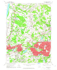 1963 Manchester1965 Print · USGSHartford County's eastern suburbs were in a period of rapid growth during the early sixties, as seen in this survey of Manchester and South Windsor. Researchers can locate family landmarks such as St James Cemetery, Mayberry Village, and Wapping Sch.5 unique versions available
 - 1964 Map of Glastonbury, 1965 Print
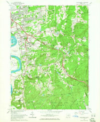 1964 Glastonbury1965 Print · USGSGlastonbury and East Hartford are shown in the mid-sixties during a period of significant suburban growth along the Connecticut River. Genealogists and local historians can trace legacy sites like Old Church Cemetery, the old Hopewell School, and the aviation footprint of Rentschler Airport.6 unique versions available
 - 1964 Map of Hartford South, 1966 Print
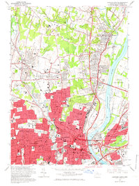
 1964 Hartford South1966 Print · USGSThe Hartford suburbs and Connecticut River valley are shown in detail during the mid-sixties growth period. Genealogists can trace family plots in Cedar Hill Cemetery and locate landmarks like Trinity College or the State Veterans Home.5 unique versions available
 - 1964 Map of Hartford North, 1966 Print
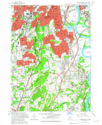
 1964 Hartford North1966 Print · USGSGreater Hartford is captured here in the mid-sixties, showing the capital's dense urban core and the rapid postwar expansion into the surrounding Connecticut River valley. Researchers can find many landmarks including the State Capitol, Mount St Benedict Cemetery, and the historic Loomis Institute.6 unique versions available
 - 1965 Map of Hartford
 1965 Hartford1965 Print · USGSSouthern New England and the Hudson Valley are shown here during the mid-sixties expansion of the Interstate era. Trace the path of the New York New Haven & Hartford RR or locate historic landmarks like West Point Military Reservation and the Merritt Parkway.2 unique versions available
End of results
Showing maps 1-7 of 7
Top cities near East Hartford
- Hartford historical maps
- New Britain historical maps
- West Hartford historical maps
- Meriden historical maps
- Manchester historical maps
- Middletown historical maps
See more
Top neighborhoods of East Hartford
- Hockanum historical maps
- East Hartford Gardens historical maps
- Forbes Village historical maps
- Forest Village historical maps
- Naubuc Avenue–Broad Street Historic District historical maps
- Coachlight Village historical maps
See more
Frequently asked questions
- What are the different types of historical maps available for East Hartford?
- What is the oldest map of East Hartford?
- Where can I purchase historical maps of East Hartford for my home or office?
- Where can I download high-res historical maps of East Hartford?
- Are there historical topographic maps available for East Hartford?
- Is there historical aerial imagery available for East Hartford?
- Where are historical maps of East Hartford sourced from?