1920s Maps of Somers, Connecticut
Explore 4 historic maps of Somers from the 1920s. These maps offer a rare glimpse into what life looked like during the 1920s — showing old roads, neighborhoods, homes, and landmarks that have changed or disappeared over time.
Whether you're researching your family's past, planning a metal detecting trip, or studying how Somers's landscape evolved across the 1920s, these high-resolution maps are a powerful tool for exploring the history of this region.
- Focus on a specific era: All maps on this page are from the 1920s, giving you a focused view of this time period.
- See what’s changed: Compare century-old streets, trails, and buildings to today's modern landscape using overlays and satellite layers.
- Research with precision: Use these maps for genealogy, historical research, land use analysis, or educational projects.
- View, download, or print: Maps are fully viewable online in high resolution, and can be downloaded or printed for your own records.
Start exploring Somers's history through authentic maps from the 1920s. This is your window into the past.
Somers, CT maps
(4)- 1920 Map of Springfield
 1920 Springfield1920 Print · USGSGreater Springfield and the Pioneer Valley are captured here during a period of intense industrial and rail expansion. Genealogists and local historians can trace the foundations of neighborhoods like Indian Orchard, locate the Shaker Sta, or study the early rail alignments of the Boston and Albany RR.
 - 1921 Map of Tolland
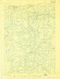
 1921 Tolland1921 Print · USGSTolland County at the start of the twenties reveals a complex network of electric rail lines and industrial waterpower. Genealogists can locate family homes and centers of trade like Stafford Springs, Talcottville, and the Conn. Epileptic Colony.
 - 1928 Map of Long Meadow
 1928 Long Meadow1928 Print · USGSNorth-central Connecticut and the Massachusetts border are captured here in the late twenties, showing the region's transition into the modern era. Genealogists can trace the rail-and-river network through Thompsonville and find the site of Shaker Sta.
 - 1928 Map of Broad Brook
 1928 Broad Brook1928 Print · USGSNorthern Connecticut’s river valley and fertile uplands are preserved here as they appeared in the late twenties. Genealogists and local historians can trace family-named hubs like Sadd's Mills and Osborne or locate old crossings at Warehouse Point.
End of results
Showing maps 1-4 of 4
Top cities near Somers
- Springfield historical maps
- Hartford historical maps
- Manchester historical maps
- Chicopee historical maps
- East Hartford historical maps
- Enfield historical maps
See more
Top neighborhoods of Somers
Frequently asked questions
- What are the different types of historical maps available for Somers?
- What is the oldest map of Somers?
- Where can I purchase historical maps of Somers for my home or office?
- Where can I download high-res historical maps of Somers?
- Are there historical topographic maps available for Somers?
- Is there historical aerial imagery available for Somers?
- Where are historical maps of Somers sourced from?